


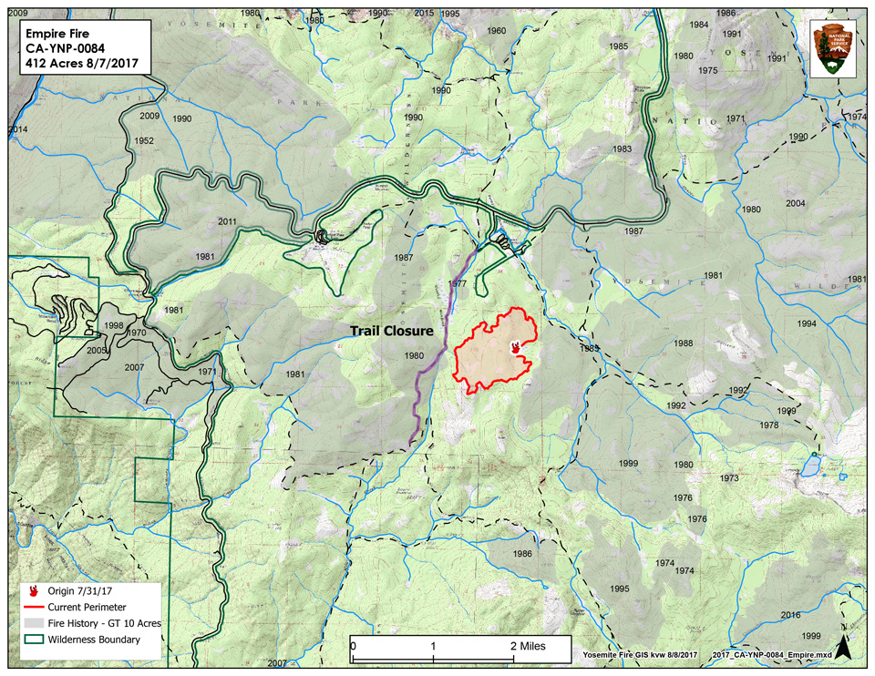
Discovery Date: July 31st, 2017
Size: 650 acres
Cause: Lightning
Update: 11:25 A.M. Thursday - Trails closed: Bridalveil CG to 1st junction with the Ostrander trail. Westfall Mdw. to Deer Camp along Alder Creek
August 10, 2017 - The Empire Fire is currently 650 acres and is burning in wilderness. The fire is being managed for both resource and protection objectives. It is approximately 1 mile south of the Bridalveil Campground east of Alder Creek drainage
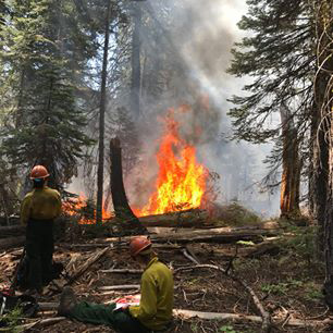 and west of Bridalveil Creek drainage burning in red fir. Fire behavior has been actively flanking and backing with some single and group tree torching. The fire has been burning in heavy pockets of dead and down timber reducing fuels build-up which increases forest resiliency. Projected fire growth is expected in the northeast and southeast flanks.
The Empire Fire is in a fire-adapted wilderness area. Allowing fires to burn naturally can result in a healthier, more diverse ecosystem. Reducing fuel buildup minimizes the potential for future catastrophic fires. Although the current fire may have transient, moderate smoke impacts, more severe fires can cause unhealthy levels of smoke for extended periods, over a much wider area.
The trail has been closed at Bridalveil Campground to the Ostrander Lake junction along Alder Creek. Signs will be placed at the affected trails this morning. There are no threats to infrastructure at Bridalveil Campground and the remainder of hiking trails in the area remain open at this time. All trails will continue to be assessed by fire crews. Future closures will be decided based on fire behavior. The fire will be visible from the high country and may be seen from multiple viewpoints in the immediate area off Glacier Point Road.
Smoke will be seen in the fire area and may impact the Bridalveil Campground. Fire Managers are working with the local Air Quality Districts and will continually be monitoring smoke impacts to the park and local communities. Community members who are sensitive to smoke may want to close their windows and doors and continually monitor the attached air quality links.
For additional Information:
- Fire Information: Yose_Fire_Info@nps.gov
- Yosemite National Park Fire Information website: http://www.nps.gov/yose/blogs/fireinfo.htm
- Facebook: Search-- Yosemite Fire and Aviation https://goo.gl/orcdws
- Twitter: Search--@YosemiteFire https://twitter.com/YosemiteFire
- Air Quality: https://www.nps.gov/yose/learn/nature/aqmonitoring.htm
Source: NPS

