
Approximate Location
37.55 latitude, -119.15 longitude
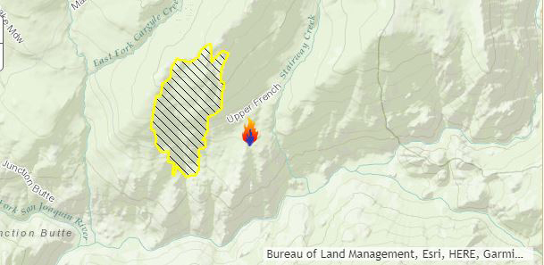
August 12, 2017 - The Butte Fire in the Sierra National Forest now at 600 acres and 25% contained as of Saturday morning.
The fire is located in the Ansel Adams Wilderness. Suppression resources are at scene and engaged. A Temporary Flight Restriction (TFR) is in place over the fire.An Air Resource Advisor (ARA) is now assigned and will provide smoke impact support to the incident management team. A smoke impact report will be available daily, see link on right for Daily Smoke Impact Report. Fire behavior has moderated on east flank as it moved into montane brush. The west flank continues to exhibit active fire behavior.
Basic Information
| Current as of | 8/12/2017, 10:04:56 AM |
|---|---|
| Incident Type | Wildfire |
| Cause | Lightning |
| Date of Origin | Monday August 07th, 2017 approx. 12:00 AM |
| Location | Ansel Adams Wilderness |
| Incident Commander | Mark Smith |
Current Situation
| Total Personnel | 155 |
|---|---|
| Size | 600 Acres |
| Percent of Perimeter Contained | 25% |
| Fuels Involved | Mixed Conifer and Red Fir. Heavy dead and down fuels. |
Current Weather
| Weather Concerns | Continued warm and dry |
|---|