


California and National Drought Summary for August 29, 2017
Summary
August 31, 2017 - Precipitation during this USDM week (August 23-29, 2017) was above normal for some of the country’s midsection, the Northern Plains to Upper Midwest, southwestern Florida, parts of New Mexico and much of Texas and Louisiana. Hurricane Harvey made landfall north of Corpus Christi as a category 4 storm bringing with it rainfall amounts there were unprecedented. In Houston, the nation’s fourth-most populous city, rainfall totals approached 50 inches in five days resulting in historical flooding. Drier than normal conditions existed for much of the Southeast, mid-Atlantic to Northeast, and western Northern Plains to Northwest. Temperatures were above normal for much of the western third of the nation and parts of the Southeast. Temperatures elsewhere were below normal. Parts of the Upper Peninsula of Michigan experienced their first freeze of the season, 3-6 weeks earlier than normal.Northeast
Precipitation for the Northeast was generally below normal with a few areas of above normal amounts. Upstate New York, western Pennsylvania, and southward into northern West Virginia received precipitation that was about one inch above normal. Dryness continued in parts of New England, especially central Maine, prompting a small expansion of abnormal dryness (D0). Temperatures during the period were generally 2-4 degrees F below normal across the region.Southeast
Dryness continued this week prompting the introduction of D0 in southern Georgia and expansion of D0 across much of South Carolina and Virginia. It was reported that low soil moisture levels were causing stress among some of the crops in Georgia. In Georgetown County, South Carolina (eastern SC), it was reported that this year’s corn harvest should be excellent and the tobacco harvest is winding down with fair to moderate yields. Conditions have been good for soybeans, cotton and peanuts. However, in central SC (Lexington County), it was reported that “crop conditions are declining rapidly”. While the corn harvest should have strong yields, the dryland cotton and soybeans have been impacted the most by the lack of precipitation. Average streamflows across the region at 28-days are running, at the most, 30 percent of normal.South
Intense and long lasting rains from slow moving Hurricane Harvey caused extensive flooding to Houston and surrounding area. Precipitation amounts up to the Tuesday morning data cutoff exceeded 20 inches in many locations, including: Houston Weather Forecast Office (42.11 inches), Houston/Will Hobby Airport (26.68 inches), and Beaumont/Port Arthur (23.40 inches). These totals have increased since the data cut off period. For more up to date totals please visit the Weather Prediction Center’s Storm Summary page. D0 was removed from the area affected by Harvey, but in western Texas, D0 remained or was slightly expanded. In Oklahoma, D0 was reduced where recent rains have alleviated any negative impacts.Midwest
Precipitation was below normal for much of the eastern part of the region during this USDM week while northern and western Missouri, western Iowa and much of Minnesota had above normal precipitation. Temperatures were as much as 6-8 degrees F below normal during the period. Rainfall deficits at 30-days stretch across a wide swath from central Illinois, Indiana and Ohio. If the remnants of Harvey do not produce beneficial rains in the area, D0 may have to be expanded. For the second consecutive week heavy rains fell in parts of Iowa. In the northwest section of the state, drought was contracted or removed to reflect the recent rains.High Plains
Precipitation was below normal for much of the High Plains this week prompting the expansion of D0 in southwest South Dakota and western Wyoming. Drought was expanded throughout Montana where long-term precipitation deficits remain. According to the USDA crop reports, 41 percent of Montana pasture and range conditions are rated very poor and 73 percent of the topsoil moisture conditions are rated very short. D0 was expanded and a small area of D1 was introduced in northeast Kansas and southeast Nebraska based on the 30-day precipitation deficits. One category improvements were made in eastern South Dakota where 1-2 inches of rain has fallen during the last two weeks. It was reported that crop conditions are very good in this eastern region.West
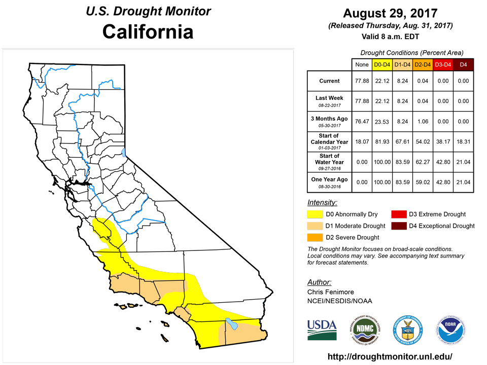
Abnormal dryness (D0) was expanded in Washington, Oregon and Idaho based on dryness out to 90-days. Temperatures were above normal for the period with readings as much as 10 degrees F above normal in California. For the past month temperatures have been much warmer-than-normal to record warm across much of the Northwest. For the summer, much of the Southwest region experienced record warm temperatures.Alaska, Hawaii, and Puerto Rico
Drought/dryness continued for the Hawaiian Islands this week. On Molokai, it was reported by ranchers that pastures are in very poor condition over the western half of the island, so D2 was introduced. Moderate drought conditions were introduced on Lanai and Kahoolawe islands based on VHI data. Based on FSA reports, pasture conditions on Maui are very poor resulting in the transition from D1 to D2. A mixed bag of Dx changes were made on the Big Island as it was reported that “the windward slopes have been getting trade wind rainfall and some areas have been getting greener even though soil moisture remains low at depth”. The existing D3 was extended and a new area of D3 was introduced between Waimea and Kawaihae as pasture conditions worsen.In Puerto Rico, rainfall amounts between 6-10 inches and isolated areas of 15 inches over the last 2-weeks were observed. As a result, D0 and D1 were contracted.
There were no changes in Alaska this week.
Looking Ahead
The remnants of Hurricane Harvey will slowly drift up the Ohio Valley and Atlantic seaboard during the next 3 days. Heavy rains may produce 2-8 inches across the South and Southeast. Separately, the southern Rockies may see some precipitation amounts totaling 0.5-1 inch. Temperatures will be generally 10 degrees below normal in the east, following the track of Harvey and at least 10 degrees F above normal in West. The longer range forecast calls for increased probability of cooler than normal temperatures stretching from the Gulf Coast into the Ohio Valley. The odds are high that warmer than normal temperatures will persist in parts of the West. The probability of above normal precipitation is highest along the Atlantic seaboard and Southwest. The probability is high that dryness will continue in the Midwest.Author(s):
Chris Fenimore, NOAA/NESDIS/NCEI
Dryness Categories
D0 ... Abnormally Dry ... used for areas showing dryness but not yet in drought, or for areas recovering from drought.Drought Intensity Categories
D1 ... Moderate DroughtD2 ... Severe Drought
D3 ... Extreme Drought
D4 ... Exceptional Drought
Drought or Dryness Types
S ... Short-Term, typically <6 months (e.g. agricultural, grasslands)L ... Long-Term, typically >6 months (e.g. hydrology, ecology)
Source: National Drought Mitigation Center

