


Empire Fire in Yosemite National Park
October 19, 2017 - Credit: NPS
October 20, 2017 - Several fires remain visible throughout Yosemite National Park's wilderness. Fire Managers are working with the local Air Quality Districts and will be monitoring smoke impacts to the park and local communities These fires are burning in designated Wilderness. Lightning ignited fires In Wilderness are often allowed to burn if they do not threaten developed areas. The Yosemite Wilderness is a fire adapted ecosystem where past fire suppression has resulted in unnaturally high fuel levels. Allowing fires to burn unimpeded produces a healthier, more diverse forest and helps reduce the severity of future fires. Updates will be issued on Fridays.
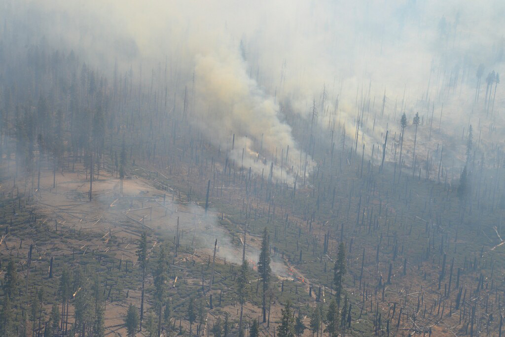
Empire
Discovered: 7/31/17 Location: East of Glacier Point Road, primarily in the Illilouette Basin. Size: 8,094 acres Cause: Lightning Containment: 85% Fuels: Red fir
Moving east deeper into the wilderness. Burning into the 2004 Meadow Fire footprint in the Illilouette drainage producing moderate smoke. This area has shrubs and heavier dead and down fuel. The trajectory of the fire will likely take it in the direction of sparser fuels and higher elevation in the coming week, which should reduce smoke production. Visible from vistas along the Glacier Point road
South Fork
Discovered: 8/13/17 Location: .75 miles east of the community of Wawona Size: 7,564 acres Cause: Lightning Containment: 90% Fuels: Mixed conifer and red fir
Fire remains quiet near the community of Wawona on the west and south flank of the fire. Sections of the north flank and the entire east flank are continuing to burn in the wilderness Fire activity has been minimal this week.
Starr King
Discovered: 8/2/17 Location: N 37° 42.965' x W 119° 29.588' at approximately 7800 feet elevation Size: 75 acres Cause: Lightning Spread Potential: Low/ Moderate Fuels: Red fir/ Lodgepole Strategy: Monitor Visible from the Glacier Point Road.
Porcupine
Discovered: 8/2/17 Location: N 37° 49.336' x W 119° 34.720' at approximately 8154 feet elevation off Tioga road. Size: 9 acres Cause: Lightning Spread Potential: Low Fuels: creeping: burning in duff and dead and down in Lodgepole/Red fir Strategy: Monitor Visible burning next to the Tioga road.
Ribbon
Discovered: 9/26/17 Location: 37 45.3 by119 38.5 at approximately 8154 feet elevation off Tioga road. Size: 2 Acres Cause: Lightning Spread Potential: Low Fuels: Low brush Strategy: Monitor Visible from Sentinel Dome and Glacier Point
Source: NPS

