


Cooks Meadow and the pedestrian trail through Cooks Meadow in Yosemite Valley on Saturday, April 7, 2018. NPS Photo
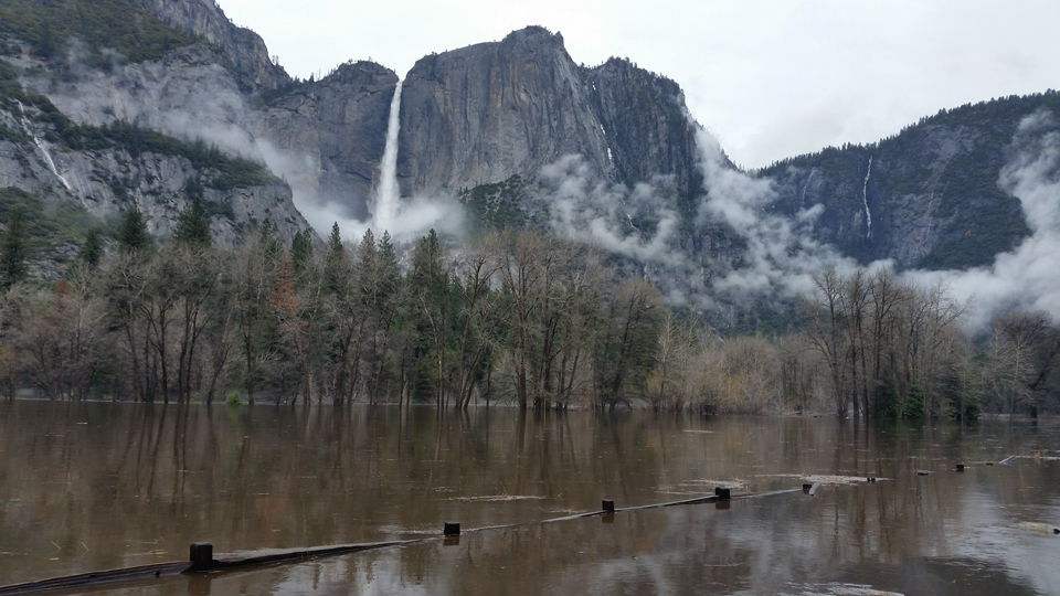
April 23 ,2018 - On April 7, 2018 Yosemite Valley experienced the 8th largest flood recorded at Pohono Bridge since 1917, the largest flood in 21 years. The Merced River peaked at Pohono Bridge at 6:15 P.M. at 13.73 feet, flowing at 12,200 cubic feet per second (cfs). Upstream at the gage at Happy Isles, the Merced River peaked at 3:45 P.M. at 10.09 feet, flowing at 8,000 cfs, which was the 6th largest on record at this gage since 1916.
During the river’s peak, more than 60% of the river’s flow entered Yosemite Valley at Happy Isles, with the rest coming mainly from the numerous tributaries flowing into the valley. At Pohono Bridge, flood conditions occurred for nearly 30 hours, rising above 10 feet on April 7 at 08:00 A.M. and dropping below 10 feet on April 8 at 1:45 P.M. Floodwater inundated roads at numerous places, water depths ranged 2 - 4 feet at Chapel Meadow, Wosky Pond, Sentinel Cross, and El Cap Cross.
The flood resulted from an unusual Spring atmospheric river of warm precipitation falling on a saturated snowpack and saturated soils. With the snowline higher than 12,000 feet, most of the precipitation falling in the Tuolumne and Merced River watersheds fell as rain. This combination of preexisting conditions and high snowline led to rapid runoff from most of the watershed area, generating flooding with only 2 – 4 inches of precipitation. This scenario differs from typical winter storms when the snowline is lower and a much smaller area of the watershed is contributing runoff.
Interestingly, during rain-through-snow events it is generally thought that rain contributes most of the runoff, while smaller amounts of runoff are contributed by melted snow. However, during this storm, snow sensors in Yosemite measured larger amounts of snowmelt, in some places possibly doubling the amount of runoff. The amount of rain during the event ranged 2 – 4 inches, while snowmelt ranged 0.7 – 4.3 inches of liquid water. During the afternoon of April 7, winter rangers in Tuolumne Meadows observed the Tuolumne River melting out rapidly, which was last observed during the historic flood of 1997. We are still investigating why such a large amount of snowmelt occurred.
Flooding of the Dana Fork of the Tuolumne River at Mammoth Meadow. NPS Photo
Source: H. Forrester, NPS

