CLICK HERE FOR A LARGE MAP (3,000 Pixels Wide and 3MB)
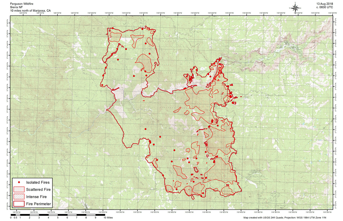
August 13, 2018 - Monday Infrared Map of the Ferguson Fire in Mariposa County near Yosemite National Park.
Official Information: 96,457 acres and 86% contained.
Acreage -
Estimated Acreage: 95,952
Weather Conditions -
The vicinity of the fire was cloud free.
Details -
The interpreters were able to designate the fire perimeter and isolated fires with no difficulty.
Areas of perimeter growth with intense and scattered fire were detected at the northeastern corner of the fire.
Additional small areas of intense fire were detected at various locations within the perimeter, with most being on the east side of the fire.
Large areas of scattered fire were detected within the northern, eastern and southern portions of the perimeter.
Isolated fires were generally within fairly close proximity to the main perimeters.
