
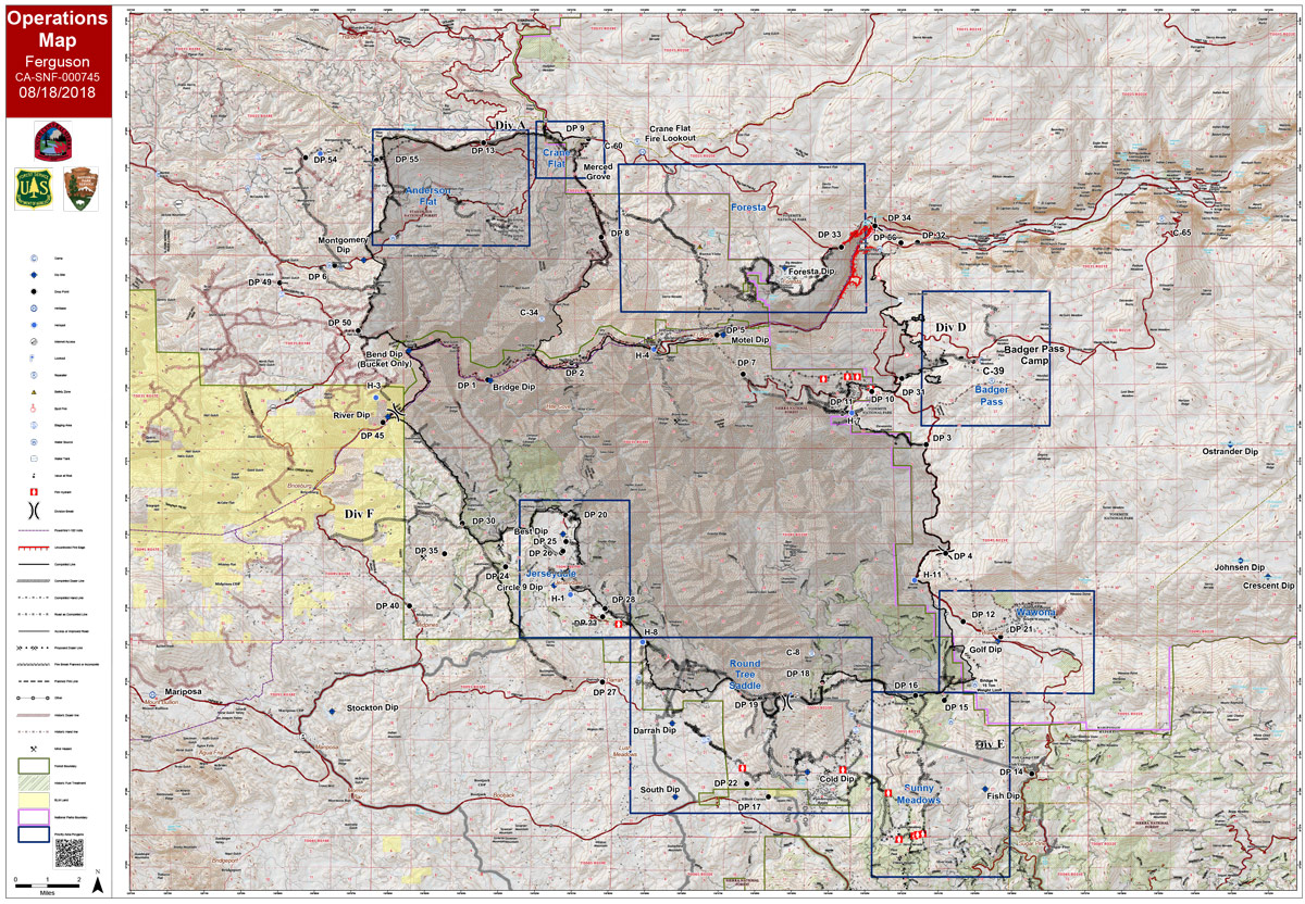
Saturday Operations Map
CLICK HERE FOR A LARGE MAP (3,000 Pixels Wide and 3MB)

CLICK HERE FOR A LARGE MAP (3,000 Pixels Wide and 2MB)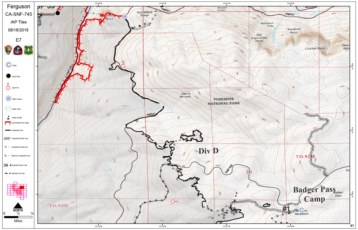
CLICK HERE FOR A LARGE MAP (3,000 Pixels Wide and 2MB)
August 18, 2018 - Saturday Operations Map of the Ferguson Fire in Mariposa County near Yosemite National Park.
Friday Evening Information: 96,824 acres and 87% containment
Planned Actions
Crews to continue suppression efforts in Divisions D. The fire continues to back to the Merced River.
The fire east of El Portal and north of Highway 140 continues to be in patrol status.
Crews continue to monitor the fire along FS Road 2S20. Resources are addressing hazard trees along all roads and containment lines, while monitoring and securing the fire area.
Projected Incident Activity
Over the next 12 hours, active fire will continue in Division D. Holding, improving and suppression repair continues in all other Divisions.
Over the next 72 hours,holding, improving and suppression repair continues.