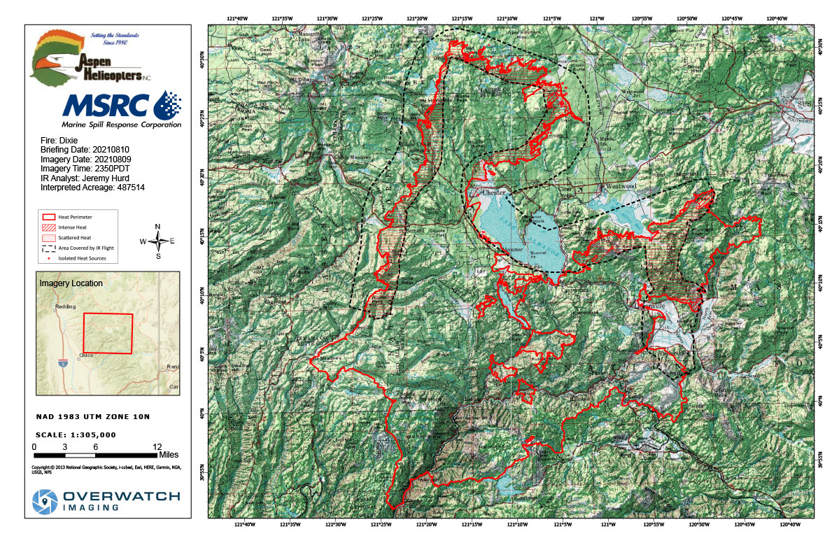
Flight Notes: Interpreted Acreage: 487,514 a Growth of 7,669 from last period
Incomplete picture of NNE perimeter does not allow for a thorough interpretation of the data, but imagery that was collected indicates the fire continues to grow with multiple hotspots outside of the main fire perimeter. Smoke up to 22k feet prevented imagery capture of much of the perimeter to the north and east of the eastern finger. NOTE: Full perimeter was not fully mapped.
Note: both maps are 1,200 pixels wideTuesday, August 10, 2021 - Above Map is the Dixie Fire Infrared Map for Today with Flight Notes.
Click Here for: California Dixie Fire Tuesday, August 10, 2021 Updates
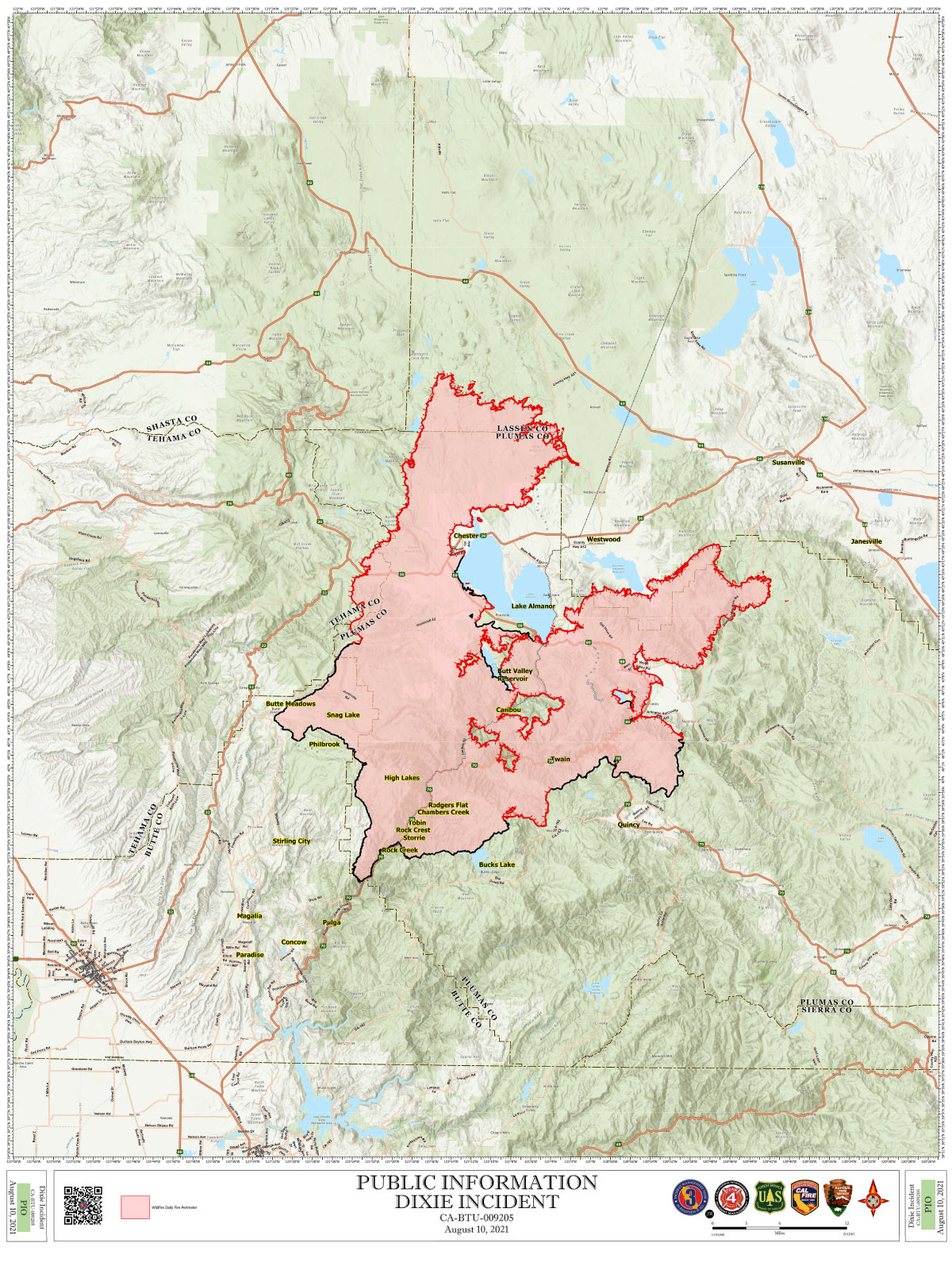
The below Map is the Public Information Map of the Dixie Fire for Today.