
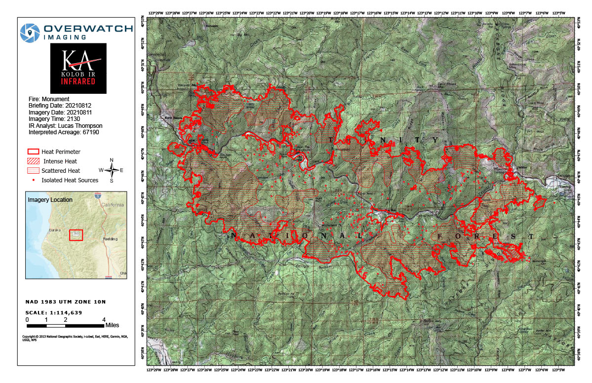
Flight Notes: Interpreted Acreage: 67,190 - Growth from last period: 4,749 Acres
Previous heat perimeter downloaded from NIFC as instructed by SITL.
Previous NIFC boundary: 62,441 acres
Previous IRIN boundary: 62,490 acres
Cloud interfered with interpretation in South East corner, included shapefile to show area that could not be interpretated.
Large heat perimeter expansions in North West and South East corners.
Note: Map is 1,200 pixels wide
Thursday, August 12, 2021 - Monument Fire Infrared Map for Today with Flight Notes.Click Here for: California Monument Fire Thursday, August 12, 2021 Updates