


Note: Click here for Dixie Fire Updates for Thursday
Dixie Fire Videos for Wednesday, September 15, 2021
Evening Update Per CAL FIRE: California Dixie Fire is at 960,583 Acres, with 86% Containment, and 2,270 personnel assigned for Wednesday evening.
Basic Information
| Current as of | 9/15/2021, 7:17:55 PM |
| Incident Type | Wildfire |
| Cause | Under Investigation |
| Date of Origin | Tuesday July 13th, 2021 approx. 05:15 PM |
| Location | Feather River Canyon near Cresta Powerhouse and Lake Almanor. |
| Incident Commander | Jerry McGowan, CAIMT1; Steve Watkins, CAIMT14; Jay Kurth, NIMO 1 |
| Incident Description | Wildfire |
| Coordinates | 39.819 latitude, -121.419 longitude |
Current Situation
| Total Personnel | 2,270 |
| Size | 960,583 Acres |
| Percent of Perimeter Contained | 86% |
| Estimated Containment Date | Thursday September 30th, 2021 approx. 12:00 AM |
| Fuels Involved |
The primary carrier of fire at lower elevations is grass and shrub mix with areas of timber litter. In the mid to upper elevation the fuels are heavy forest litter with shrubs and small trees. There are pockets of heavy dead and down. |
| Significant Events |
Minimal Creeping Smoldering Flanking Minimal fire activity today. Majority of fire activity is smoking stump holes, some cat-faces in standing trees and a few logs holding heat. Little duff creep and smolder as things have dried out since wetting rain. Very low probability of surface fire spread in needle cast that shed in burned areas; not enough continuity and density. |
Outlook
| Planned Actions |
Priority areas include: the Lassen & Shasta Sectors, Old Station and surrounding communities, the Highway 395 escarpment area including Janesville, Milford and Herlong Junction as well as Lake Davis and the Grizzly Creek area west of the escarpment. The Community of Old Station was repopulated 9/14 @ 0700 and Highway 89 was opened to the intersection of Hwy 44. Continue to establish direct and indirect containment lines south of Old Station. Resources continue to establish containment lines north of Highway 44 in the vicinity of Hat Creek Rim and Plateau as well as protecting critical fiber optic infrastructure. Provide for service calls within communities impacted by the fire: Chester, Hwy 36 corridor, Hwy 89 corridor, Hwy 395 corridor, Paxton, Greenville, Jonesville, Crescent Mills, Taylorsville, Prattville, Butte Meadows, Bucks Lake, Meadows Valley, Rush Creek, Warner Valley, Pecks Valley, Williams Valley, Hunt Canyon, Susanville, Janesville, and the Greater Almanor area. Continued mop up of and patrol of 1,000-hr fuels will require a significant amount of resources due to the volume of fuels and the steep and rugged terrain. Continued holding actions and point protection of communities and critical infrastructure will require a significant resource presence for the next several operational periods. East Zone priorities: (1) Patrol direct line in the Devil's Punchbowl area. (2) Resources will continue to mop up dozer and handline from Lake Davis to Clover Valley and mop up dozer and handline further south into Dixie Valley, as well as south towards Clover Valley and Portola. (3) East of Milford, patrol and mop up containment lines on the northwest flanks of the fire (4) Maintain containment, mop-up, and backhaul of equipment on western and central divisions in the Zone. (5) Initiate suppression repair in high priority areas identified by the Resource Advisors and where equipment is already present. Structure protection is in place within Genesee, Dixie Valley, Lake Davis area, Milford, and Taylorsville. |
| Projected Incident Activity |
12 hours: (Wednesday night) Ridge winds southwest 8 to 12 mph, gusts to 25 mph through 2200, becoming south-southwest 4 to 8 mph with gusts to 14 mph. Valley wind up valley/upslope downslope/down valley 5 to 10 mph with gusts to 18 mph becoming downslope/down valley 2 to 5 mph. Cool temperatures in the low 40s to low 50s are expected. Humidity recovery is expected to be in the 45 to 67 percent range. 24 hours: (Thursday) Temperatures begin a gradual cooling trend, though humidity remains low, dropping into the teens in the afternoon. The warming and drying trend continues for one more day. High temperatures are forecast to rise into the upper 70s to upper 80s. Winds will shift to the southwest, gusting around to 20 to 28 mph on ridges in the afternoon. 48 hours: (Thursday night and Friday) Southwest ridge winds continue gusting to 25 mph throughout the evening, with gusts to 14 after midnight. Overnight temperatures a few degrees cooler. Humidity recovery should remain moderate. Highs will trend cooler, around 70 to 80. Southwest winds increase and become gusty, up to 25-30 mph over ridges in the late afternoon and early evening. Afternoon humidity levels remain dry, generally dropping into the teens. 72 hours: (Friday night and Saturday) Gusty southwest winds continue overnight, with overnight temperatures a few degrees cooler. The cooling trend continues, with Saturday highs dropping about 5 degrees from Friday, about 70 to 80. Humidity levels will increase a little but will still remain quite dry in the upper teens and lower 20s, bringing increased fire weather concerns. Southwest winds increase further, gusting to 25 to 35 mph. |
Current Weather
| Weather Concerns |
East Zone: High pressure continued with mostly sunny skies with some haze. Humidity recovery trended lower but was good to moderate this morning, with 40 to 60 percent on the ridges and around 75 percent in the valleys. Afternoon humidity was very low, dropping to around 9 to 14 percent. Wind from the southwest gusted to around 15 to 25 mph. Temperatures trended a few degrees warmer, in the upper 80s to the low 90s. West Zone: Calm weather again today with highs in the mid 70s to mid 80s depending on elevation. Skies were mostly clear; some smoke and haze was present as well. Relative humidity decreased to 10-15%. Winds were mostly terrain-driven at lower levels. However, a southwesterly general wind of 5-10 mph with gusts as high as 20 mph were recorded on ridgetops. Overall, fair weather. |
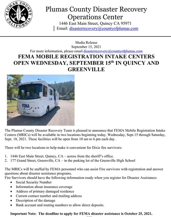
Update: FEMA Mobile Registration Centers opens Wednesday September 15th in Quincy, CA at 1446 East Main Street and in Greenville, CA at 177 Grand Street.
They will be available until September 18th, 2021, and open from 10:00 A.M. until 6:00 P.M.
Important Note: The deadline to apply for FEMA disaster assistance is October 25, 2021.
Bring the following information when you register: Social Security Number, info about insurance coverage, address of primary damaged residence, current contact number and mailing address, description of the damage, and bank account and routing numbers to allow direct deposits. For more information, please email disasterrecovery@countyofplumas.com.
In regard to the Dixie Fire all remaining Evacuation Warnings for Plumas County have been lifted.
To see the county evacuation map, go to community.zonehaven.com
For the full release click https://plumascounty.us/DocumentCenter/View/37932/Lift-for-9-15-2021
This area is deemed safe from active fire though residents should stay alert to changing conditions.
Remember the fire is still active within the burned area and you may see spots of smoke. Fire personnel will still be actively working the interior and edges of the fire. Expect to see hotspots for some time. Do not call 911 to report unless there is an immediate threat to life or property. Be vigilant to weather and wind conditions and take any future orders seriously, should they change.
Just because the flames are out doesn’t mean the danger is over. Damaged trees/terrain and flash flooding are just some of the dangers that exist after a wildfire.
DO NOT put yourself or your loved ones in danger by exploring.
Caltrans District 2 would like to remind residents returning to their properties that emergency work is underway in several areas on State Route 89 and State Route 70 due to damage from the Dixie Fire. Delays range from 1 to 2 hours depending on the location. To get the most up-to-date information on closures and delays, please visit QuickMap.dot.ca.gov.
Public Notice – Dixie Fire 9/15/2021 12:00 P.M.
No Change • Evacuation Status Summary
Check the status of your address at: community.zonehaven.com
Mandatory Evacuation Orders remain in place for:
- North of Black Gulch Rd from the Lassen County line east to but not including Little Valley Zones LAS-E036-H,J,K,E
- North of Halls Flat area from the Lassen County Line east to Pittville Rd and north to Black Gulch Rd Zone LAS-E036-B
- Blacks Mountain area from Pittville Rd east to Forest Route 34N30 north to Black Ridge Lookout Rd Zone LAS-E036-C
- South of Wilson Springs Rd from Pittville Rd east to Black Gulch Rd Zone LAS-E036-I
- North of Hwy 44 from the Lassen County line east to Forest Services Route 32NO2 and north to the Blacks Mountain and Halls Flat Area. ZONE LAS-E035-A, LAS-E035-G, LAS- E35-D
- North of Hwy 44 from Forest Route 33NO2 east to County Rd A21 and north to Crater Lake Campground – Zones LAS-E035-F
- South of Hwy 44 from the Lassen County line east to County Rd A21 – Zone LAS-EO31A
Evacuation Warnings remain in place for:
- West of but not including Boyd Springs Road southwest to the Lassen County line – Zones LAS-E066-B, EO65-C, E072-B
- Hoover Flat Reservoir area west of Boyd Springs Road and Little Valley Rd – Zone LAS- E068-B
- Little Valley and Dixie Peak area north of the Lassen National Forest from Wilson Springs Rd east to Dixie Peak and north to Pit River Canyon LAS-E072-A, EO65-B, EO68-A
- Hoover Flat Reservoir area North of Dixie Peak and South of Boyd Hill LAS-EO68-B
- Juniper Lake and Snag Lake area east of the Lassen County Line – Zone LAS-E031-B
Dixie Fire – State Route 44 Road Reopening
Road closure on State Route 44 between County Road A-21 and State Route 89 at Old Station will be lifted on Wednesday, September 15, 2021, at 11:00 AM.
Between the junction of State Route 89 and County Road A-21.
Traffic control measures and a pilot car will be in place in Shasta County due to roadway hazards related to the Dixie Fire.
Current roadway status can be found at: Caltrans – https://roads.dot.ca.gov or http://quickmap.dot.ca.gov
September 15, 2021 - Dixie Fire is 960,583 acres and 75% contained for Wednesday morning.
Basic Information
| Current as of | 9/15/2021, 7:21:57 AM |
| Incident Type | Wildfire |
| Cause | Under Investigation |
| Date of Origin | Tuesday July 13th, 2021 approx. 05:15 PM |
| Location | Feather River Canyon near Cresta Powerhouse and Lake Almanor. |
| Incident Commander | Jerry McGowan, CAIMT1; Steve Watkins, CAIMT14; Jay Kurth, NIMO 1 |
| Incident Description | Wildfire |
| Coordinates | 39.819 latitude, -121.419 longitude |
Current Situation
| Total Personnel | 2,413 |
| Size | 960,583 Acres |
| Percent of Perimeter Contained | 75% |
| Estimated Containment Date | Thursday September 30th, 2021 approx. 12:00 AM |
| Fuels Involved |
The primary carrier of fire at lower elevations is grass and shrub mix with areas of timber litter. In the mid to upper elevation the fuels are heavy forest litter with shrubs and small trees. There are pockets of heavy dead and down. |
| Significant Events |
Minimal Creeping Smoldering Flanking Minimal fire activity today across the Dixie East fire area. Majority of fire activity is smoking stump holes, some cat-faces in standing trees and a few logs holding heat. Little duff creep and smolder as things have dried out since wetting rain. Very low probability of surface fire spread in needle cast that shed in burned areas; not enough continuity and density. The most active portions of fire are likely to remain in unburned interior islands/peninsulas northwest of Cluster Lakes and between North Prospect Peak, Little Bunchgrass, Rim Spur, and Baker Roads. Watch for isolated heat along Suicide Tie and between Jelly Cap and Pole Line Roads and across Highway 44 which could flare up and rapidly spread north and east into continuous vegetation and checkerboard timber plantations. |
Outlook
| Planned Actions |
Priority areas include: the Lassen & Shasta Sectors, Old Station and surrounding communities, the Highway 395 escarpment area including Janesville, Milford and Herlong Junction as well as Lake Davis and the Grizzly Creek area west of the escarpment. The Community of Old Station was repopulated 9/14 @ 0700 and Highway 89 was opened to the intersection of Hwy 44. Continue to establish direct and indirect containment lines south of Old Station. Resources continue to establish containment lines north of Highway 44 in the vicinity of Hat Creek Rim and Plateau as well as protecting critical fiber optic infrastructure. Provide for service calls within communities impacted by the fire: Chester, Hwy 36 corridor, Hwy 89 corridor, Hwy 395 corridor, Paxton, Greenville, Jonesville, Crescent Mills, Taylorsville, Prattville, Butte Meadows, Bucks Lake, Meadows Valley, Rush Creek, Warner Valley, Pecks Valley, Williams Valley, Hunt Canyon, Susanville, Janesville, and the Greater Almanor area. Continued mop up of and patrol of 1,000-hr fuels will require a significant amount of resources due to the volume of fuels and the steep and rugged terrain. Continued holding actions and point protection of communities and critical infrastructure will require a significant resource presence for the next several operational periods. East Zone priorities: (1) Patrol direct line in the Devil's Punchbowl area. (2) Resources will continue to mop up dozer and handline from Lake Davis to Clover Valley and mop up dozer and handline further south into Dixie Valley, as well as south towards Clover Valley and Portola. (3) East of Milford, patrol and mop up containment lines on the NW flanks of the fire (4) Maintain containment, mop-up, and backhaul of equipment on western and central divisions in the Zone. (5) Initiate suppression repair in high priority areas identified by the Resource Advisors and where equipment is already present. Structure protection is in place within Genesee, Dixie Valley, Lake Davis area, Milford, and Taylorsville. |
| Projected Incident Activity |
12 hours: (Tuesday night) Light downslope wind and cool temperatures in the low 40s to low 50s are expected. Humidity recovery is expected to remain in the 40 to 60 percent range. Minimal fire activity as fuels dry out and consume since the precipitation on September 9-10. Primarily stump holes with some surface activity possible as the day warms and dries along with the gusty winds. Needle cast fuel beds will support surface fire in interior islands and patches, but zero to low probability in areas that underburned or greater. Potential for some torching trees will increase the chances of short-range spotting. Low to moderate fire behavior expected; mostly smoldering in forest litter and duff, due to increased fire containment. Low to moderate RH recovery will also likely limit behavior. A recent flare-up on the steep flanks of Lassen Peak will continue to flank and spread north and east and will likely cause control issues due to inaccessibility. 24 hours: (Wednesday) Temperatures begin a gradual cooling trend, though humidity remains low, dropping into the teens in the afternoon. The warming and drying trend continues for one more day. High temperatures are forecast to rise into the upper 70s to upper 80s. Winds will shift to the southwest, gusting around 25 mph on ridges in the afternoon. Peak winds up to 18 mph in the afternoon could cause unburned interior islands to flare up with a very slight possibility of isolated torching. Flare-up on Lassen Peak and torching trees could loft embers outside existing firelines with subsequent moderate flame lengths and rate of spread. 48 hours: (Wednesday night and Thursday) Southwest ridge winds continue gusting to 25 mph throughout the evening, with gusts to 14 after midnight. Overnight temperatures a few degrees cooler. Humidity recovery should remain moderate. Highs will trend cooler, remaining in the low 70s to low 80s. Southwest winds increase and become gusty, up to 20-26 mph over ridges in the late afternoon and early evening. Afternoon humidity levels remain dry, generally dropping into the teens. Afternoon southwest wind gusts up to 15 mph create a slight chance for isolated flare-ups and spotfires outside of containment lines. Anything that escapes should remain on the surface and be attackable by crews/engines/dozers. 72 hours: (Thursday night and Friday) Gusty southwest winds continue overnight, with overnight temperatures a few degrees cooler. The cooling trend continues, with Friday highs dropping about 3 degrees from Thursday. Humidity levels will increase a little but will still remain quite dry, bringing increased fire weather concerns. Southwest winds increase further, gusting to 24 to 28 mph. These winds are likely to test existing containment lines and increase the potential for flare-ups in unburned interior islands and spotfires across firelines. Unlined portions of the fire have significant moderate duration crownfire potential. |
| Remarks |
Transfer of command from CAL FIRE IMT1 to California Interagency Incident Management Team 14 (CAIIMT 14) and NIMO (Kurth) Team occurred this morning at 0700 hours. |
Current Weather
| Weather Concerns |
East Zone: High pressure continued with mostly sunny skies with a few high clouds and some haze. Humidity recovery trended lower but was good to moderate this morning, with 40 to 60 percent on the ridges and over 75 percent in the valleys. Afternoon humidity was very low, dropping to around 9 to 14 percent. Wind from the west-northwest gusted to around 12 to 17 mph. Temperatures trended a few degrees warmer, in the upper 80s to around 90. West Zone: Calm weather again today with another increase in temperatures. Today was the hottest day this week. Highs were in the mid 70s to upper 80s depending on elevation. Skies were mostly clear; some smoke and haze was present as well. Relative humidity continued to drop, decreasing to 10-15%. Winds were mostly terrain-driven, with a light northwesterly general wind of 5-10 mph. Some gusts to 15 mph were recorded. Overall, fair weather. |
Click here for: California Dixie Fire Tuesday, September 14, 2021 Updates
