
California and National Drought Summary for December 26, 2017
Summary
December 28, 2017 - series of storm systems tracked across the lower 48 States, dropping light to moderate precipitation on the Northwest and northern half of the Rockies, which eventually entrained ample Gulf moisture into the system while over the lower Mississippi Valley. As a result, widespread moderate to heavy rains (2-6 inches, locally to 10 inches) fell from northeastern Texas northeastward into the southern and central Appalachians, with the greatest totals reported in central Arkansas and western Tennessee. As the systems trekked farther eastward, light to moderate precipitation also fell on the Northeast and the Carolinas as frigid conditions gradually replaced the mild air from earlier in the week across the eastern two-thirds of the Nation. Dry conditions prevailed across the Southwest, southern third of the High Plains, along the Gulf Coast, and in parts of the mid-Atlantic. In Hawaii, very heavy rains (4-10 inches) during December 20-21 in the central islands (western Maui, Lihue, eastern Molokai) interrupted what had been a relatively quiet (dry) December.
Northeast
Light to moderate precipitation fell across much of New England and parts of the mid-Atlantic, with lake-enhanced snows dumping several feet on favored downwind locations of Lakes Erie and Ontario. Erie, PA, reported its greatest all-time daily snowfall record (34 inches) on December 25, easily breaking its former Nov. 22, 1956 mark of 20 inches. In northern New England, 1.5-2 inches of precipitation was enough to negate short-term deficits in east-central New York and southwestern Vermont (D0 removed), but lower precipitation totals (less than an inch) in New England were not great enough to significantly reduce short-term deficiencies, thus D0 remained. Farther south in central Pennsylvania, totals were less than 0.5 inches, and D0 and D1 was slightly expanded there to depict 60- and 90-day shortages of 3-6 and 4-8 inches, respectively, along with declining 7-day averaged USGS stream flow levels (lower 10th percentiles). Between 0.5-1.5 inches of precipitation fell along the border of southeastern Pennsylvania and northeastern Maryland, delaying the addition of D1 there for at least another week. Farther south into Virginia, however, little or no precipitation this week did allow for deterioration (see Southeast).
Southeast
Several modifications were made across the region. Where the rains missed and temperatures averaged well above normal, general deterioration occurred in extreme northern (Virginia and northern North Carolina) and southern Southeast sections (southern Alabama and Georgia, northern Florida). In contrast, slight improvements were made in central portions (northern Alabama and Georgia, South Carolina) where decent rains (1.5-4 inches) fell. During the past 60-days, less than half of normal precipitation fell on central Virginia and North Carolina, accumulating 3-6 inch deficits as 1-, 7-, 14-, and 28-day averaged USGS stream flows dropped to near- or record low levels as of Dec. 25 from Maryland southward into northern North Carolina. Accordingly, D1 was extended southward from Maryland into central Virginia and westward toward Roanoke and Lynchburg, VA, with the 2 locations closing in on one of their driest Nov-Dec periods on record. Abnormal dryness was also expanded westward in south-central Virginia and west-central North Carolina where the precipitation was less than 0.5 inches. In addition, with temperatures averaging 9 to 15 degF above normal, little or no rain falling along the central and eastern Gulf Coast, and 60- and 90-day precipitation at half of normal, D0 was expanded in southern Alabama and D1 increased in south-central Alabama and the Panhandle of Florida.
In contrast, moderate to heavy rains (1-4 inches) was measured at locations in the northern thirds of Alabama and Georgia, into most of South Carolina, and western North Carolina. The precipitation was plentiful (2-4 inches) in northern Alabama for D0 removal, but not quite widespread and heavy enough to completely remove the D0 and D1 in central sections of the Carolinas and northeastern Georgia, but where at least 1.5 inches or more rain occurred, some D0 and D1 was erased. The USGS 1-, 7-, 14-, and 28-day stream flows have mostly responded to the rains, remaining in the near normal range (25-75 percentiles).
South
Widespread, moderate to heavy precipitation (2-6 inches, locally to 10 inches) fell across a large portion of short-term drought (D1-D3) in the lower Mississippi Valley and southern Great Plains, with the greatest totals falling on southeastern Oklahoma, northeastern Texas, central Arkansas, northern Mississippi, and western Tennessee. Light to moderate precipitation (0.5-2 inches) occurred in eastern Texas and Oklahoma, northern Louisiana, northern Arkansas, central Mississippi, and eastern Tennessee. With soils unfrozen, moderate to low temperatures, minimal evaporation, short-term drought, and an extended precipitation event (minimal runoff), the rain was ideal for recharging soil moisture. Accordingly, 1- and 2-category improvements were made in northeastern Texas, southeastern Oklahoma, northern Louisiana, much of Arkansas and Tennessee, and northern Mississippi (with improvements extending into neighboring areas of the Midwest and Southeast). A small area of 3-category improvement was made in central Arkansas (Grant and southern Lonoke Counties) where 8-10 inches of rain fell over a D3 area which went to D0. Many 30- and 60-day SPIs in the heavy rain bands flipped from very dry (-2 or less) to wet (+1 or more), although 90-day SPIs were mostly slightly negative (-0.5 to -1.5). Objective short and long-term blends were at normal or wet in eastern Texas, southeastern Oklahoma, Arkansas, northern Mississippi, and Tennessee after the event, with most other indices and tools showing marked improvement.
However, not all Southern areas received precipitation, especially western sections. In the Texas and Oklahoma Panhandles, western Oklahoma, and southwestern Kansas, little or no precipitation this week, coupled with minimal precipitation during the past 80-days plus above-normal temperatures, gusty winds, and lingering long-term (subsoil) moisture deficits, has negatively impacted the condition of the pastures, ranges, and winter wheat crop, and depleted small stock ponds. Based upon field reports, D1 was expanded across the Texas Panhandle, western Oklahoma, and southwestern Kansas, with D2 increased in the Oklahoma Panhandle, southwestern Kansas, and northern Texas. For example, Amarillo, TX, has 73 consecutive days without measurable precipitation (since Oct. 13), but had 2.09 inches during Oct. 3-6. Similar dry spells existed for several locations in the Oklahoma Panhandle (e.g. Guymon, OK, only 0.03 inches since Oct. 6).
Midwest
With winter’s frigid readings, frozen soils, non-growing season, and climatologically low fall and winter precipitation amounts, especially in the upper Midwest, conditions should remain in hibernation unless unseasonable events occur (e.g. huge storm, long thaw). This was the case in the upper Midwest as light snow fell across parts of northern Minnesota and Wisconsin, and in southern Iowa, northern Illinois and Indiana, northwestern Ohio, and Michigan. No changes were made in these states. Farther south in Missouri, southern Illinois, and Kentucky, where temperatures and soils were warmer, moderate to heavy rains (1.5-4 inches) dampened the Missouri Bootheel, extreme southern Illinois and southwestern Indiana, and most of Kentucky where a 1-category improvement was made. Similar to the fall, this time of year is ideal for soil moisture recharge if the ground is not frozen. In contrast, the small D1 area in northeastern Missouri, which missed out on the precipitation, was merged with the larger D1 area in western Illinois based upon similar short-term indices and tools. Light precipitation over central Missouri prevented the D1 area from expanding westward.
High Plains
Like the upper Midwest, with frigid temperatures, a non-growing season, frozen soils, and a climatological dry time of year (fall and winter), conditions should remained locked in place. With that said, light snow fell across portions of the High Plains, providing a thin to medium blanket of snow across Montana, North Dakota, Wyoming, Nebraska, northern halves of Colorado and Kansas, and southern South Dakota. Snow was lacking across northern South Dakota as readings dropped below 0 degF by week’s end. In more southern locations where temperatures were somewhat warmer and soils not as deeply frozen, short-term D1 and D2 was expanded in southwestern and central Kansas in response to similar drought indices in neighboring Oklahoma. Fortunately, with longer-term conditions not as dire in Kansas as in Oklahoma, impacts were less severe in Kansas.
West
Significant precipitation (1-4 inches) was limited to along the Washington and Oregon Coasts, in the northern Cascades, and the northern and central Rockies. Little or no precipitation was observed across much of the Southwest, Great Basin, and southern Rockies. While the Water Year-to-Date (WYTD) basin average precipitation was near to above-normal (85-120%) across the northern half of the West, warmer temperatures have reduced the average basin snow water content (SWC) to near or slightly below normal across the Northwest (50-100%), although eastern Idaho, Montana, and Wyoming has fared better (100-150%). With the recent precipitation, some slight reduction (improvement) in the western edges of the D0 and D1 areas in northwestern Montana were made as 1.5-4 inches brought indices at or closer to normal. The rest of Montana remained unchanged as light snow and subnormal temperatures locked conditions in place for now.
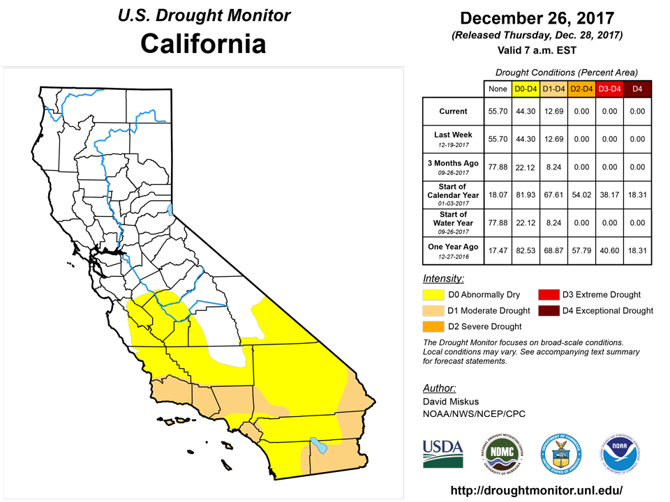
Across the southern half of the West, the WYTD precipitation and SWC have been the opposite of the north, with nearly all basins below normal (drier as one heads southward) and SWC at half of normal or less. Basin average precipitation and SWC in Arizona, southern Utah and Colorado, and New Mexico lingered below 25%, with SWC in single digits in parts of Arizona and New Mexico. In western New Mexico, dry weather during the past 90-days brought indices in line with D1 conditions. In central and eastern New Mexico, however, wet weather during late September has kept this area out of D1, but as this time period falls out of the past 90-days, D1 expansion is possible as very little precipitation has fallen since then. For example, Albuquerque, NM, has recorded 81 consecutive days without measurable precipitation through Dec. 25 (but 2.10 inches during Sep. 27-30). Across the rest of the Four Corners states, future degradation is possible due to a poor WYTD, but recent light precipitation, lower temperatures, and waiting for final December numbers and impacts staved off downgrades this week. In southern California, the Thomas Fire continued to burn, with 272,600 acres consumed as of Dec. 22.
Alaska, Hawaii, and Puerto Rico
After a relatively tranquil (dry) December, this week brought heavy rains to the central islands (eastern Molokai, Lanai, and western Maui), with largest 2-day totals (8am HST Dec. 19-8am HST Dec. 21) totals of 6 to 11 inches in western Maui. Kahului, Maui, set its wettest day on record with 6.40 inches on Dec. 20, breaking the former mark of 5.82 inches on Dec. 21, 1955. Other 2-day totals included 2-6 inches on western Molokai and about 2 inches on Lanai. Although much of the rain fell on non-drought areas, D0 was erased in western Maui and on Lanai. Elsewhere, light showers and subnormal temperatures occurred across most portions of the islands, preventing any further deterioration of conditions.
In Alaska, typical drier weather prevailed across the interior while 2-4 inches of precipitation fell on the Alaska Peninsula and Kodiak Island. Less than 0.5 inches of precipitation was reported along the climatologically wetter south and southeastern coasts, although heavy precipitation was measured here during the previous 2 weeks. Drier weather returned to Puerto Rico, especially southern sections, after a wet first half of December across the northern half. No D0 or drought was depicted in both Alaska and Puerto Rico.
Looking Ahead
The next 5 days (December 28-January 1) appear to be a mostly dry period, with the greatest precipitation (2-6 inches) expected in the Pacific Northwest and northern Rockies, offshore and along the Gulf and southern Atlantic Coasts (0.5-3 inches), and in the typical snow belt locations of the Great Lakes (1-2 inches). Little or no precipitation is favored elsewhere. Arctic air should be entrenched east of the Rockies while unseasonably mild weather envelops the West.
During the 6-10 day period (January 2-6), the odds favor near to below-median precipitation across much of the lower 48 States, with elevated chances for above-median precipitation limited to along the Gulf and southern Atlantic Coasts, and in Alaska. Subnormal temperatures are expected to persist in the eastern half of the contiguous U.S., with above normal readings probable in the Southwest, California, and Alaska.
Author(s):
David Miskus, NOAA/NWS/NCEP/CPC
Dryness Categories
D0 Abnormally Dry—used for areas showing dryness but not yet in drought, or for areas recovering from drought.
Drought Intensity Categories
D1 Moderate DroughtD2 Severe DroughtD3 Extreme DroughtD4 Exceptional Drought
Drought or Dryness Types
S Short-Term, typically less than 6 months (e.g. agricultural, grasslands)L Long-Term, typically greater than 6 months (e.g. hydrologic, ecologic)
Sourcce: National Drought Mitigation Center