
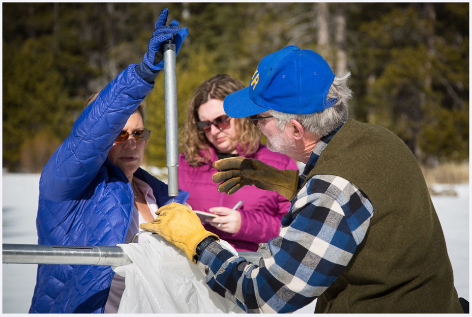
Left, Michelle Mead, Warning Coordination Meteorologist National Weather Service and Courtney Obergfell, General Forecaster National Weather Service assist Frank Gehrke Chief of the California Cooperative Snow Surveys Program with the second snow survey of the 2018 snow season at Phillips Station in the Sierra Nevada Mountains. The survey site is approximately 90 miles east of Sacramento off Highway 50 in El Dorado County. Photo taken February 1, 2018.
Dale Kolke / California Department of Water Resources.
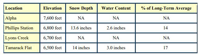
Measurements at Phillips Station revealed a snow water equivalent (SWE) of 2.6 inches, 14 percent of the early-February average at Phillips as measured there since 1964. SWE is the depth of water that theoretically would result if the entire snowpack melted instantaneously.
“California experiences the most variable weather in the nation,” said DWR Director Karla Nemeth. “It’s vital that water conservation efforts remain consistent regardless of the year’s precipitation.”
More telling than a survey at a single location like Phillips are DWR’s electronic readings today from 103 stations scattered throughout the Sierra. Measurements indicate the SWE of the northern Sierra snowpack is 4.6 inches, 27 percent of the multi-decade average for today’s date. The central and southern Sierra readings are 5.8 inches (30 percent of average) and 3.8 inches (25 percent of average) respectively. Statewide, the snowpack’s SWE is 4.9 inches, or 27 percent of the Feb. 1 average.
“The snow survey today shows water content far below average for this time of year,” said Frank Gehrke, chief of the California Cooperative Snow Surveys Program who conducted today’s survey at Phillips. “Today’s measurements indicate an anemic snowpack to date, but there is still the possibility of a wet February and March.”
On average, the snowpack supplies about 30 percent of California’s water needs as it melts in the spring and early summer. The greater the snowpack water content, the greater the likelihood California’s reservoirs will receive ample runoff as the snowpack melts to meet the state’s water demand in the summer and fall.
The Phillips snow course, near the intersection of Highway 50 and Sierra-at-Tahoe Road, is one of 260 that are surveyed manually throughout the winter. Manual measurements augment the electronic readings from the snow pillows in the Sierra Nevada that provide a current snapshot of the water content in the snowpack.
Results of today’s manual readings by DWR near Echo Summit are as follows:
California’s exceptionally high precipitation last winter and spring has resulted in above-average storage in 154 reservoirs tracked by the Department. DWR estimates total storage in those reservoirs at the end of January was 24.7 million acre feet (MAF), or 106 percent of the 23.4 MAF average for this time of year.
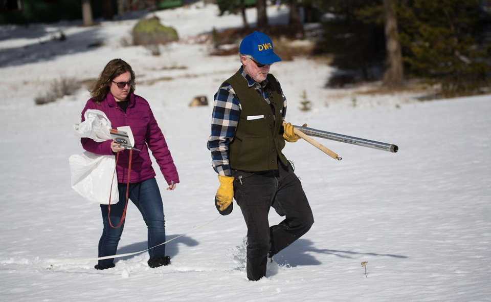
Left, Courtney Obergfell, General Forecaster National Weather Service assists Frank Gehrke Chief of the California Cooperative Snow Surveys Program with the second snow survey of the 2018 snow season at Phillips Station in the Sierra Nevada Mountains. The survey site is approximately 90 miles east of Sacramento off Highway 50 in El Dorado County. Photo taken February 1, 2018.
Dale Kolke / California Department of Water Resources.
Source: DWR