
CLICK HERE FOR A LARGE MAP (3,000 Pixels Wide and 3MB)
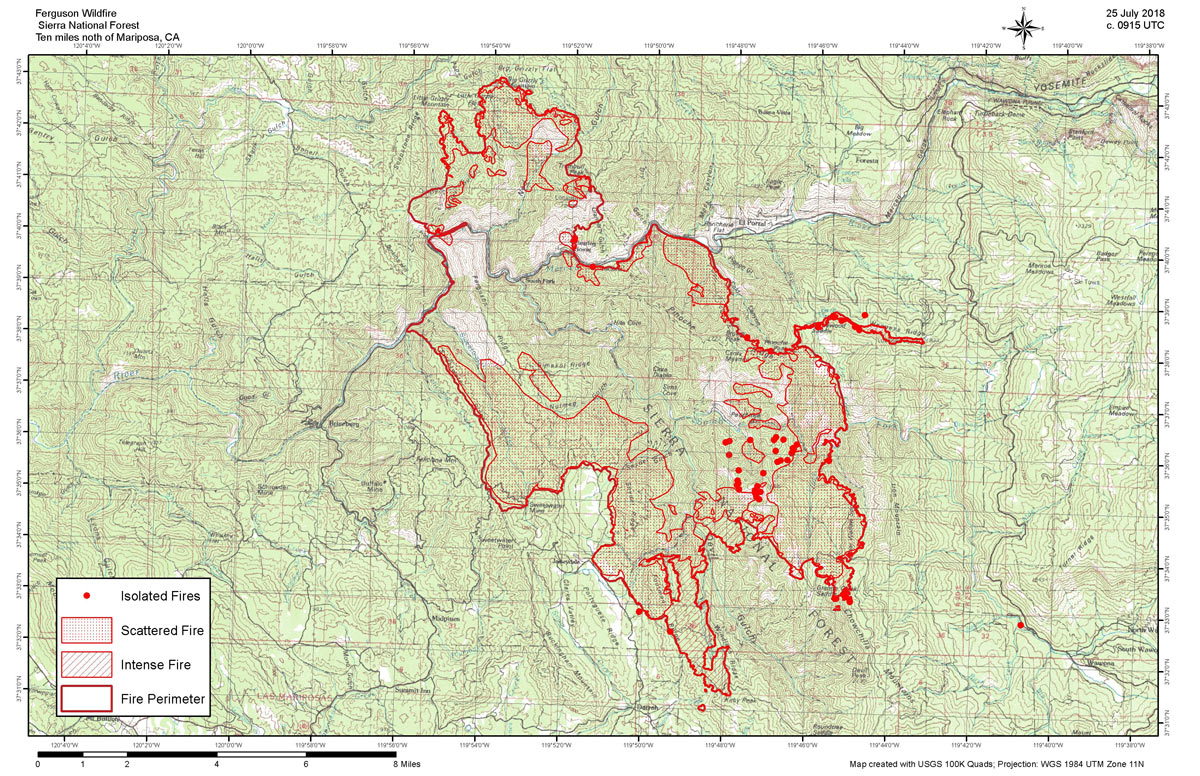
July 25, 2018 - Wednesday Infrared Map of the Ferguson Fire in Mariposa County near Yosemite National Park.
Acreage -
Estimated Acreage: 39,869 Acres
Acreage Change: + 3,282 Acres
Weather Conditions -
The vicinity of the fire was cloud free.
Details -
The interpreters were able to designate the fire perimeter and isolated fires with little difficulty.
There were some orthorectification issues in the northern part of the center area of the fire and in the area of the burnout on the east.
There was an isolated fire to the north of the burnout along the ridge to the east of the fire; It is on the northwest facing slope at 37 38' 46.4" N x 119 44' 45.5".
Another isolated fire was location on the SE part of the incident, and was mapped, though it may have been a vehicle exhaust, as it was close to a road.
To the south, the fire has reached Kirby Peak and there area a couple of spots to the west and southwest of the main fire. The spot fire to the southwest is on the SE side of Kirby Peak.
To the ENE, the fire appears to have reached the Granite Creek Saddle, with numerous spot fires in that location.
The NW part of the fire has reached both Little Grizzly Mountain and Big Grizzly Mountain