
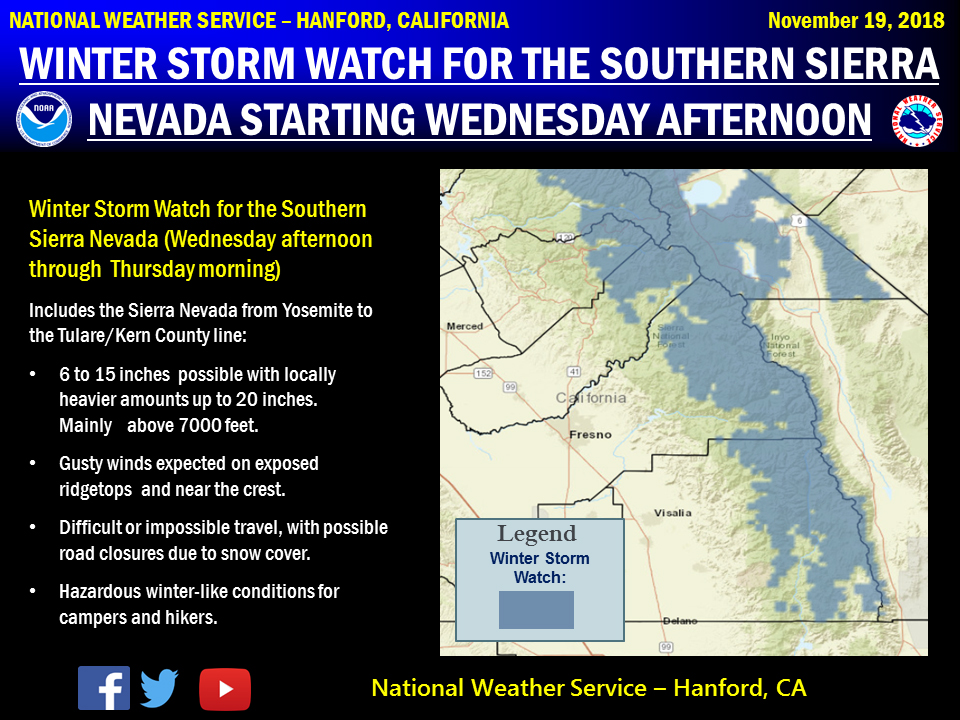
November 20, 2018 - The National Weather Service Hanford office reports a winter-like storm will bring significant amounts of snow to the southern Sierra Nevada Wednesday afternoon through Thursday morning.
Travel could be very difficult to impossible.
Holiday travelers in the mountains should be prepared for long delays and possible road closures at or above 7000 ft elevation.
If traveling consider alternate plans, remember to carry tire chains, extra food, water and clothing.
Campers and hikers should be prepared for hazardous winter-like conditions.
For information on road conditions, including possible closures or delays, call Caltrans at 1-800-427-7623 or visit http://www.dot.ca.gov/cgi-bin/roads.cgi.
Winter Storm Watch
URGENT - WINTER WEATHER MESSAGE
National Weather Service Hanford CA
953 PM PST Mon Nov 19 2018

CAZ096-097-201400-
/O.CON.KHNX.WS.A.0006.181121T2000Z-181122T1800Z/
Sierra Nevada from Yosemite to Kings Canyon-
Tulare County Mountains-
953 PM PST Mon Nov 19 2018

...WINTER STORM WATCH REMAINS IN EFFECT FROM WEDNESDAY AFTERNOON
THROUGH THURSDAY MORNING...

* WHAT...Heavy snow possible. Total snow accumulations of 6 to
  15 inches above 7000 feet with up to 20 inches possible.

* WHERE...Sierra Nevada from Yosemite to Kings Canyon and Tulare
  County Mountains.

* WHEN...From Wednesday afternoon through Thursday morning.

* ADDITIONAL DETAILS...Travel could be very difficult to
  impossible. Holiday travelers should be prepared for long
  delays and possible road closures. If traveling consider
  alternate plans, remember to carry tire chains, extra food,
  water and clothing.

PRECAUTIONARY/PREPAREDNESS ACTIONS...

A Winter Storm Watch means there is potential for significant
snow, sleet or ice accumulations that may impact travel. Continue
to monitor the latest forecasts.
Source: NWS