
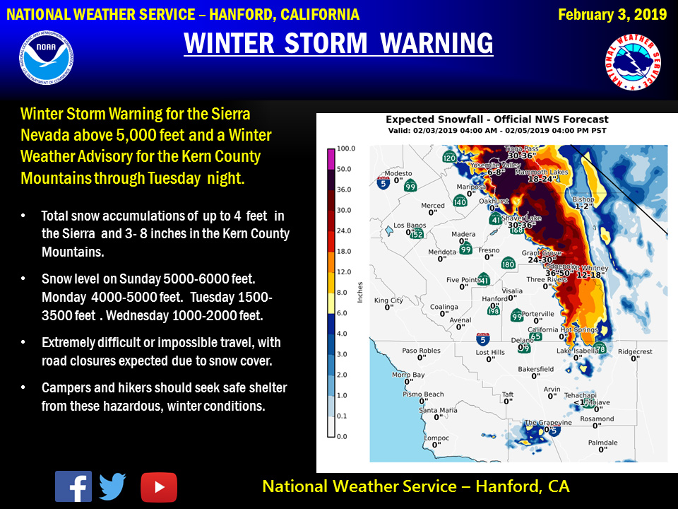
Yosemite Valley could receive 6"to 8"of snow
February 3, 2019 - The National Weather Service Hanford Office reports a colder storm system will start affecting central California tonight and Monday and continue bringing snow showers into Wednesday.
Thus a Winter Storm Warning is in effect for the Southern Sierra Nevada through Tuesday and a Winter Weather Advisory for the Kern County Mountains through Tuesday night.
Lowering snow levels will start 5,000-6,000 feet Sunday then dropping to 1,000-2,000 feet by Wednesday.
Strong, gusty winds are likely on exposed ridgetops and near the crest.
Winter Storm Warning
URGENT - WINTER WEATHER MESSAGE
National Weather Service Hanford CA
357 AM PST Sun Feb 3 2019


Sierra Nevada from Yosemite to Kings Canyon-
Tulare County Mountains-
Including the cities of Camp Nelson, Giant Forest, and Lodgepole
357 AM PST Sun Feb 3 2019

...WINTER STORM WARNING NOW IN EFFECT UNTIL 4 PM PST TUESDAY
ABOVE 5000 FEET...

* WHAT...Heavy snow above 5000 feet. Additional snow accumulation
  today through Tuesday up to 4 feet above 5000 feet. Between 4000
  and 5000 feet, 1 to 2 feet of snow are possible Monday and
  Tuesday. Winds could gust as high as 70 mph along the crest.
  Snow levels will be around 5000 today, then lowering to 4000 to
  4500 feet by Monday morning. Snow levels will drop below 4000
  feet Monday night and Tuesday.

* WHERE...Sierra Nevada from Yosemite to Kings Canyon and Tulare
  County Mountains.

* WHEN...Until 4 PM PST Tuesday.

* ADDITIONAL DETAILS...Travel could be very difficult to
  impossible. The hazardous conditions could impact the morning or
  evening commute. Strong winds could cause extensive damage to
  trees and power lines.

PRECAUTIONARY/PREPAREDNESS ACTIONS...

A Winter Storm Warning means significant amounts of snow, sleet
and ice will make travel very hazardous or impossible.

The latest road conditions for the state you are calling from can
be obtained by calling 5 1 1.
Source: NWS