
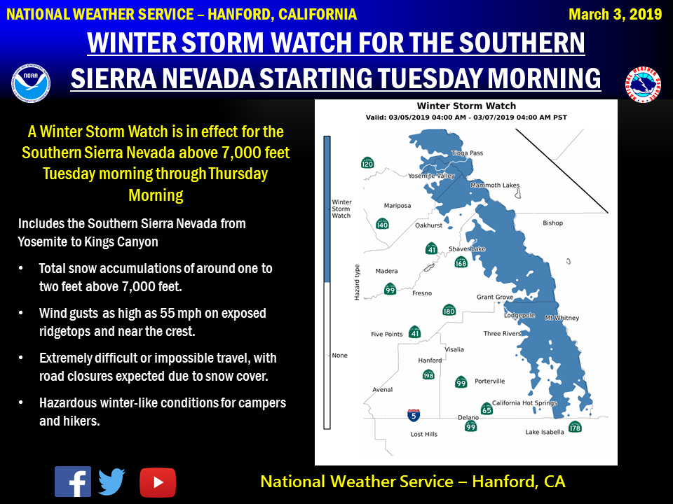
March 4, 2019 - The National Weather Service Hanford Office reports a storm system will produce snow and wintry travel conditions above 7,000 feet in the Southern Sierra Nevada Tuesday morning through Thursday morning.
Motorists should anticipate lengthy delays and slick, hazardous road conditions, as well as potential road closures above 7,000 feet.
If traveling, consider alternate plans and remember to carry tire chains, plenty of food, a good deal of water, and warm clothing.
For information on road conditions, including closures or delays, call Caltrans at 1-800-427-7623 or visit http://www.dot.ca.gov/cgi-bin/roads.cgi.
Winter Storm Watch
URGENT - WINTER WEATHER MESSAGE
National Weather Service Hanford CA
1013 PM PST Sun Mar 3 2019


Sierra Nevada from Yosemite to Kings Canyon-
Tulare County Mountains-
1013 PM PST Sun Mar 3 2019

...WINTER STORM WATCH REMAINS IN EFFECT FROM LATE MONDAY NIGHT
THROUGH LATE WEDNESDAY NIGHT ABOVE 7000 FEET...

* WHAT...Heavy snow possible above 7000 feet. Total snow
  accumulation of 1 to 2 feet possible. Local amounts could reach
  as high as 3 feet at higher elevations. Winds could gust as
  high as 55 mph.

* WHERE...Sierra Nevada from Yosemite to Kings Canyon and Tulare
  County Mountains.

* WHEN...From late Monday night through late Wednesday night.

* ADDITIONAL DETAILS...Travel could be very difficult to
  impossible. The hazardous conditions could impact the morning
  or evening commute. Gusty winds could bring down tree branches.

PRECAUTIONARY/PREPAREDNESS ACTIONS...

A Winter Storm Watch means there is potential for significant
snow, sleet or ice accumulations that may impact travel. Continue
to monitor the latest forecasts.
Source: NWS