
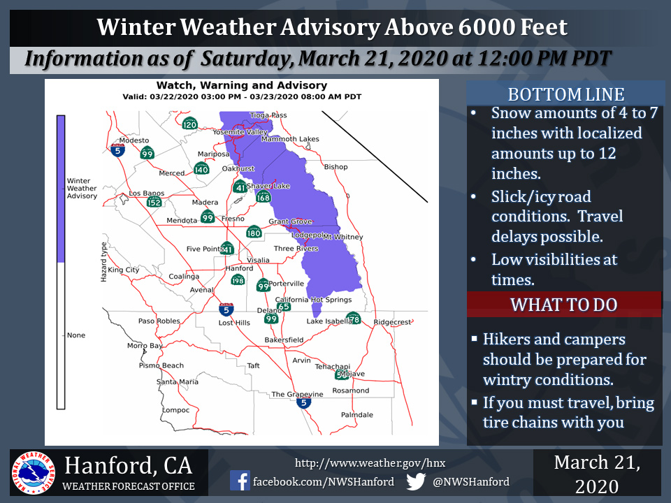
March 21, 2020 - The National Weather Service Hanford Office reports a Winter Weather Advisory is effect for parts of the Sierra Nevada from Yosemite to the Tulare/Kern County line above 6000 feet from 3:00 PM Sunday until 8:00 AM Monday.
Snow accumulations from 4 to 7 inches with local accumulations of up to 12 inches.
Motorists should anticipate slick driving conditions, travel delays and possible road closures. Hikers and campers should be prepared for wintry conditions.
Winter Weather Advisory
URGENT - WINTER WEATHER MESSAGE
National Weather Service Hanford CA
1141 AM PDT Sat Mar 21 2020

CAZ192>194-220245-
/O.NEW.KHNX.WW.Y.0007.200322T2200Z-200323T1500Z/
Central Sierra-North Kings River-Sequoia Kings-
Including the cities of Devils Postpile, Florence Lake,
Lake Thomas Edison, Tuolumne Meadows, Bass Lake, Fish Camp,
Wawona, Shaver Lake, Camp Nelson, Giant Forest, Lodgepole,
Grant Grove, and Johnsondale
1141 AM PDT Sat Mar 21 2020

...WINTER WEATHER ADVISORY IN EFFECT FROM 3 PM SUNDAY TO 8 AM PDT
MONDAY...

* WHAT...Snow expected. Total snow accumulations of 4 to 7 inches
  above 6000 feet with local amounts of up to 12 inches.

* WHERE...The southern Sierra from Yosemite to the Kern County
  line.

* WHEN...From 3 PM Sunday to 8 AM PDT Monday.

* IMPACTS...Plan on slippery, snow covered roads, travel delays
  and possible road closures. Tire chains may be required. Hikers
  and campers should be prepared for wintry weather and wind chill
  temperatures in the single digits and teens.


PRECAUTIONARY/PREPAREDNESS ACTIONS...

Slow down and use caution while traveling.

The latest road conditions can be obtained by calling CALTRANS
at 1-800-427-7623.
Source: NWS