
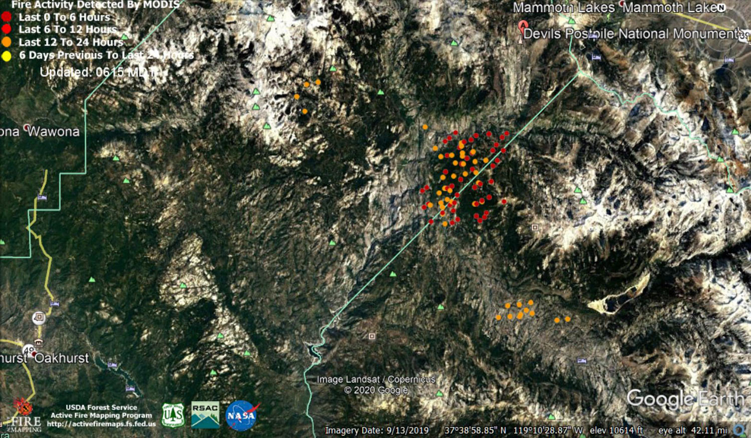
MODIS map of the Creek Fire on Thursday at 5:15 A.M. PST
Note: 1,500 Wide and older yellow detections removed
MODIS Active Fire Mapping Program Frequently Asked Questions
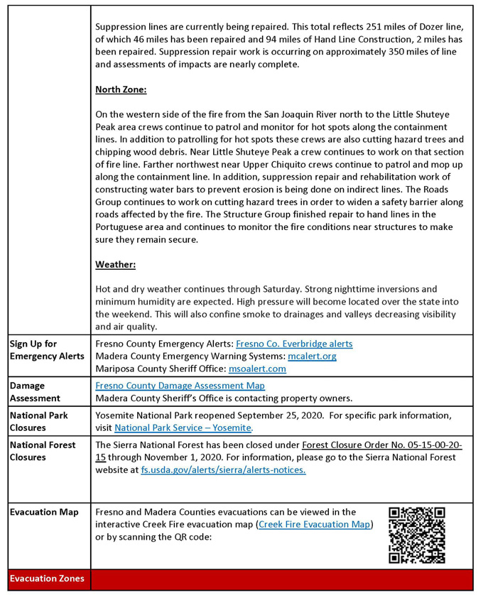
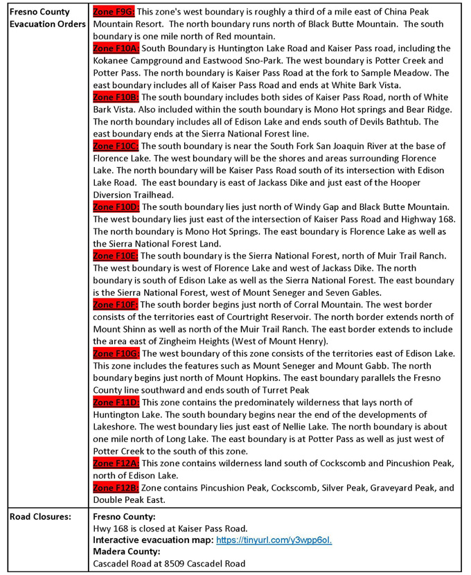
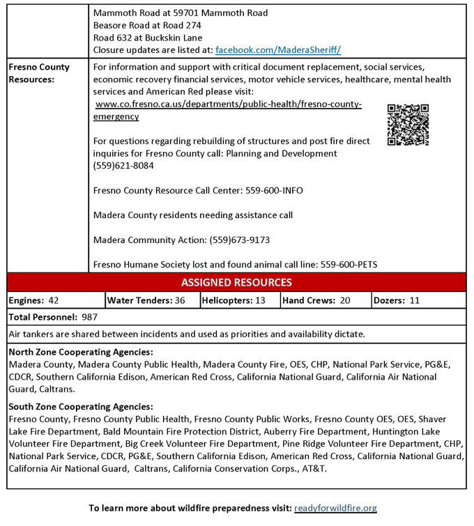
Update for 7:00 P.M. CAL FIRE Evening Update for the Creek Fire: The fire is currently 341,722 acres, 58% contained with approximately 987 personnel assisting with fire suppression and logistical operations.
'Click' here to view 4 page PDF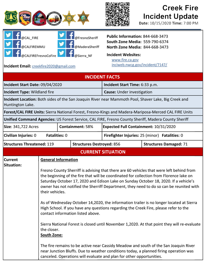
Update: 9:55 A.M.: Forest Service Wildland Fire Smoke/Air Quality Outlook Due to the Creek Fire in the Yosemite Area for October 15 & 16, 2020
Update 9:10 A.M. CAL FIRE Morning Update for the Creek Fire: 341,722 acres and 55% containment.
'Click' here to view 4 page PDF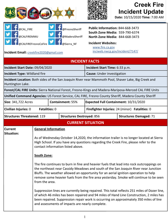
Update for 9:00 A.M.: Sierra National Forest Creek Fire Operations Briefing Video for Thursday, October 15, 2020
Update 5:30 A.M.: Sierra National Forest Creek Fire Public Information Map for Thursday, October 15, 2020 - Shows Contained Line and Uncontrolled Fire Edge
October 15, 2020 - Overnight infrared mapping has the Creek Fire at 341,722 Interpreted Acres.
Comments and notes on flight:
DP 70 filled in.
There was some growth and spotting in Div I.
Areas of intense heat persist in Div J.
The most intense heat and majority of acreage addition was eastward in Div M similar to previous flights.
Light spotting was detected off the north side of DP 34 near Edison Lake.
Wednesday Evening Update: 337,655 acres and 55% containment.
Sierra National Forest Creek Fire Updates for Wednesday, October 14, 2020