
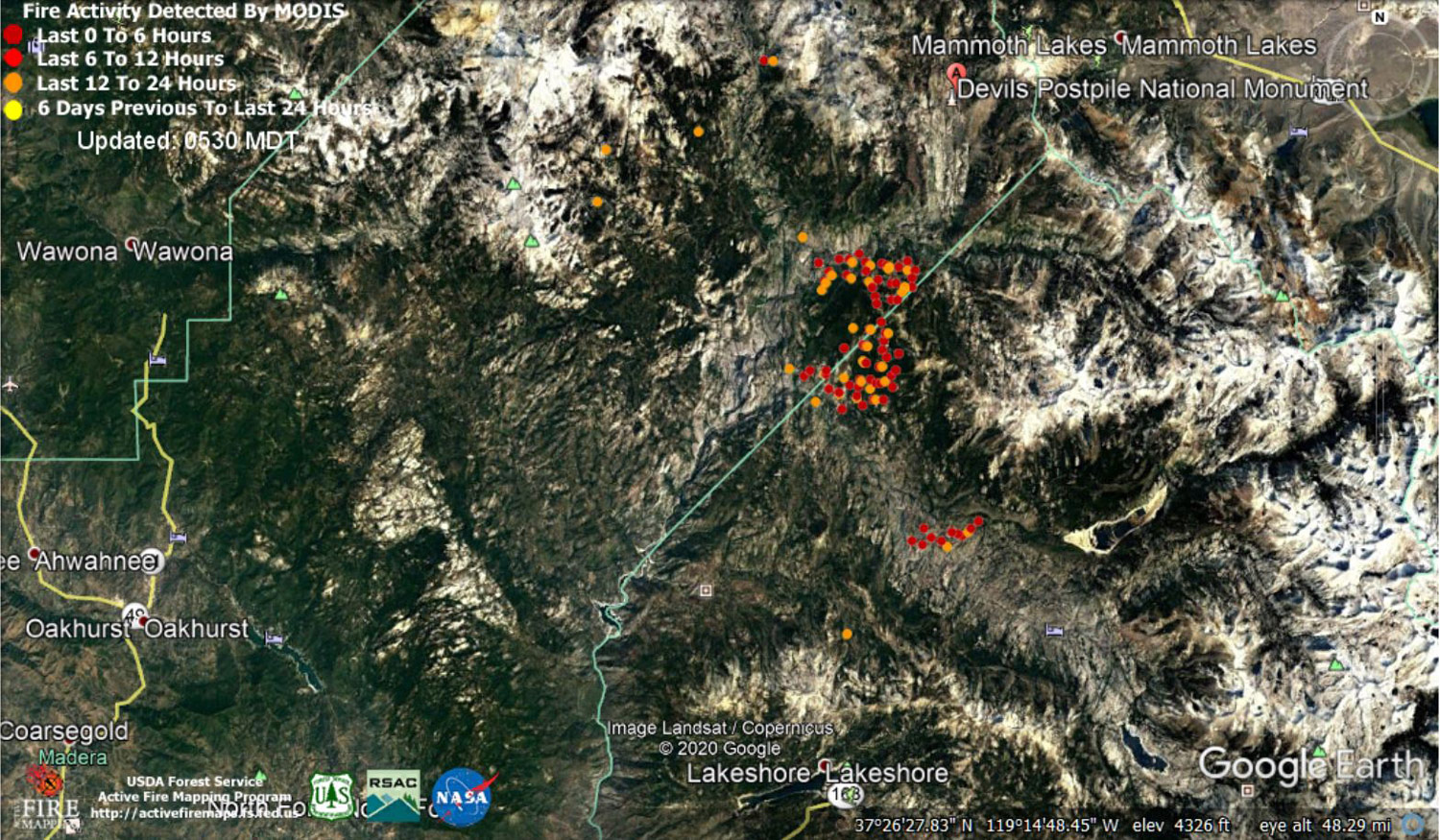
MODIS map of the Creek Fire on Friday at 4:30 A.M. PST
Note: 1,500 Wide and older yellow detections removed
MODIS Active Fire Mapping Program Frequently Asked Questions
Update 7:05 P.M. CAL FIRE Evening Update for the Creek Fire: fire remains at 344,042 acres and 60% contained.
'Click' here to view 4 page PDF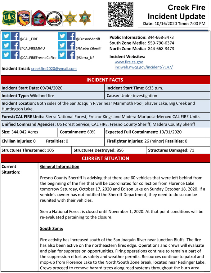
Update 7:00 P.M. (LIVE): Sierra National Forest to Hold a Creek Fire Livestream Incident Briefing with CAL FIRE on Friday, October 16, 2020
Update 12:15 P.M.: Sierra National Forest Creek Fire North Zone Operations Briefing Video for Friday, October 16, 2020
Update: 9:55 A.M.: Forest Service Wildland Fire Smoke/Air Quality Outlook Due to the Creek Fire in the Yosemite Area for October 16 & 17, 2020
Update for 9:30 A.M.: Sierra National Forest Creek Fire Operations Briefing Video for Friday, October 16, 2020
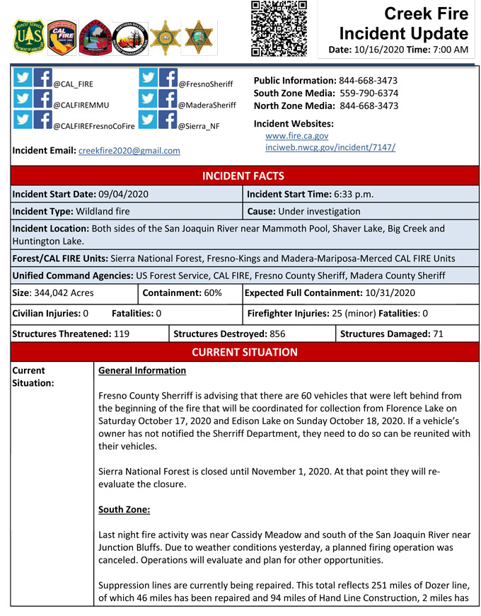
Update 8:45 A.M. CAL FIRE Morning Update for the Creek Fire: 344,042 acres and 60% containment.
'Click' here to view 4 page PDF
Update 5:15 A.M.: Sierra National Forest Creek Fire Public Information Map for Friday, October 16, 2020 - Shows Contained Line and Uncontrolled Fire Edge
October 16, 2020 - Overnight infrared mapping has the Creek Fire at 344,042 Interpreted Acres.
Comments and notes on flight:
The northeast peninsula in Div M again saw the most growth, however it was more moderate this evening with easterly winds.
Small amounts of growth continue all around Div I border.
There was also a small amount of activity north of Lakeshore to the north.
Thursday Evening Update: 341,722 acres and 58% containment.
Sierra National Forest Creek Fire Updates for Thursday, October 15, 2020