
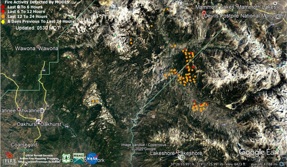
MODIS map of the Creek Fire on Saturday at 4:30 A.M. PST
Note: 1,500 Wide and older yellow detections removed
MODIS Active Fire Mapping Program Frequently Asked Questions
Update for 7:00 P.M. CAL FIRE Evening Update for the Creek Fire: fire remains at 346,477 acres and 60% contained.
'Click' here to view 5 page PDF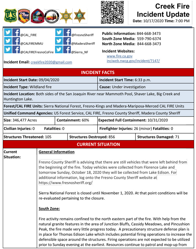
Update for 9:35 A.M.: Sierra National Forest Creek Fire South Zone Operations Briefing Video for Saturday, October 17, 2020
Update: 8:55 A.M.: Forest Service Wildland Fire Smoke/Air Quality Outlook Due to the Creek Fire in the Yosemite Area for October 17 & 18, 2020
Update 8:05 A.M. CAL FIRE Morning Update for the Creek Fire: 346,477 acres and 60% containment.
'Click' here to view 4 page PDF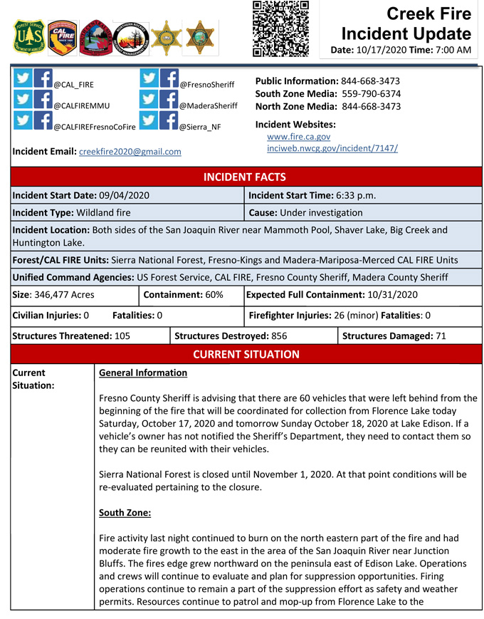
Update 5:45 A.M.: Sierra National Forest Creek Fire Public Information Map for Saturday, October 17, 2020 - Shows Contained Line and Uncontrolled Fire Edge
October 17, 2020 - Overnight infrared mapping has the Creek Fire at 346,477 Interpreted Acres.
Comments and notes on flight:
A point of isolated heat was detected off the Southwest border in Div Z. It might be a campfire but no vehicles were detected.
Overall the isolated and scattered heat points were hotter this evening with several hotspots cropping up throughout the burn.
The northeast peninsula in Div M again saw more moderate growth to the east.
Small amounts of growth continue all around Div I border. The border grew northward on the peninsula east of Edison Lake.
Friday Evening Update: 344,042 acres and 60% containment.
Sierra National Forest Creek Fire Updates for Friday, October 16, 2020