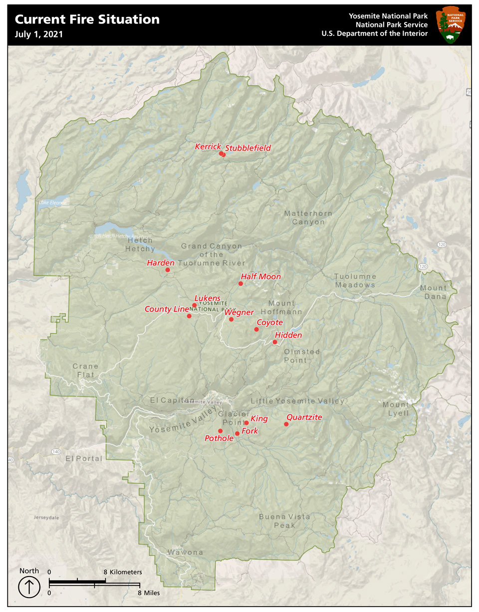
July 1, 2021 - Yosemite National Park experienced multiple lightning strikes igniting wildfires June 29-30, 2021. Park management is still determining the total number and location of fires to prioritize fire management actions. At this time thirteen fires have been detected.
Yosemite National Park is a fire adapted ecosystem. The strategy for all fires is to provide for the safety of employees and public, as well as protect natural and cultural resources. Currently there are no threats to infrastructure.
- Three fires posing threats to public safety and park resources are being suppressed: King (8 acres); Pothole (.1 acre) and Harden (.1 acre). Two segments of trails from Illilouette Creek to Nevada Falls are currently closed due to King Fire.
- Two fires will be confined and contained: County Line (.1 acre) and Lukens (.1 acre). These are near last year’s Wolf and Blue Jay fires, in the area around White Wolf, and will be contained using last year’s fire footprints and natural barriers such as granite and bare ground.
- The remaining nine fires have been placed in monitor status due to their remote location and low potential for fire spread. This minimizes suppression impacts in the wilderness while providing for the healthy ecological effects of natural fire. Firefighters will routinely monitor fire behavior and take suppression actions as warranted.
Fire Update:
Location: Yosemite National Park
Size: 0.1 to 15 acres
Containment: 0%
Strategy: Suppression, Confine/Contain, Monitor
Cause: Lightning
Yosemite Current Fire Situation Map
Fires will be visible from numerous vantage points throughout the park, including Tioga Road, Glacier Point, and other high-country viewpoints.
Park Managers are working with the local Air Quality Districts and will be monitoring smoke impacts to the park and local communities.
Look for future updates coming soon at the InciWeb Incident Information System. https://inciweb.nwcg.gov/
Source: NPS