Click here for: Washburn Fire in Yosemite National Park Updates for Monday, July 11, 2022
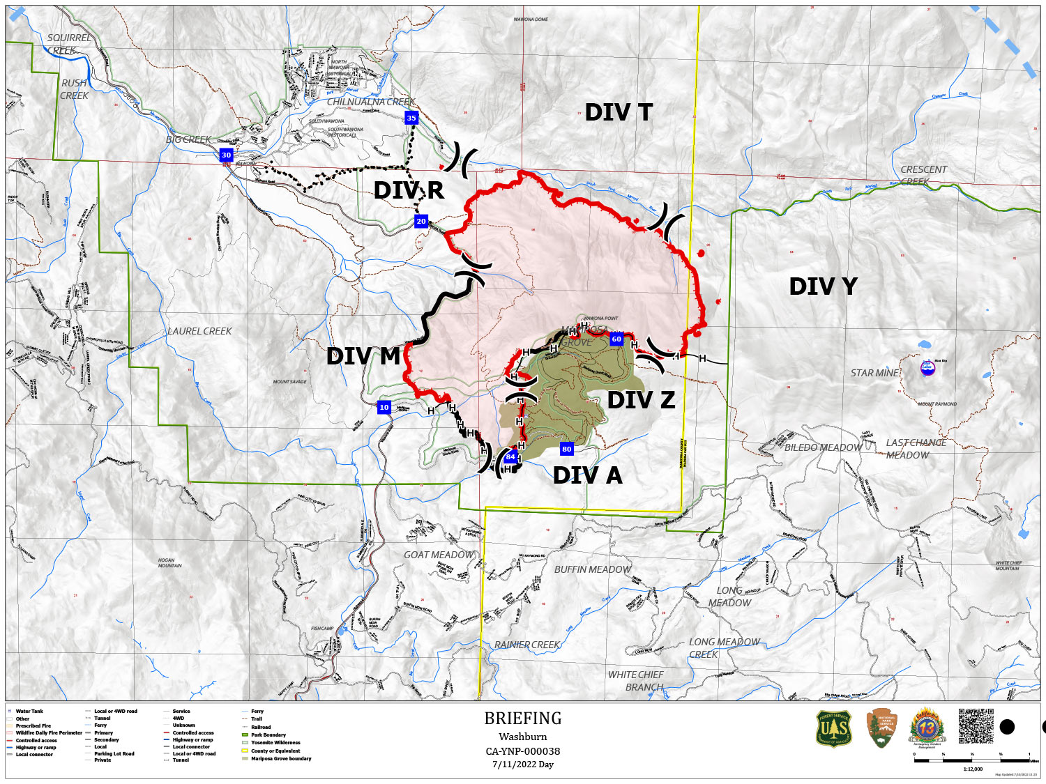
Note: Map is 1,500 Pixels Wide.
Shows Divisions. Dozer Lines and Uncontrolled Fire Edge.
Below Map:
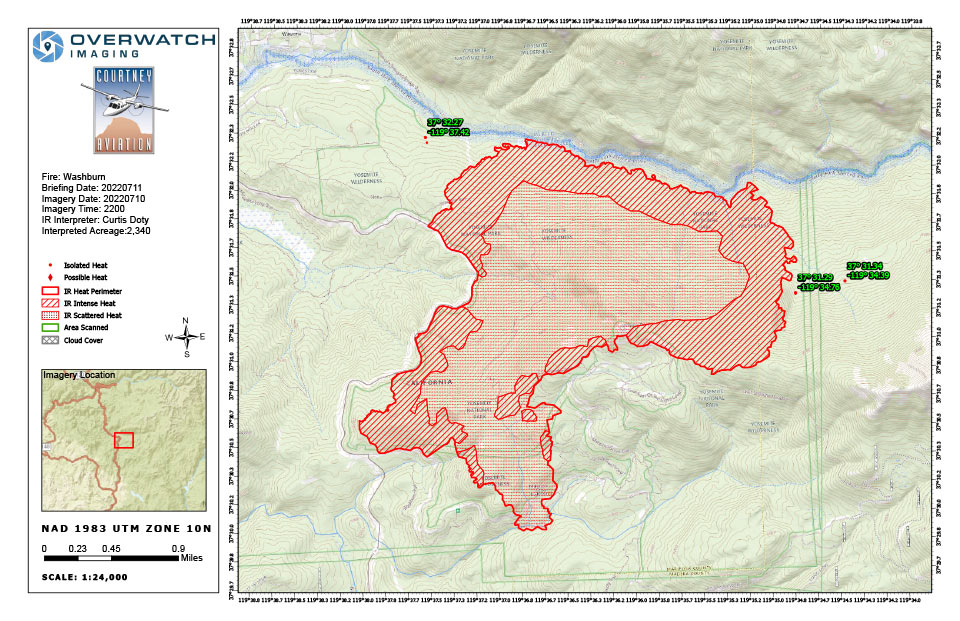
Infrared Map for Monday, July 11, 2022
Acreage: 2,340 Acres (Growth since last flight: 749 Acres)
Flight Notes: Comments /notes on tonight’s mission and this interpretation:
Weather was clear over the incident with light smoke, providing good georectification and visibility.
Intense heat along the head, left and right flanks. Entire interior is still covered with scattered heat.
Three significant spots outside of the perimeter. (Note the two heat points outside of the scanbox are the fire pits in Tenaya Lodge Explorer Cabins and unrelated to the incident.)


