


Click Here for California Fires
September 18, 2022 - One new large fire was reported in Kansas. Currently, 94 large fires and complexes have burned 910,842 acres in 8 states. The number of wildland firefighters and support 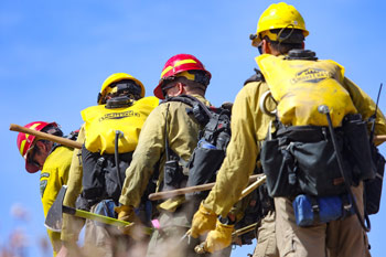 personnel assigned to incidents has gone down to about 15,600. One national incident management organization team, six Type 1 incident management teams (IMTs), nine Type 2 IMTs and one complex IMT are supporting large fires in the West.
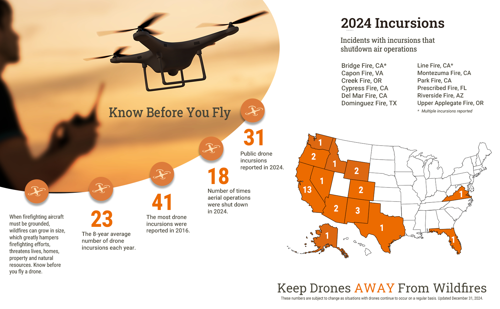
To date, 14 unauthorized drone incursions have been reported near active wildfires. Air operations were shutdown on 12 incidents while authorities located the drone operators. When firefighting aircraft are grounded for any reason, fire crews lose access to a valuable resource which can adversely affect the safety and efficiency of the overall firefighting effort. To inform drone pilots of flight restrictions, the Federal Aviation Administration (FAA) has developed an easy-to-use smartphone app called B4UFLY. The app helps drone pilots determine whether there are restrictions or requirements in effect at the location where they want to fly. B4UFLY is available for free and can be downloaded in the App Store for iOS and Google Play store for Android devices. Additional information is available on the FAA Know Before You Fly website.
Predictive Services specialists at the National Interagency Coordination Center closely analyze weather, vegetation, and other factors that affect fire activity. Visit their website for more information about current weather conditions and listen to the weekly fuels and fire danger podcast.
Wetting rain will fall over the central and northern California coast and spread inland to the western slopes of the Sierra. Heavy rain is expected in portions of the Coast Ranges and possibly in portions of the Sacramento Valley. Isolated thunderstorms are likely in portions of the Inland Northwest, Idaho, and Montana, with better chances and coverage near a stalled surface front. South-southwest sustained winds of 12-20 mph with gusts of 25-40 mph amid minimum relative humidity of 8-25% are expected in portions of the eastern Sierra across the southern half of the Great Basin into the Colorado Rockies, southern Wyoming, and northern Arizona. Dry and breezy conditions are likely to spread onto portions of the southern and central High Plains as well. Isolated thunderstorms are also possible from southeast Arizona and southern New Mexico into southwest Colorado. Thunderstorms will likely continue along portions of the Gulf Coast and over much of the Florida Peninsula, and strong to severe thunderstorms are likely in portions of the Midwest. Tropical Storm Fiona is forecast to strengthen into a hurricane before making landfall on Puerto Rico, with tropical storm to hurricane conditions across the entire island, including widespread heavy rain and flooding. Strong winds, rain, and coastal flooding will continue on portions of the western Alaska coast.
| Number of new large fires or emergency response * New fires are identified with an asterisk |
1 | States currently reporting large fires: |
| Number of active large fires Total does not include individual fires within complexes. |
94 | |
| Acres from active fires | 910,842 | |
| Fires contained | 3 |
Year-to-date statistics
| 2022 (1/1/22-9/18/22) | Fires: 51,079 | Acres: 6,793,291 |
| 2021 (1/1/21-9/18/21) | Fires: 45,056 | Acres: 5,628,846 |
| 2020 (1/1/20-9/18/20) | Fires: 42,866 | Acres: 7,236,139 |
| 2019 (1/1/19-9/18/19) | Fires: 37,715 | Acres: 4,343,105 |
| 2018 (1/1/18-9/18/18) | Fires: 48,177 | Acres: 7,310,798 |
| 2017 (1/1/17-9/18/17) | Fires: 49,840 | Acres: 8,530,183 |
| 2016 (1/1/16-9/18/16) | Fires: 43,511 | Acres: 4,798,163 |
| 2015 (1/1/15-9/18/15) | Fires: 46,552 | Acres: 8,826,623 |
| 2014 (1/1/14-9/18/14) | Fires: 39,851 | Acres: 2,954,749 |
| 2013 (1/1/13-9/18/13) | Fires: 38,119 | Acres: 4,003,954 |
| 2012 (1/1/12-9/18/12) | Fires: 46,653 | Acres: 8,379,998 |
10-year average Year-to-Date
| 2012-2021 | Fires: 43,737 | Acres: 6,182,404 |
Source: NIFC
