
Update Thursday Morning 10:30 A.M.: The Fire Weather Watch has been canceled due to the current forecast not meeting the criteria for a Red Flag Warning. However, minimum relative humidity is still expected to be 15 to 20% and wind gusts are expected to be 20 to 30 mph today, so fire risk is still elevated.
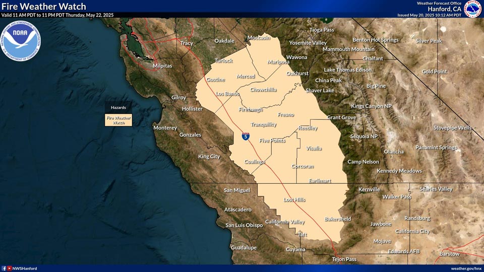
May 20, 2025 - National Weather Service Hanford Office officials report a Fire Weather Watch is in effect for the San Joaquin Valley from Merced to Kern County and the adjacent Coastal and Sierra Foothills.
The Fire Weather Watch is in effect from mid-morning to late evening on Thursday, May 22nd.
At that time, warm temperatures, dry air and strong winds will make the dry grass suspectable to fire starts.
Fire Weather Watch
URGENT - FIRE WEATHER MESSAGE
National Weather Service Hanford CA
924 AM PDT Tue May 20 2025


CAZ579-580-590-591-210030-
/O.NEW.KHNX.FW.A.0001.250522T1800Z-250523T0600Z/
West Side Hills-San Joaquin Valley-Central Sierra Foothills-
Southern Sierra Foothills-
924 AM PDT Tue May 20 2025

...FIRE WEATHER WATCH IN EFFECT FROM THURSDAY MORNING THROUGH
THURSDAY EVENING FOR STRONG WINDS AND LOW HUMIDITY FOR SAN
JOAQUIN VALLEY AND ADJACENT COASTAL AND SIERRA FOOTHILLS...

The National Weather Service in Hanford has issued a Fire Weather
Watch, which is in effect from Thursday morning through Thursday
evening.

* AFFECTED AREA...Fire weather zone 579 West Side Hills. Fire
  weather zone 580 San Joaquin Valley. Fire weather zone 590
  Central Sierra Foothills. Fire weather zone 591 Southern Sierra
  Foothills.

* WIND...West to Northwest winds 15 to 20 mph with gusts reaching
  25 to 35 mph. Ridge-top wind gusts reaching 35 mph.

* HUMIDITY...5 to 15 percent.

* IMPACTS...Any fires that develop will likely spread rapidly.
  Outdoor burning is not recommended.

PRECAUTIONARY/PREPAREDNESS ACTIONS...

A Fire Weather Watch means that critical fire weather conditions
are forecast to occur. Listen for later forecasts and possible
Red Flag Warnings.
Source: NWS