
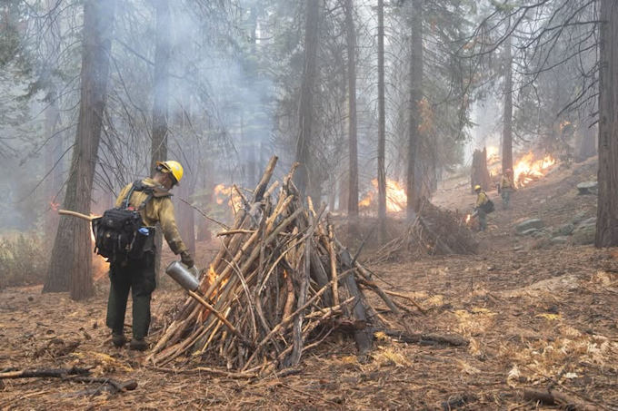
Pile burning credit: NPS
November 14, 2026 - The Bass Lake Ranger District of the Sierra National Forest continues prescribed fire operations beginning on Saturday, Nov. 14. Fire Management officials aim to complete a total of 500 acres at Nelder Grove, through Monday, Nov. 16 or until all planned units are complete. Fire managers intend to continue prescribed fire operations through the winter of 2026 and into spring 2027, as conditions allow. The Forest Service uses prescribed fire to reduce overgrown vegetation, help protect local communities, infrastructure, and natural resources from wildfires, and prepare areas for reforestation.
Map
This project is the culmination of treatment for fuels reduction work completed under the Giant Sequoia Emergency Response Project or GSER, which started in September of 2022. The effort is the largest treatment of fuels and vegetation within the Giant Sequoia grove area since 1925. The prescribed burn project will treat 470 acres of machine piles and an additional 30 acres of hand piles along the Chimney Tree trail.
Planned Prescribed Fire operations site on the Bass Lake Ranger District:
- Prescribed Fire Operation –
- Giant Sequoia Emergency Response (GSER) - Boundary Area:
- North: Graveyard of the Giants Trail (5S19B Road) at the north boundary of Nelder Grove
- South: Sky Ranch Road at 6S47Y Road
- East: Nelder Grove boundary along 6S90 Road
- West: Calvin Crest property boundary at 6S90 Road
- Giant Sequoia Emergency Response (GSER) - Boundary Area:
Fire management officials work with the California Air Resources Board and the San Joaquin Valley Air Pollution Control District (SJVAPCD) smoke specialists to plan prescribed fire projects. These projects are conducted when weather is most likely to move smoke up and away from our communities. While prescribed fire managers take significant preventive measures, communities may experience smoke during or immediately after prescribed fire operations.
For information on smoke impacts and how to reduce exposure, please visit www.airnow.gov or www.valleyair.org.
Residents and visitors to Oakhurst, Bass Lake, Ahwahnee, Sugar Pine, Fish Camp, and other mountain communities may see smoke or flames from the project areas and are encouraged not to report prescribed fire projects through the 911 system. Smoke from the ignitions may also be visible from CA Highway 41, Highway 49, and Madera County Roads 222, 223, and 274, as well as the ALERTCalifornia.org camera network, and other vantage points. Visitors are encouraged to use caution and watch for fire crews and equipment when traveling near prescribed burn areas.
Source: SNF