Click here for: Washburn Fire in Yosemite National Park Updates for Thursday, July 14, 2022
Note: Map is 1,500 Pixels Wide.
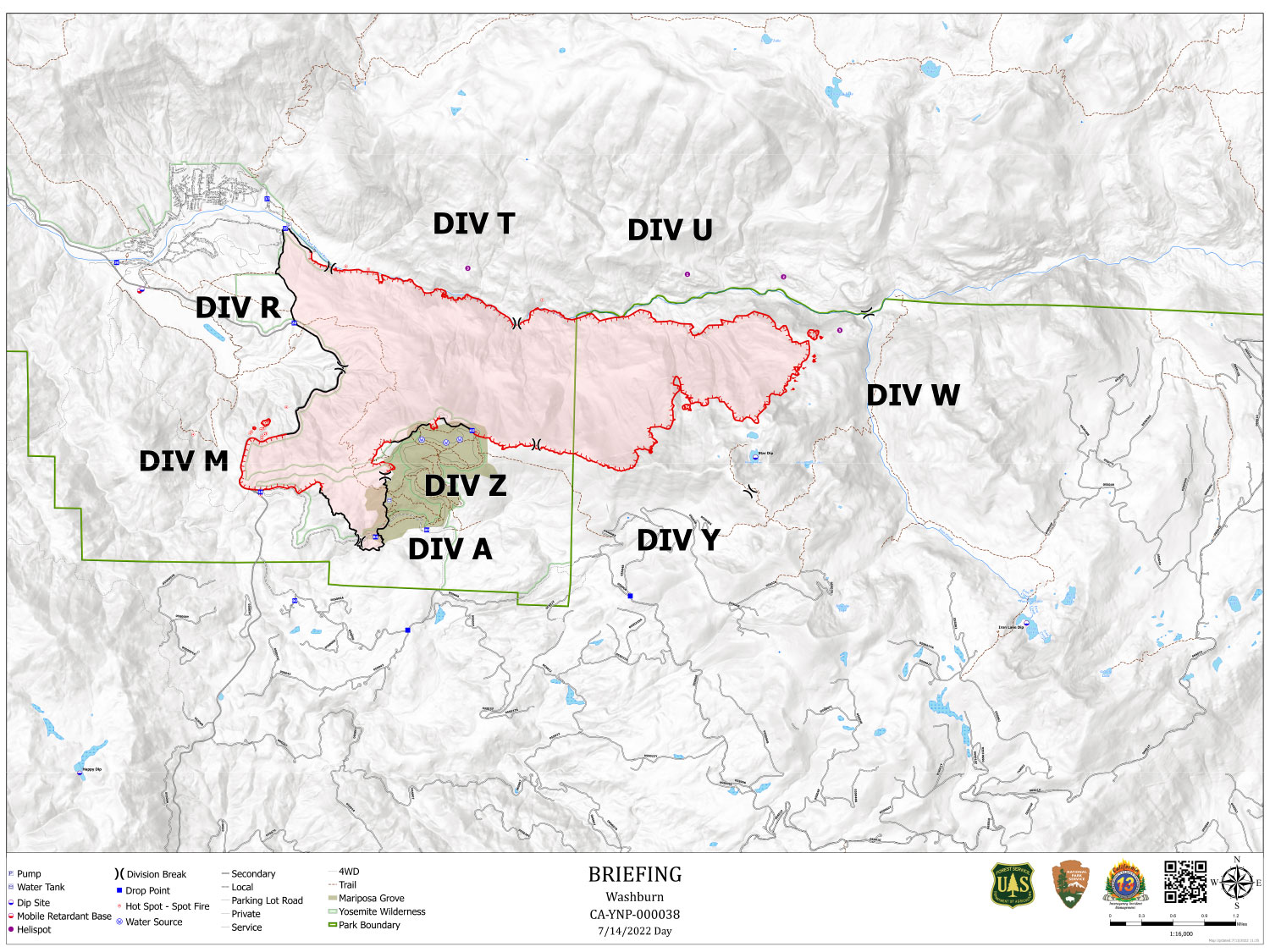
Shows Divisions. Dozer Lines and Uncontrolled Fire Edge.
Below Map:
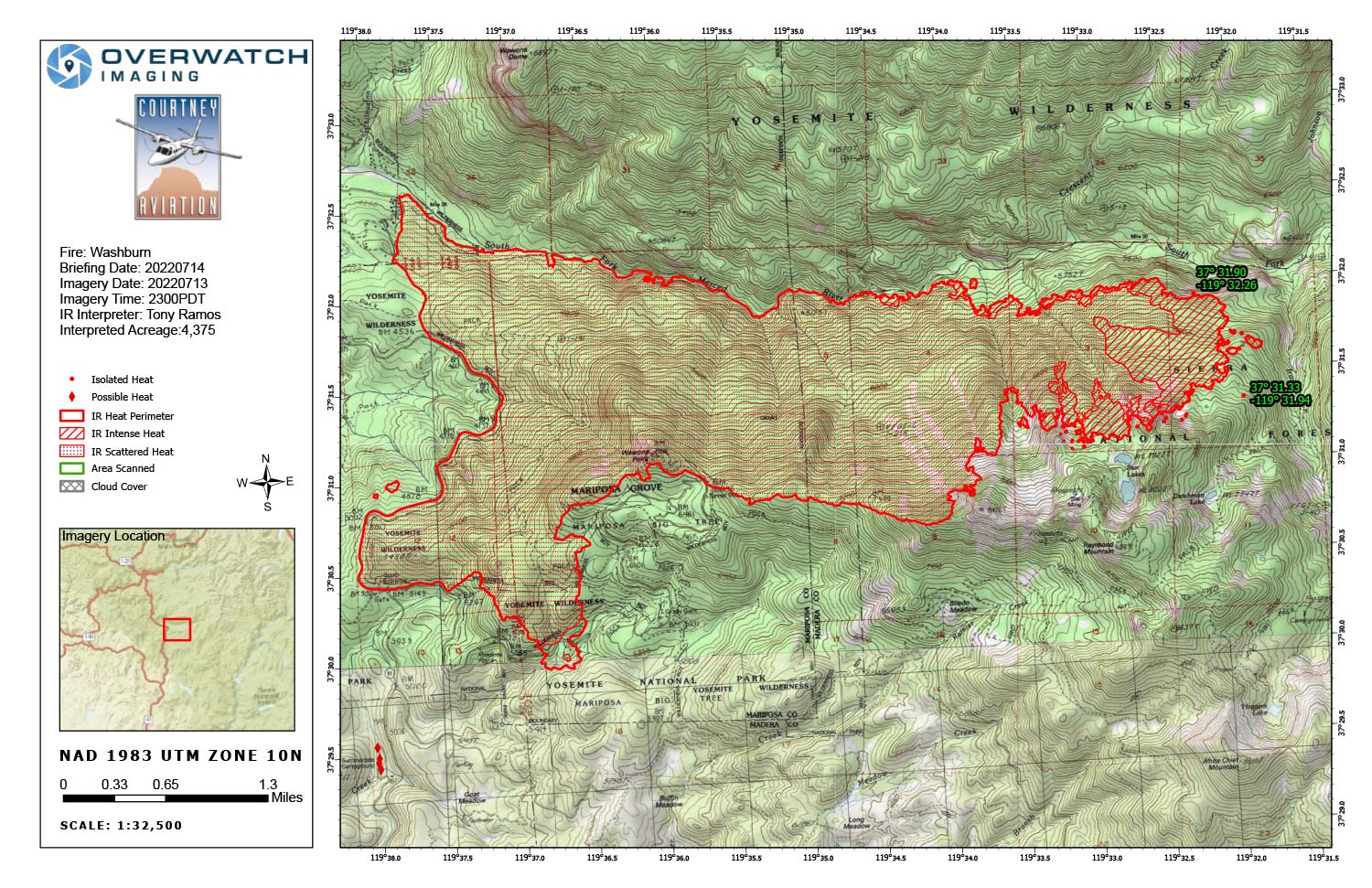
Infrared Map for Thursday, July 14, 2022
Note: Map is 1,500 Pixels Wide.
Acreage: 4,375 Acres (Growth since last flight: 603 Acres)
Weather was clear over the incident and imagery georectification was accurate.
Identified 4 possible heat points south west of incident. Suspect heat points to be camp warming fires.
One isolated heat point of note apx. ¼ mile east of active head.
No heat observed north of Merced River.