Click here for: Washburn Fire in Yosemite National Park Updates for Friday, July 15, 2022
Note: Map is 1,500 Pixels Wide.
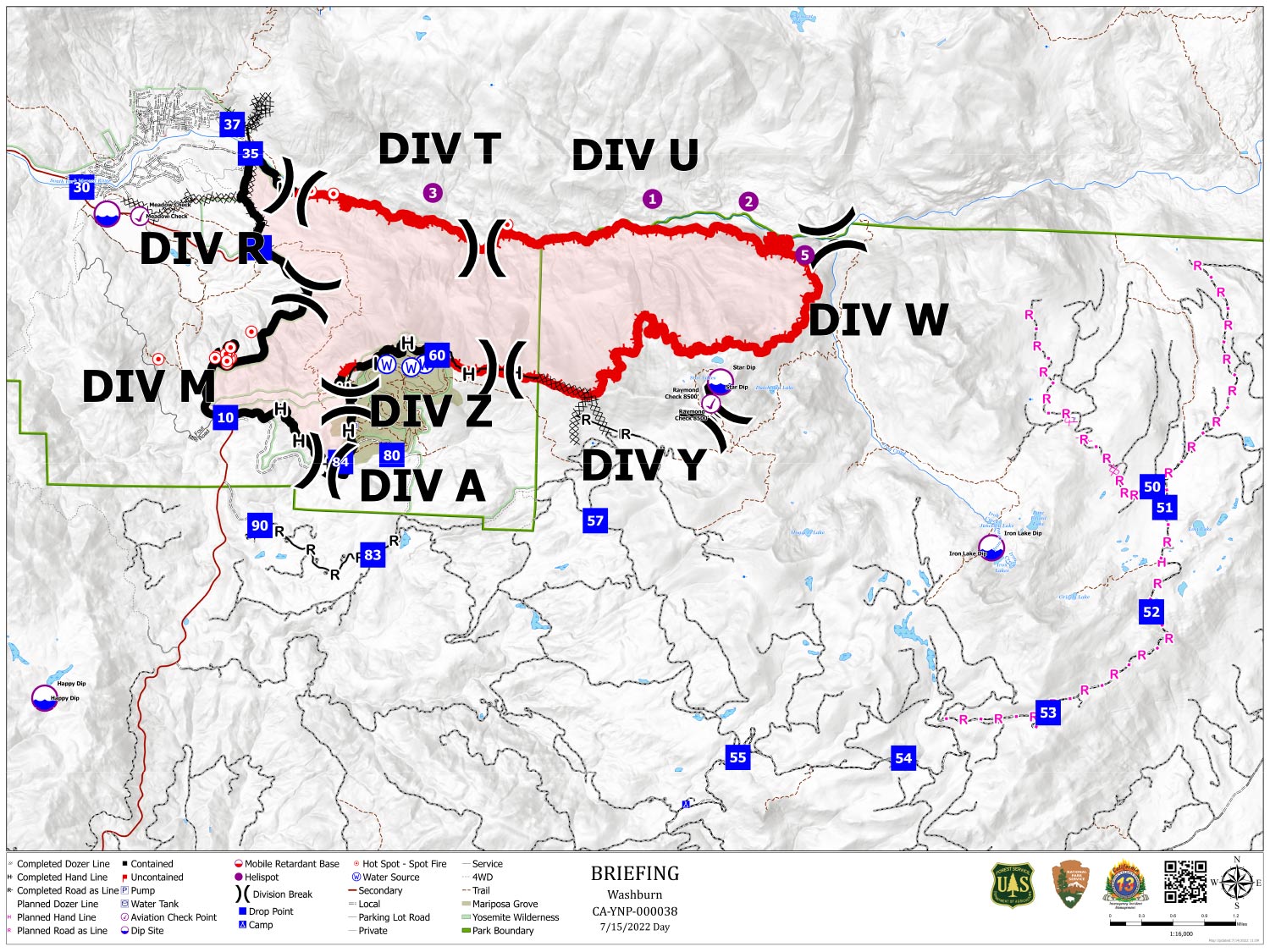
Shows Planned Hand Line, Planned Road as Line, Divisions. Dozer Lines and Uncontrolled Fire Edge.
Below Map:
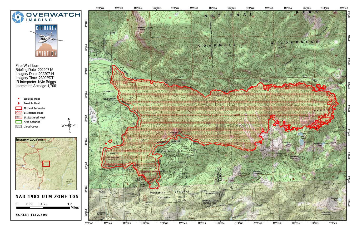
Infrared Map for Friday, July 15, 2022
Note: Map is 1,500 Pixels Wide.
Acreage: 4,700 Acres (Growth since last flight: 625 Acres)
Weather was clear over the incident and imagery georectification was accurate.
The southern portion of the eastern run of fire perimeter looks like it was possibly created using AI driven polygons derived from mixed methods. That portion was showing perimeter extending well beyond what seemed to be the fire edge (based on ir imagery collected tonight).