Click here for: Washburn Fire in Yosemite National Park Updates for Saturday, July 16, 2022
Note: Map is 1,500 Pixels Wide.
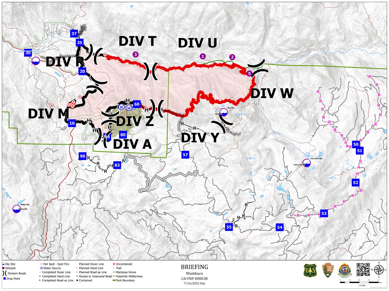
Shows Planned Hand Line, Planned Road as Line, Divisions, Dozer Lines and Uncontrolled Fire Edge.
Below Map:
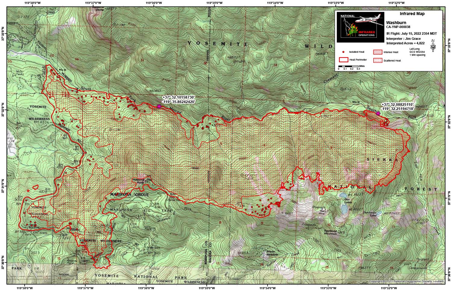
Infrared Map for Saturday, July 16, 2022
Note: Map is 1,500 Pixels Wide.
Acreage: 4,822 Acres (Growth since last flight: 18 Acres)
I Started interpretation with the new NIFS Perimeter.
Start Acres 4,804
End Acres 4,822
There were two areas of concern, one appeared over the Merced approximately 2,900 feet west of the confluence of Iron Creek and the Merced River at Lat 37° 32.08825110', Long -119° 32.25194718'
The other is at at 37° 32.10158730', Long -119° 35.86242420'
Both locations are noted on the map with lat/long
Small areas of perimeter growth all along the north flank along the Merced River with the largest being at the far east end of the fire moving down into the Iron Creek drainage. Intense heat was detected in the far easter end of the fire and about 90 percent of the remaining area was covered in scattered heat. Isolated heat was mapped in areas that were not dense with scattered heat.