Click here for: Washburn Fire in Yosemite National Park Updates for Thursday, July 21, 2022
Note: Map is 1,500 Pixels Wide.
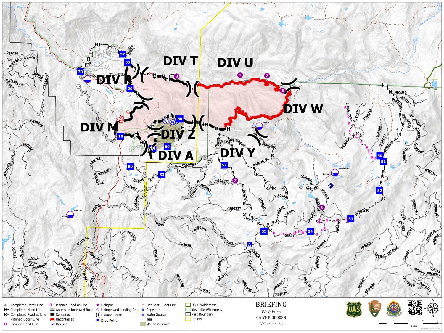
Shows Planned Hand Line, Planned Road as Line, Divisions, Dozer Lines and Uncontrolled Fire Edge.
Below Map:
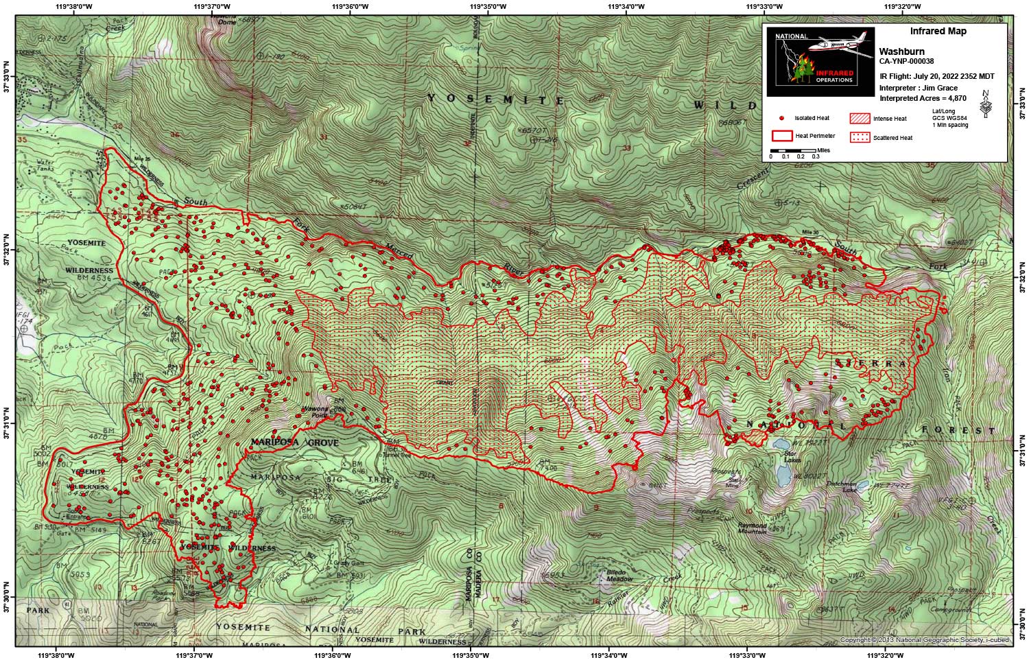
Infrared Map for Thursday, July 21, 2022
Note: Map is 1,500 Pixels Wide.
Acreage: 4,868 Acres (Growth since last flight: 8 Acres)
I Started interpretation with the new NIFS Perimeter.
Start Acres 4,866
End Acres 4,870
The large pockets of scattered heat are getting smaller each night with more isolated heat mapping.