Click here for: Washburn Fire in Yosemite National Park Updates for Friday, July 22, 2022
Note: Map is 1,500 Pixels Wide.
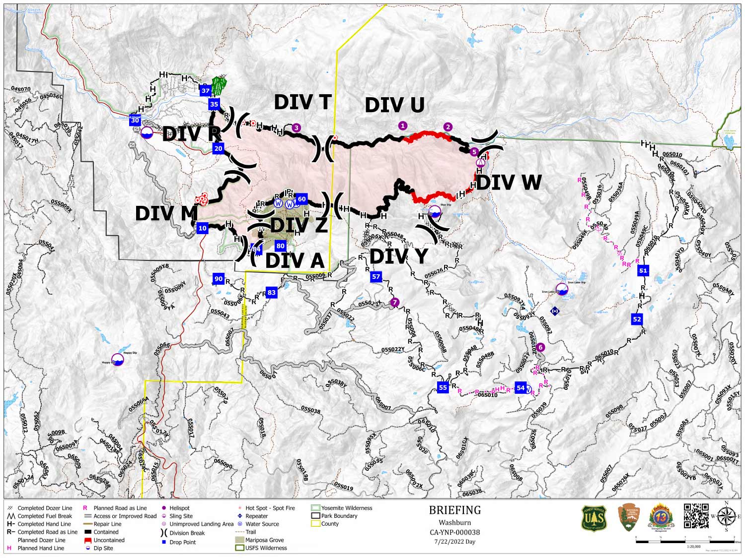
Shows Planned Hand Line, Planned Road as Line, Divisions, Dozer Lines and Uncontrolled Fire Edge.
Below Map:
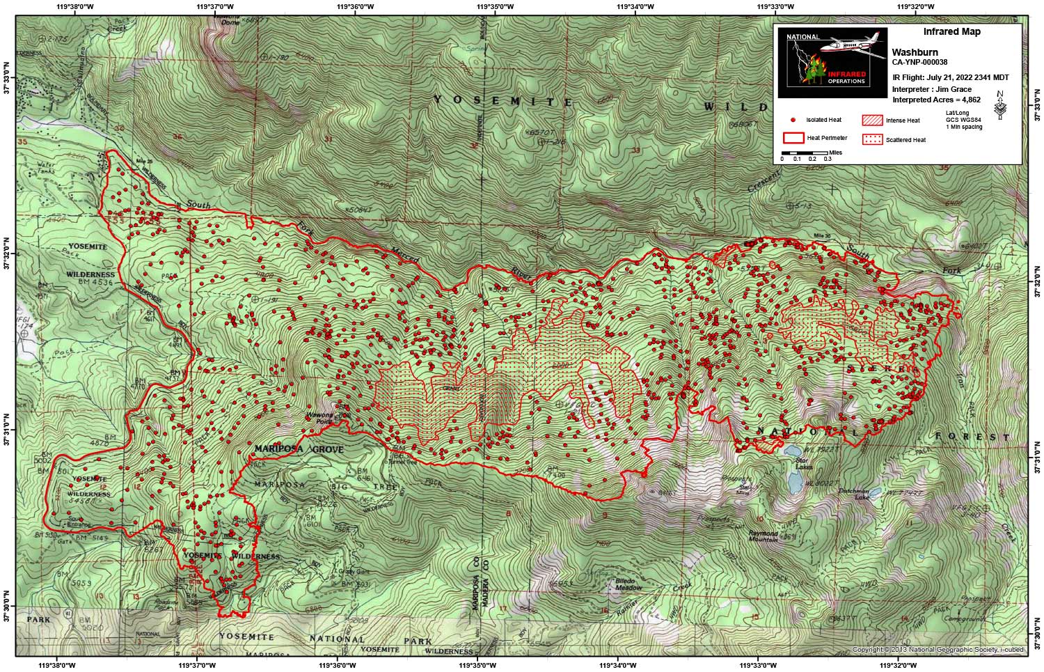
Infrared Map for Friday, July 22, 2022
Note: Map is 1,500 Pixels Wide.
Acreage: 4,862 Acres (Growth since last flight: 6 Acres)
I Started interpretation with the new NIFS Perimeter.
Start Acres 4,856
End Acres 4,862
The large pockets of scattered heat are getting smaller each night with more isolated heat mapping.
Two pockets on intense heat along the perimeter where the growth occurred. These were just North of Star Lakes on the Southeast end of the fire and on the North end at the confluence of the stream/draw that comes out of Star Lakes and the South Fork of the Merced River.