Note: Click here for large map (30MB) file size
Click here for: Mariposa County Oak Fire Updates for Sunday, July 24, 2022
Note: Map is 1,500 Pixels Wide.
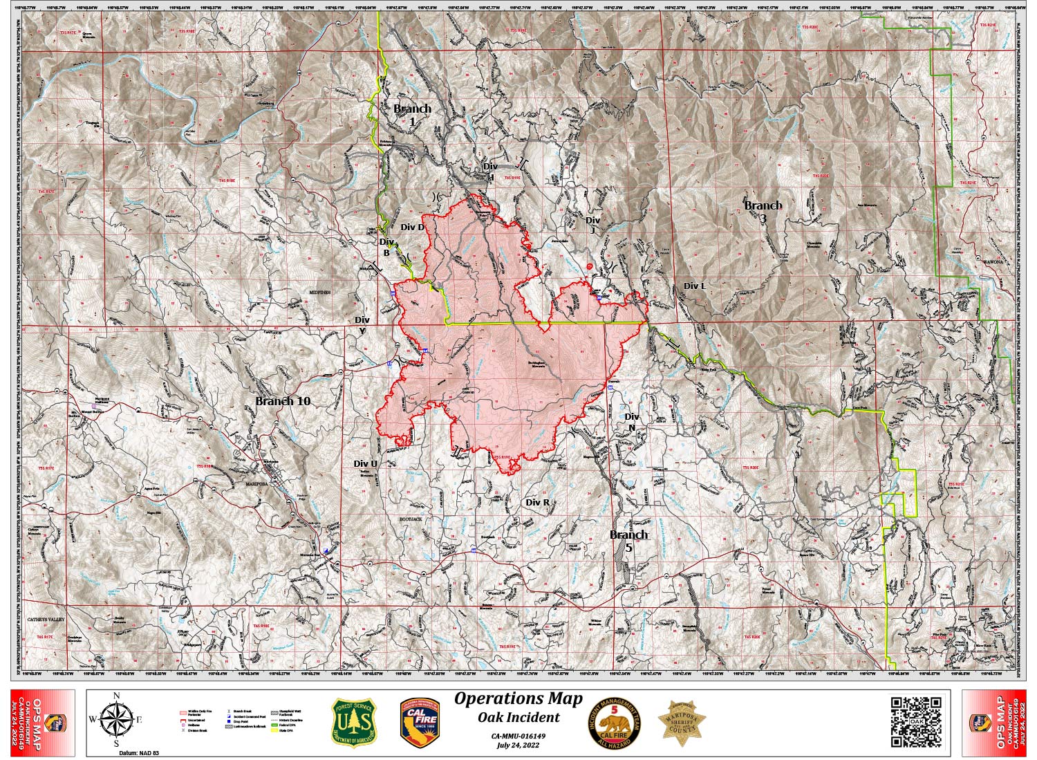
Shows Divisions and Uncontrolled Fire Edge.
Below Map:
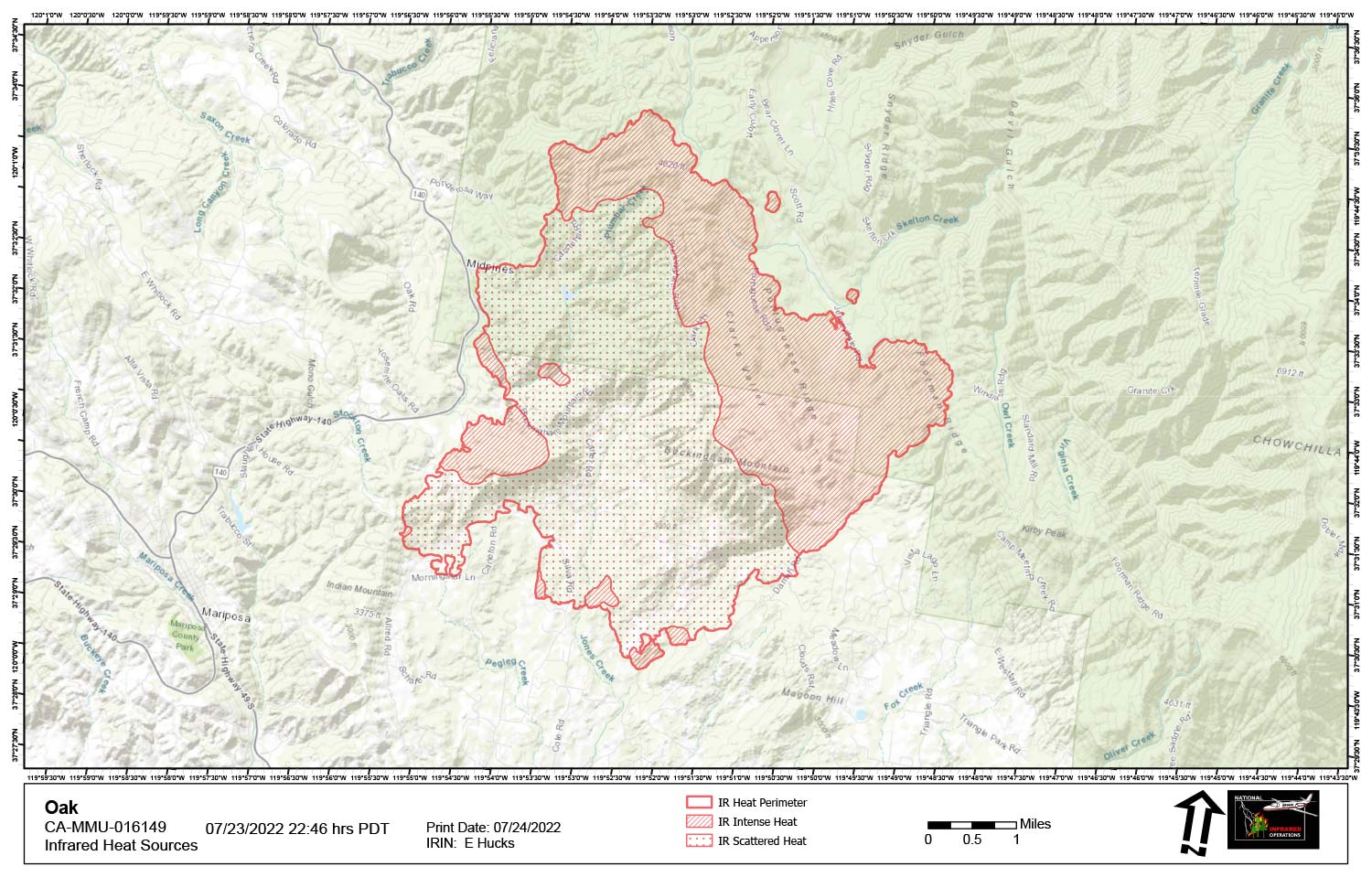
Infrared Map for Sunday, July 24, 2022
Note: Map is 1,500 Pixels Wide.
Acreage: 13,187 Acres (Growth since last flight: 991 Acres)
Intense heat and spotted was observed across the north / northeast section of the fire area.
Pockets of intense heat are present around the entire fire area.
The southwestern interior shows cooling to scattered heat. No isolated heat points were present.