


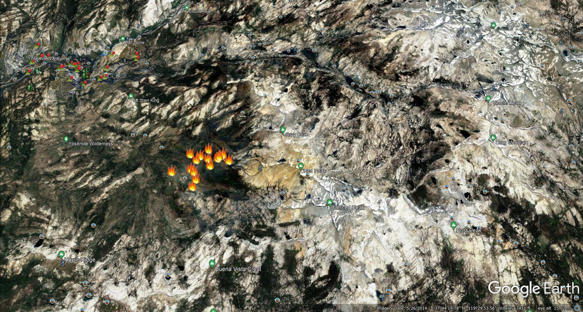
Fires in Yosemite detected by MODIS on Sunday Morning
Note: 1,200 Pixels Wide
MODIS Active Fire Mapping Program Frequently Asked Questions
August 15, 2022 - Yosemite National Park Red Fire grew to 398 acres as of yesterday. Fire crews have been closely looking at all nearby natural barriers (mostly granite in this case) to confine
 and contain the fire.
RED FIRE
Location: between Red Creek and Illilouette Creek
Elevation: 7,800
Discover date: August 4, 2022
Size: 398 acres
Cause: Lightning
Fire history: burning in the 2001 Hoover fire footprint
Yosemite fire crews are assessing natural barriers (like granite) to confine and contain the fire
No trail closures, no threat to infrastructure
https://inciweb.nwcg.gov/incident/8332/
RODGERS FIRE
Location: northwest of Rodgers Canyon and southwest of Pleasant Valley
Elevation: 8,100
Discover date: August 8, 2022
Size: 25 acres
Cause: Lightning
Yosemite fire crews are assessing natural barriers (like granite) to confine and contain the fire
No trail closures, no threat to infrastructure
https://inciweb.nwcg.gov/incident/8333/
For air quality information, please visit: https://fire.airnow.gov/
Earlier Information:
August 14, 2022 - Yosemite National Park reports two fires are burning in the high country due to lightning. As of Sunday morning the Red Fire has grown to 250 acres. Trails remain open and there are no threats to critical infrastructure.
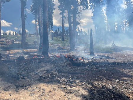
NPS Photo
Information from August 13:
Earlier information from August 12:
Red Fire
Elevation: 7,800
Discover Date: August 4, 2022
Size: 50 acres (updated to 167 acres on the evening of August 12)
Cause: Lightning
Fire history: burning in the 2001 Hoover fire footprint
Yosemite fire crews are on scene. No current trail closures.
Rodgers Fire
Elevation: 8,100
Discover Date: August 8, 2022
Size: 5 acres
Cause: Lightning
Yosemite fire crews are on scene. No current trail closures.
Earlier information from August 10:
Yosemite fire crews estimate the Red fire to be 2 acres now. #RedFire was discovered on August 4 at approx 7,800 ft elevation in the wilderness and is a lightning caused fire.
Earlier information from August 8:
The Rodgers fire was discovered today by Yosemite Helicopter-551 northwest of Rodgers Canyon and south of Pleasant Valley.
It is about 3/4 acre at approx 8,100 ft elevation. This is a lightning caused fire.
The lightning caused Red fire remains at 1/4 acre at 7,800 ft elevation.
There are no current trail closures in these areas.
Earlier information from August 4:
A new fire was reported between Red Creek and Illilouette Creek. Yosemite’s Helicopter-551 confirmed the lightning caused Red fire is about 1/4 acre, burning at approx 7,800 ft elevation, with no current threat to trails
Source: NPS

