


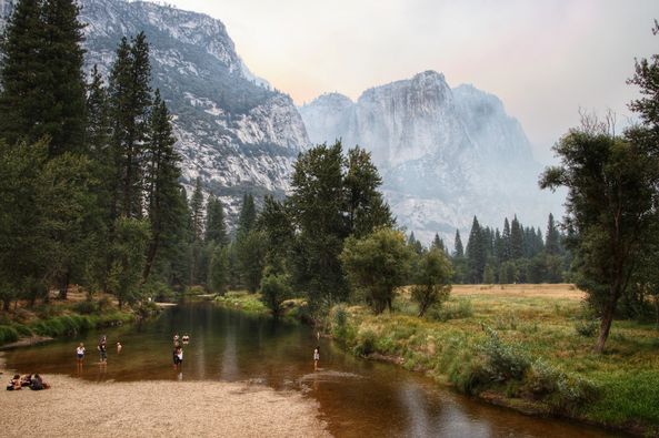
Yosemite Valley
Credit: NPS
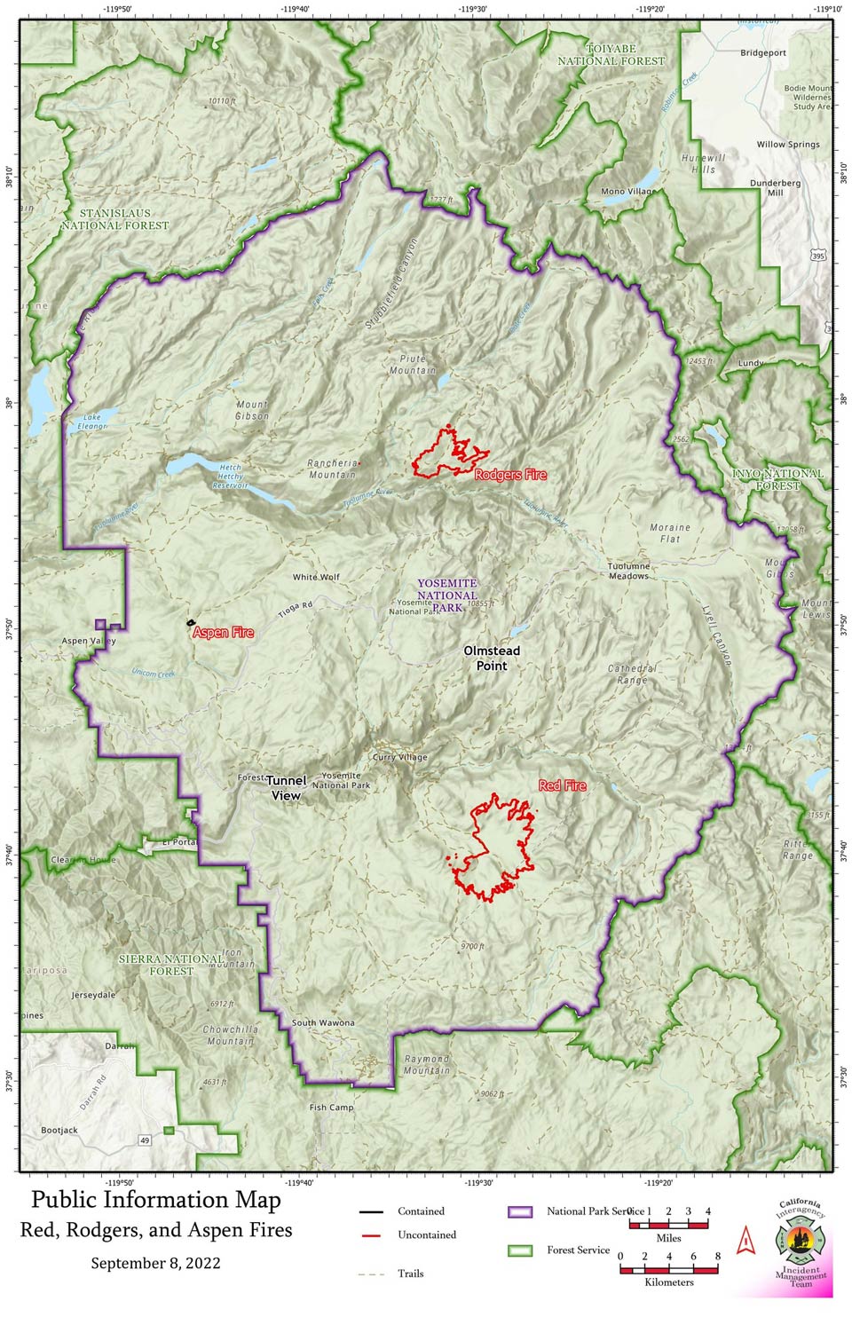
September 9, 2022 - Yosemite National Park officials report the #RedFire (7,340 acres) and #RodgersFire (2,576 acres) Both are being managed for multiple objectives. Trail closures are associated within these fire areas.
For more information, visit: Red Fire: https://inciweb.nwcg.gov/incident/8332/
Total personnel: 225
Fire History: Burning in the 2001 Hoover Fire footprint: burning in red fir, lodgepole pine litter.
Trail closures on segments heading out the Illilouette drainage from Glacier Point area to Merced Pass Lake.
The fire showed an increase in activity yesterday due to outflow winds from thunder activity, especially on the
southwest edge.
The #AspenFire, near Aspen Valley, is currently mapped at 26 acres and is now 100% contained. No evacuations or closures are associated with the Aspen Fire.
For more information, visit: Aspen Fire: inciweb.nwcg.gov/incident/8385/
Ranch Fire
Location: Northeast of Hetch Hetchy Reservoir
Elevation: 4,000
Discover date: September 7, 2022
Size: Single tree strike
Cause: Lightning
Being fully suppressed
No closures
Alder Fire
High temperatures are anticipated to continue today. More seasonable conditions are expected to move into the area over the weekend, with a chance of showers and thunderstorms due to moisture from Hurricane Kay.
Several small fires have been detected over the last few days, and isolated smokes may be visible to residents and visitors. These include the #AlderFire, near Alder Creek, and the #RanchFire, east of Hetch Hetchy Reservoir. Both of these fires are being fully suppressed. There are no closures associated with these fires.
Smoke:
Smoky conditions have been common in Yosemite Valley during the morning hours due to smoke from the Red Fire that is draining down the Illilouette Creek basin and into the Yosemite Valley. Cloud cover and easterly winds can delay this dispersion of smoke and create lingering air quality issues into the afternoon.
Yesterday, Yosemite Valley also received smoke from the Mosquito Fire that is burning in the Tahoe National Forest in Placer County. Smoke from this fire settled into the northern San Joaquin Valley, and northwest winds pushed this smoke southward and eastward into Yosemite National Park. In addition, rain showers and thunderstorms to the east of Yosemite Valley brought easterly outflow winds and cooler temperatures at higher elevations. This trapped the smoke within Yosemite Valley and led to a significant increase in particulate matter (smoke).
Similar conditions are possible throughout the upcoming weekend with potential for prolonged smoke impacts within Yosemite Valley and throughout the region as cloud cover helps trap smoke closer to the surface. Daily Smoke Outlooks will remain available to help guide when the best air quality is expected, available at https://outlooks.wildlandfiresmoke.net/outlook/17996aec.
You can always find current Fire, Smoke, and Air Quality information at https://fire.airnow.gov/.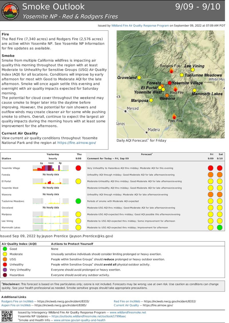
Source: NPS

