


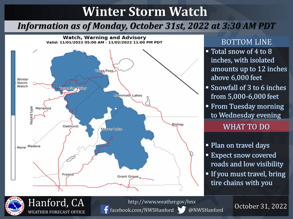
October 31, 2022 - The National Weather Service Hanford Office reports a Winter Storm Watch has been issued for the Sierra Nevada north of Tulare County above 5,000 feet from Tuesday morning to Wednesday evening.
The majority of the heavy snow will fall later on Tuesday and Tuesday night.
This is the first storm of the season so if you plan to travel, consider alternate strategies.
If you must travel, remember to carry tire chains, plenty of food, a good deal of water, warm clothing, and a flashlight in your vehicle.
For information on road conditions, including closures or delays, call Caltrans at 1-800-427-7623.
Winter Storm Watch
URGENT - WINTER WEATHER MESSAGE
National Weather Service Hanford CA
251 AM PDT Mon Oct 31 2022

...First Significant Storm of the Wet Season Early This Week...

A strong storm system will move out of the Gulf of Alaska on
Monday and move into the Pacific Northwest on Monday night. We
are expecting a strong cold front to move across the region on
Tuesday night. Snow is expected to increase during the day on
Tuesday with the potential heavy snow on Tuesday night. The front
will push south into the Kern county area on Wednesday and
provide lighter amounts.


Yosemite NP outside of the valley-Upper San Joaquin River-
Kaiser to Rodgers Ridge-
Including the cities of Tuolumne Meadows, Wawona,
Devils Postpile, Florence Lake, Lake Thomas Edison, Lake Wishon,
Huntington Lake, and Shaver Lake
251 AM PDT Mon Oct 31 2022

...WINTER STORM WATCH REMAINS IN EFFECT FROM LATE TONIGHT THROUGH
WEDNESDAY EVENING...

* WHAT...Heavy snow possible. Total snow accumulations of 4 to 8
  inches possible with isolated amounts up to 12 inches above
  6000 feet. Total snow accumulations 3 to 6 inches from 5000
  feet to 6000 feet. West winds could gust as high as 40 mph
  above 6000 feet.

* WHERE...Yosemite NP outside of the valley, Upper San Joaquin
  River and Kaiser to Rodgers Ridge.

* WHEN...From early Tuesday Morning through late Wednesday
  evening.

* IMPACTS...Travel could be very difficult with high country
  road closures. The hazardous conditions could impact hikers
  and campers in the National Parks.


PRECAUTIONARY/PREPAREDNESS ACTIONS...

Monitor the latest forecasts for updates on this situation.
Source: NWS

