


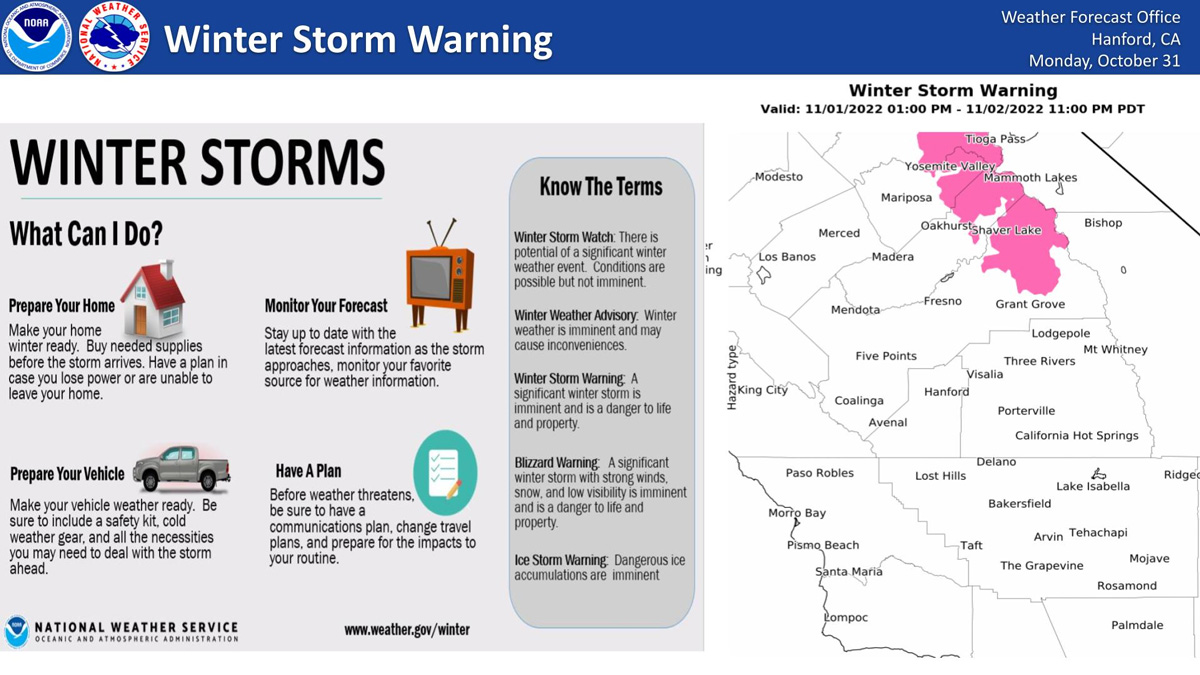
November 1, 2022 - The National Weather Service Hanford Office reports a Winter Storm Warning will take effect at 1:00 P.M. Tuesday November 1, 2022 and will run until Wednesday November 2, 2022 at 11:00 PM.
Winter Storm Warning
URGENT - WINTER WEATHER MESSAGE
National Weather Service Hanford CA
1150 PM PDT Mon Oct 31 2022

...First Significant Storm of the Wet Season Early This Week...

A strong storm system will move out of the Gulf of Alaska Monday
and move into the Pacific Northwest on Monday night. We are
expecting a strong cold front to move across the region on
Tuesday night. Snow is expected to increase Tuesday afternoon
with the potential heavy snow on Tuesday night. The front will
push south into the Kern county area on Wednesday and provide
lighter amounts.


Yosemite NP outside of the valley-Upper San Joaquin River-
Kaiser to Rodgers Ridge-
Including the cities of Tuolumne Meadows, Wawona,
Devils Postpile, Florence Lake, Lake Thomas Edison, Lake Wishon,
Huntington Lake, and Shaver Lake
1150 PM PDT Mon Oct 31 2022

...WINTER STORM WARNING REMAINS IN EFFECT FROM 1 PM TUESDAY TO
11 PM PDT WEDNESDAY...

* WHAT...Heavy snow expected. Total snow accumulations of 4 to 8
  inches above 6000 feet. Snow level lowering to 5000 feet
  Tuesday night with 3 to 6 inches of snow. Winds gusting as
  high as 45 mph.

* WHERE...Yosemite NP outside of the valley, Upper San Joaquin
  River and Kaiser to Rodgers Ridge.

* WHEN...From 1 PM Tuesday to 11 PM PDT Wednesday.

* IMPACTS...Travel could be very difficult with high country
  road closures. The hazardous conditions could impact hikers
  and campers in the National Parks.

PRECAUTIONARY/PREPAREDNESS ACTIONS...

If you must travel, keep an extra flashlight, food, and water in
your vehicle in case of an emergency.

The latest road conditions for the state you are calling from can
be obtained by calling 5 1 1.
Source: NWS

