


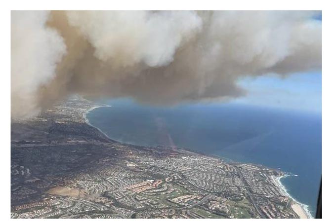
An example of wildfire smoke propagation over an urban area.
In collaboration with CAL FIRE, UC Davis researchers use Unmanned Aerial Vehicles (UAV) to measure and map wildfire fire smoke
January 12, 2023 - In 2022, researchers Ajith Kaduwela, Prabhash Ragdir, and Zhaodan Kong from the UC Davis Cyber-human-physical systems lab began field work on a project designed to 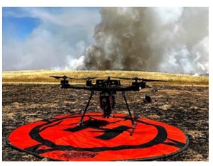 document the particle size and chemical development of wildland fire smoke. The goal is to build a spatial model of how smoke expands and moves over time, and the data is being collected using Unmanned Aerial Vehicles (UAVs).
An example of a monitoring drone used by the UC Davis research team.
The motivation to undertake this work is to ultimately be able to better protect human health by collecting accurate and real-time data on the distribution and concentration of air toxins related to wildland fire smoke.
The California Air Resources Board (CARB) estimated that in one year (2020) carbon dioxide emissions from wildfires exceeded 100 million metric tons. Furthermore, a study released by the American Chemical Society estimated that 12 million Californians were exposed to at least one day of smoke meeting federal “unhealthy” standards in 2020. This underlines the need for a greater understanding of the chemistry, duration, and spatial extent of wildland fire smoke’s potential impacts to public health.
CAL FIRE Enviromental Scientists assist the research team’s data collection efforts by gaining access to prescribed fires implemented by CAL FIRE’s Vegetation Management Program (VMP) or Vegetation Treatment Program (VTP). Communication with burn bosses, landowners, and the CAL FIRE Air Operations Chief is essential – as public UAV flights are strictly prohibited in or around the perimeter of active fire operations for safety reasons.
The partnership between the UC Davis research team and CAL FIRE, allows the team access to smoke while also providing valuable insight on smoke distribution and chemical content to CAL FIRE, other government entities and the public.
The team currently uses a single UAV equiped with air quality sensors and a tube air sampler to collect smoke data, but future plans include the the use of UAV swarms to improve the resolution of air toxin measurements and to serve as a mobile sensor network. The UC Davis team aims to use this data to develop a deep-learning-based model to predict how air polution from wildfire spreads over time, while also measuring toxic substances in wildfire plumes to better understand potential impacts to human health.
Associate Professor Kong explained that this research could ultimately be used for prescribed fire impacts too. “This model, I believe, can be used by researchers and practitioners. For instance, what I hope we can develop is an interface where you can type some basic information-- the time and location of the planned burn, and our model will be able to predict the propagation of smoke.”
To date, the research team has successfully collected smoke data at several prescribed burns in CAL FIRE’s Tuolomne-Calaveras (TCU) Unit, and Sonoma-Lake-Napa (LNU) Unit. Future work aims to build a data cache at a greater variety of prescribed burns throughout the first quarter of 2023 and ultimately prepare for incident deployment, where researchers can collect data on wildfire smoke. The UC Davis team’s research is funded by Sony and CITRIS.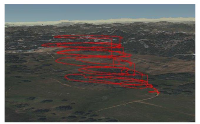
Dimensional mapping of the propagation of smoke captured by circling the smoke plum with the drone.
Source: CAL FIRE
CAL FIRE, UC Davis Researchers Mapping Wildfire Smoke to Better Understand Air Toxin Distribution and Concentration
- Details

