


California and National Drought Summary for August 23, 2016
Summary
August 25, 2016 - An active weather pattern across the central and eastern U.S. led to more drought reduction than introduction, although pesky dryness and hot conditions led to some expansion of dryness and drought in the southern Atlantic States. In stark contrast, catastrophic flooding from the historic, August 12-13 downpours gradually subsided across southern Louisiana; as recovery efforts began, media reports noted that there were at least a dozen fatalities and that more than 60,000 residences were damaged or destroyed. Heavy rain shifted northward and westward during the drought-monitoring period, soaking the western Gulf Coast region and delivering spotty drought relief across the interior Southeast. Pockets of locally heavy rain were also noted across the northern and central Plains, the Midwest, and the Northeast. Elsewhere, scant rainfall occurred west of the Rockies, except for a few monsoon-related showers in the Southwest.Northeast
Rainfall during the monitoring period was heaviest in northern New England, although beneficial showers occurred in some of the hardest-hit drought areas. However, rain was neither heavy nor sustained enough to dent the region’s two core areas of severe to extreme drought (D2 to D3). Still, Manchester, New Hampshire, received 1.12 inches of rain on August 22—the first one-inch daily total in that location since September 30, 2015. Through August 23, Northeastern communities with year-to-date precipitation deficits of 7 to 8 inches included Concord, New Hampshire; Boston, Massachusetts; Hartford, Connecticut; and Islip, New York. In western New York, Buffalo’s year-to-date precipitation totaled just 16.09 inches (66% of normal), or 8.25 inches below normal.Agricultural reports continued to reflect the Northeastern drought. On August 21, the U.S. Department of Agriculture (USDA) rated topsoil moisture 100% very short to short in Rhode Island, along with 90% in Massachusetts; 71% in Connecticut and Vermont; 68% in New Hampshire; 55% in Maine; and 49% in New York. Subsoil moisture was also rated 100% very short to short in Rhode Island, followed by 80% in Connecticut; 77% in Massachusetts; 70% in Vermont; 64% in New Hampshire; 50% in New York; and 41% in Maine. On the same date, USDA rated at least half of the pastures in very poor to poor condition in Rhode Island (80%), Connecticut (78%), Massachusetts (72%), New Hampshire (70%), and Maine (62%).
Southeast
The general Southeastern trend was for drought improvement across interior areas, while short-term dryness expanded in the Atlantic coastal plain. An area of moderate drought (D1) was introduced along the Georgia coast, extending into South Carolina, and abnormal dryness was expanded southward to connect with the previously existing D0 area in eastern Florida. From June 1 – August 23, rainfall in Savannah, Georgia, totaled 11.17 inches, 68% of normal. Farther south, in northeastern Florida, Jacksonville’s year-to-date rainfall through August 23 stood at just 21.48 inches (64% of normal), nearly 12 inches below normal. Farther inland, however, locally heavy showers continued to chip away at dryness (D0) and moderate to extreme drought (D1 to D3). Through August 23, month-to-date rainfall climbed to 9.72 inches (359% of normal) in Athens, Georgia, and 8.48 inches (254%) in Meridian, Mississippi. However, significant year-to-date rainfall deficits persisted in several locations, including Chattanooga, Tennessee (22.27 inches, or 12.17 inches below normal), and Anniston, Alabama (25.86 inches, or 8.27 inches below normal).USDA topsoil moisture statistics continued to reflect significant shortages in parts of Georgia (53% very short to short), Alabama (33%), and South Carolina (32%), with dryness creeping into parts of the southern Mid-Atlantic region. On August 21, topsoil moisture was rated 30% very short to short in North Carolina, along with 26% in Virginia. On the same date, pastures were rated 31% very poor to poor in Georgia, along with 24% in South Carolina and 20% in Alabama.
Southern Plains
Multiple rounds of heavy rain drenched the western Gulf Coast region, but only spotty showers dotted the southern High Plains. As a result, there was a marked difference between dryness/drought eradication in much of southern and eastern Texas and drought intensification across western Texas and eastern New Mexico. Through August 23, month-to-date rainfall surged to 8.82 inches (600% of normal) in Del Rio, Texas. In contrast, June 1 – August 23 rainfall in Lubbock, Texas, totaled just 2.46 inches (39% of normal). Severe drought (D2) was introduced in an area straddling the Texas-New Mexico border. On August 21, topsoil moisture in New Mexico was rated 78% very short to short, according to USDA. Also on August 21, at least one-quarter of the cotton was rated very poor to poor in New Mexico (28%) and Texas (25%). Nationally, only 18% of the cotton crop was rated very poor to poor. Deteriorating conditions were also noted in parts of central and northeastern Oklahoma, as shown by expansion of dryness (D0) and moderate drought (D1).North Plains and Corn Belt
Well-placed showers brought some relief to drought-affected areas from southern Montana to the Black Hills of South Dakota. Pockets of dryness (D0) and moderate drought (D1) were also reduced in size or eliminated in parts of the western and eastern Corn Belt. On August 21, Ohio and Michigan led the Midwest with 29% of the pastures rated very poor to poor, according to USDA. Montana led the northern Plains with one-third (33%) of its rangeland and pastures rated very poor to poor, followed by South Dakota with 25%. Rain in the eastern Corn Belt brought improved crop conditions; from August 14 to 21, corn rated very poor to poor declined from 22 to 21% in Ohio and from 18 to 15% in Michigan. Similarly, soybeans rated very poor to poor declined from 15 to 13% in Ohio and from 15 to 11% in Michigan.Northwest
Several cold fronts crossed the Northwest, accompanied by breezy conditions but little rainfall. By August 23, nearly three dozen large wildfires—in various stages of containment—were burning across the Northwest. Among them were the 100,000-acre Pioneer fire north of Idaho City, Idaho, and the 21,000-acre Copper King fire near Thompson Falls, Montana. In eastern Washington, a half-dozen large fires were burning, including the 6,000-acre Spokane complex. Due to short-term dryness, abnormal dryness (D0) and/or moderate drought (D1) were expanded in several areas, including southwestern Washington, northern Utah, and northwestern Colorado. On August 21, Oregon led the West with 49% of its rangeland and pastures rated in very poor to poor condition, according to USDA.Southwest
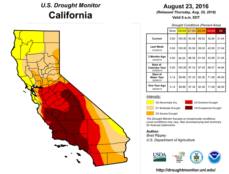
Spotty monsoon-related showers were heaviest in the southern Rockies. However, the Southwestern drought depiction was largely unchanged, except for a small reduction in the coverage of dryness (D0) in north-central New Mexico. Drought expansion in parts of eastern New Mexico was discussed in the “Southern Plains” paragraph.California
No changes to the drought depiction were made in California, as the summer dry season continued. Still, long-term drought and a variety of weather factors contributed to the spread of the destructive Blue Cut fire, which scorched more than 36,000 acres of vegetation near Lytle Creek, California, northwest of San Bernardino. The fire also destroyed at least 105 homes and more than 200 outbuildings.Alaska, Hawaii, and Puerto Rico
Heavy rain and early-season snow fell across parts of northern Alaska, including the Noatak and Lower Kobuk Valleys. Precipitation totals of 2 to 4 inches or more were observed at some locations in those valleys, with slightly lower amounts reported in the Upper Kobuk Valley, across the northwestern Brooks Range, and on the western interior Arctic Slope. From August 15-19, precipitation totaled 0.75 inch in Barrow, on the North Slope. Barrow also netted a daily-record snowfall (1.6 inches) on August 19. Northern Alaska’s significant precipitation led to the elimination of abnormal dryness (D0), and marked the first observance of no dryness anywhere in the state since February 10, 2015. One benefit of Alaska’s showery summer has been to suppress wildfire activity; through August 23, year-to-date wildfires have charred less than one-half million acres statewide.In Hawaii, where there was no change in the drought depiction, locally heavy showers were mainly confined to non-dry windward locations. Late in the drought-monitoring period, on August 22-23, rainfall intensified in several areas, including windward sections of Maui and the Big Island. Hilo, on the Big Island, received 11.02 inches of rain on August 22-23, boosting its month-to-date rainfall to 16.61 inches (221% of normal).
Meanwhile, showers dotted Puerto Rico, but heavier amounts (locally 2 to 4 inches or more) were confined to non-dry western sections of the island. As a result, the drought depiction was unchanged, with lingering pockets of abnormal dryness (D0) and moderate drought (D1) in southeastern Puerto Rico and the neighboring island of Vieques.
Looking Ahead
For the remainder of the week, late-summer heat will return to the East and the Far West, while a surge of cool air will briefly cover much of the nation’s mid-section. During the weekend, however, temperatures will rebound to near- or above-normal levels in the central U.S., while late-season heat will persist in the East and West. During the next 5 days, the most significant, large-scale plume of moisture will stretch from southern sections of the Rockies and Plains into the Great Lakes region, resulting in 1- to 5-inch rainfall totals. In contrast, the Far West and the Mid-Atlantic States will remain mostly dry. During the weekend, a tropical wave (or named tropical storm) could result in heavy showers and local flooding in the southern Atlantic region, especially across southern Florida.The NWS 6- to 10-day outlook for August 30 – September 3 calls for the likelihood of above-normal temperatures nearly nationwide, with the greatest odds of late-summer heat occurring in the eastern U.S. Cooler-than-normal conditions should be confined to northern California and the Pacific Northwest. Meanwhile, below-normal rainfall across the Intermountain West, Southwest, and central and southern Plains will contrast with wetter-than-normal weather across the nation’s northern tier, along and near the Gulf Coast, and in the mid-South and Midwest.
Author(s):
Brad Rippey, U.S. Department of Agriculture
Dryness Categories
D0 ... Abnormally Dry ... used for areas showing dryness but not yet in drought, or for areas recovering from drought.Drought Intensity Categories
D1 ... Moderate DroughtD2 ... Severe Drought
D3 ... Extreme Drought
D4 ... Exceptional Drought
Drought or Dryness Types
S ... Short-Term, typically <6 months (e.g. agricultural, grasslands)L ... Long-Term, typically >6 months (e.g. hydrology, ecology)
Source: National Drought Mitigation Center
