


California and National Drought Summary for September 6, 2016
Summary
September 8, 2016 - This U.S. Drought Monitor week saw improvements in drought conditions in parts of the Southeast and Mid-Atlantic in association with Hurricane-Tropical Storm Hermine. Hurricane Hermine marked the first hurricane to make landfall in Florida in eleven years since Hurricane Wilma in 2005. The hurricane came ashore along the Florida Panhandle moving northeast and impacting eastern portions of Georgia, South Carolina, and North Carolina before moving off-shore. The system brought flooding and heavy rainfall accumulations ranging from three-to-eighteen inches with the heaviest accumulations observed in Florida as well as coastal areas of the Carolinas. In the Central Pacific sector, two hurricanes (Hurricane Madeline and Hurricane Lester) approached the Hawaiian Islands during the past week; both veered away from the island chain, however. Some impacts were observed on the windward side of the Big Island where seven-to-nine inches of rain fell in association with moisture from Hurricane Madeline as it passed just south of the Big Island. Elsewhere, significant rainfall accumulations were observed in southeastern New Mexico as well as portions of the Central Plains where bands of heavy rainfall soaked northwestern Kansas. In New England, dryness continued to deteriorate conditions in Maine, New Hampshire, and Upstate New York. In the West, California and the Great Basin remained in a dry pattern.The Northeast
On this week’s map, short-term precipitation deficits (30–60 day), low streamflows, and dry soils led to the expansion of areas of Extreme Drought (D3) in the Finger Lakes District of New York as well as in southeastern New Hampshire. In Maine, short-term precipitation deficits (4–10 inches during the past 90 days) and low streamflows led to the expansion of areas of Moderate Drought (D1) and Severe Drought (D2) along the coast. During the past week, the Northeast remained in an overall dry pattern with no significant rainfall accumulations observed across the majority of the region. Average temperatures were one-to-five degrees above normal across the much of the region with the greatest temperature anomalies observed in northern Maine.Mid-Atlantic
On this week’s map, improvements occurred in areas impacted by Tropical Storm Hermine where significant rainfall accumulations (five-to-ten inches) led to the removal of areas of Abnormally Dry (D0) in the Inner Coastal Plain and Piedmont of North Carolina. Northern portions of the Mid-Atlantic missed out on moisture associated with Tropical Storm Hermine as it drifted off the North Carolina shore. Further north in the Maryland panhandle, precipitation deficits (one-to-three inches) during the past 30 days and low streamflows (8-to-13 percentile for the 28-day average) let to the introduction of Abnormally Dry (D0) conditions. Similarly, short-term dryness led to the expansion of Abnormally Dry (D0) in southeastern Virginia. For the seven-day period, temperatures were slightly above normal in western portions of the region while eastern portions were slightly below normal.The Southeast
The big story of the week was the passing of Hurricane-Tropical Storm Hermine across the region. Hurricane Hermine marked the first hurricane to make landfall in Florida in the past eleven years. Hurricane Hermine made landfall early Friday morning in the eastern portion of the Florida Panhandle as a Category 1 hurricane. After coming ashore, it drifted in a northeasterly path across southeastern portions of Georgia, South Carolina, and North Carolina. Heavy rainfall associated with Tropical Storm Hermine (downgraded from a hurricane to a tropical storm as it moved on-shore) led to one-category improvements in areas of Abnormally Dry (D0), Moderate Drought (D1), and Severe Drought (D2) in the region. Western portions of Georgia and the Carolinas were not impacted to the same extent of eastern portions as there was a fairly tight precipitation gradient from east to west. Elsewhere in the region, generally dry conditions persisted in parts of Alabama leading to expansion of areas of Abnormally Dry (D0) in central and northwestern Alabama as well as expansion of an area of Severe Drought (D2) in east-central where 28-day average streamflows dipped to the third percentile.The South
On this week’s map, some minor changes were made across parts of Texas – including North Texas, the Panhandle, South Coast, Trans Pecos, and West Texas. In general, these areas received one-to-three inch rainfall accumulations during the past week. In response, one-category improvements were made – mainly in areas of Abnormally Dry (D0) and Moderate Drought (D1). Temperatures generally were below normal (one-to-six degrees) across western portions of the region while eastern portions were one-to-five degree above normal.Midwest
The Midwest saw some minor improvements on the map in northwestern Iowa where locally heavy rainfall accumulations (two-to-five inches) led to the removal of an area of Abnormally Dry (D0). Moving eastward, dry soil conditions identified on several monitoring products, including North American Land Data Assimilation System model (NLDAS) and NASA GRACE-Based Surface Soil Moisture Drought Indicator, led to the expansion of an area of Moderate Drought (D1) in northeastern Ohio. Overall, average temperatures were near to slightly above normal across most of the region. In general, the region was dry during the past week with the exception of some modest rainfall accumulations (one-to-three inches) in western Illinois, east-central Indiana, Iowa, Minnesota, and northern Wisconsin.The Plains
Across the Plains, short-term conditions improved in isolated areas of western South Dakota and northeastern Wyoming leading to one-category improvements in areas of Extreme Drought (D3), Severe Drought (D2), and Moderate Drought (D1). Conversely, a small area of Extreme Drought (D3) in northwestern South Dakota was slightly expanded in response to very dry conditions observed on satellite-based vegetative health products as well as reports of lack of forage and deteriorating stock pond conditions. In northwestern Kansas, a band of heavy rain improved conditions leading to the removal of an area of Moderate Drought (D1) and reduction in areas of Abnormally Dry (D0). Temperatures were two-to-eight degrees above average in the Northern Plains while further south temperatures hovered within a few degrees of normal.The West
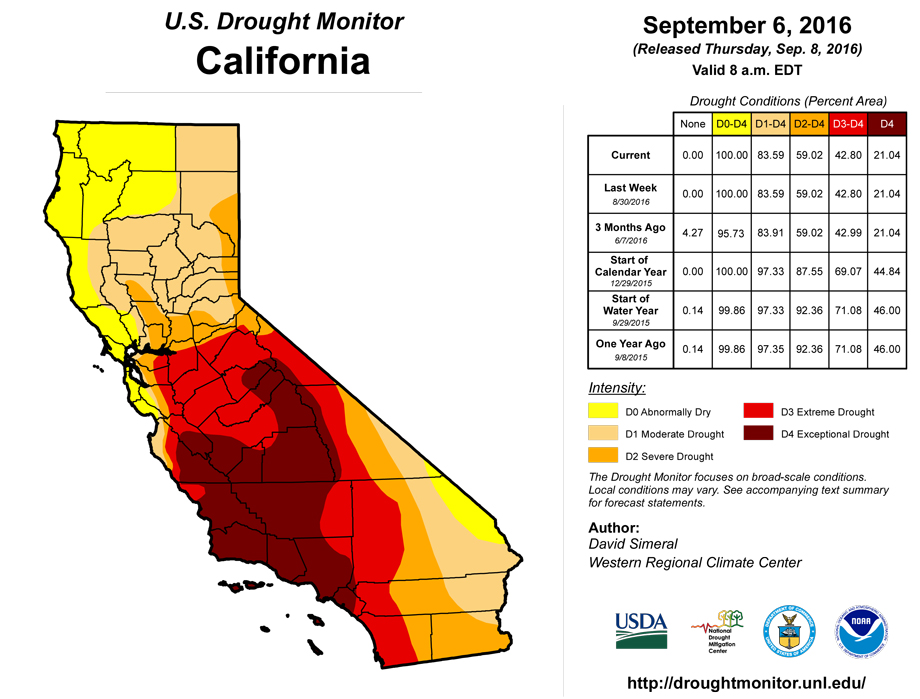
During the past week, average temperatures were below normal across California, most of the Great Basin, Northern Rockies, and western portions of the Southwest while areas east of the Continental Divide were slightly above normal. Overall, the West was dry last week with the exception of areas of isolated precipitation in northwestern Washington, eastern Montana, and southeastern New Mexico. Dryness during the past 90 days led to expansion of areas of Abnormally Dry (D0) and Moderate Drought (D1) in southeastern and south-central Idaho. In northwestern Wyoming, an area of Severe Drought (D2) was expanded in the headwater region of the Snake River where baseflow has been well below normal. In southeastern New Mexico, locally heavy rainfall accumulations ranging from two-to-ten inches led to one-category improvements in areas of Abnormally Dry (D0) and Moderate Drought (D1).Hawaii, Alaska, and Puerto Rico
On this week’s map, minor improvements were made in areas of Abnormally Dry (D0) and Moderate Drought (D1) on the Big Island as moisture associated with the near-miss of Hurricane Madeline brought heavy rains to the windward side of the island. On Kauai, a persistent area of drought deteriorated leading to the introduction of an area of Severe Drought (D2) and expansion of Moderate Drought (D1). In Alaska, temperatures were two-to-ten degrees above normal with the greatest departures observed in the Interior and western Alaska. In Puerto Rico, a slight reduction in an area of Moderate Drought (D1) was made on the map; groundwater levels remain well below normal, however, in the southern coastal municipalities of Guayama and Salinas.Looking Ahead
The NWS WPC 7-Day Quantitative Precipitation Forecast (QPF) calls for significant rainfall accumulations (two-to-five inches) across the nation’s midsection – primarily focused on eastern portions of the Southern Plains, Midwest, and southern portions of the Southwest in association with Tropical Storm Newton. Rainfall accumulations in southeastern Arizona and southern New Mexico are forecasted to be in the two-to-four inch range. Dry conditions are forecast in the Far West, Pacific Northwest, and Intermountain West. The CPC 6–10 day outlooks call for a high probability of above-normal temperatures in the eastern third of the U.S. and most of the Pacific Northwest while below-normal temperatures are expected in the Desert Southwest, Intermountain West, Rockies, and extending eastward into the Plains and western portions of the Midwest. Below-normal precipitation is forecasted for the Pacific Northwest, Northern Rockies, Northern Plains, and northern portions of the Mid-Atlantic while there is a high probability of above-normal precipitation across the Central Rockies, eastern portions of the Southwest, Central and Southern Plains, and northern portions of the Midwest.Author(s):
David Simeral, Western Regional Climate Center
Dryness Categories
D0 ... Abnormally Dry ... used for areas showing dryness but not yet in drought, or for areas recovering from drought.Drought Intensity Categories
D1 ... Moderate DroughtD2 ... Severe Drought
D3 ... Extreme Drought
D4 ... Exceptional Drought
Drought or Dryness Types
S ... Short-Term, typically <6 months (e.g. agricultural, grasslands)L ... Long-Term, typically >6 months (e.g. hydrology, ecology)
Source: National Drought Mitigation Center
