
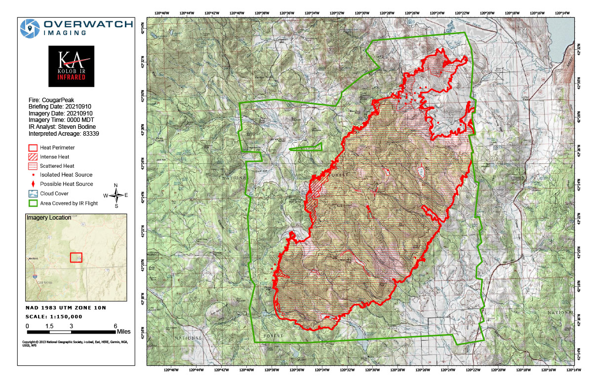
Flight Notes: Interpreted Size: 83,339 Acres - Growth Since Last Flight: 46,347 Acres
Due to weather we were unable to capture a portion of east side of fire.
Note: Map is 1,200 pixels wide
Friday, September 10, 2021 - Above Map is the Cougar Peak Fire Infrared Map for Today with Flight Notes.Click Here for: Oregon Cougar Peak Fire Friday, September 10, 2021 Updates