
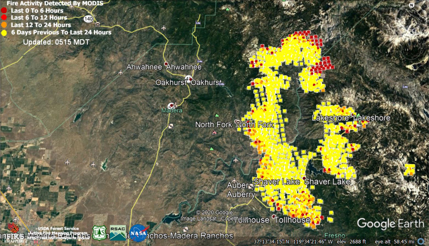
 MODIS map of the Creek Fire on Thursday at 4:15 A.M. PST
Note: 1,500 Wide
MODIS Active Fire Mapping Program Frequently Asked Questions
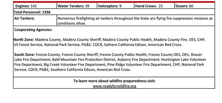
Update 8:30 P.M. Per CAL FIRE: Creek Fire Northeast of Shaver Lake in Fresno County is 175,893 acres and 6% contained, with 1,336 total fire personnel.
Update 7:00 P.M. Sierra National Forest to Hold a Livestream Incident Briefing with CAL FIRE for the Creek Fire Tonight (Thursday) at 7:00 P.M.
Update 9:24 A.M. CAL FIRE: Structures Threatened: 14,074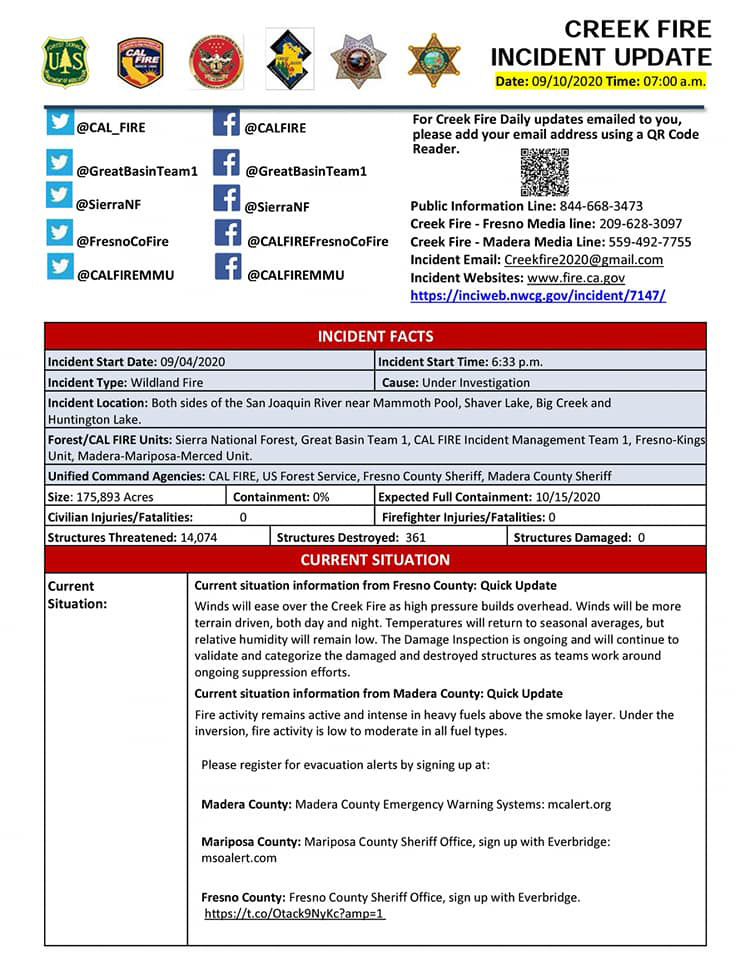
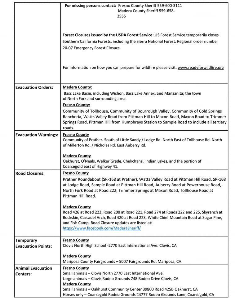
Update 9:10 A.M. Per InciWeb: Creek Fire Interactive Evacuation Map
Update 5:30 A.M.: Sierra National Forest Creek Fire Operations Briefing Map for Thursday, September 10, 2020
September 10, 2020 - Overnight infrared mapping has the Creek Fire at 175,893 Interpreted Acres.
Comments and notes on flight:
Fire continues to grow, mostly to the northeast (Divisions J, M, and N), where most of the intense heat is located. Some growth was also detected to the south (Divisions W and V).
Wednesday Evening Update: 166,965 Acres with 0% Containment
Sierra National Forest Creek Fire Updates for Wednesday, September 9, 2020