
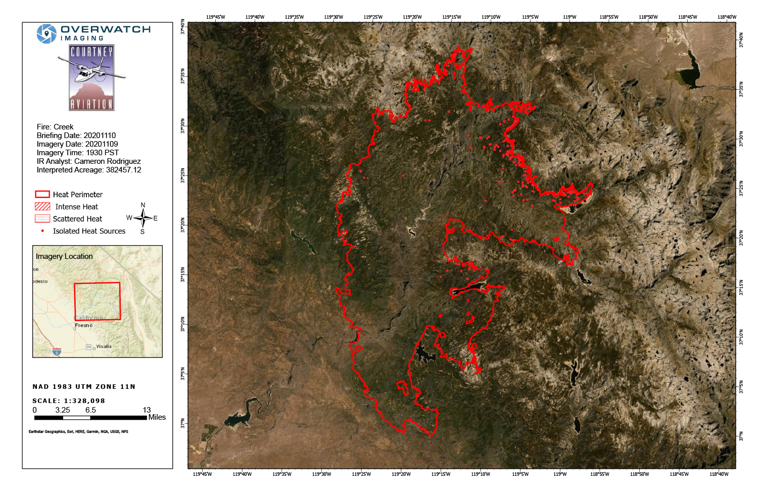
Infrared Map of the Creek Fire on Tuesday
Note: 1500 wide
Click Here for Large Map (914K)
Update 11:35 A.M.: Sierra National Forest Creek Fire Operations Briefing Video for Tuesday, November 10, 2020
Update 8:05 A.M.: Sierra National Forest Morning Update for the Creek Fire: 379,729 acres and 70% containment
Update 7:55 A.M.: Forest Service Wildland Fire Smoke/Air Quality Outlook Due to the Creek Fire in the Yosemite Area for November 10 & 11, 2020
MODIS map of the Creek Fire on Tuesday at 4:30 A.M. PST shows no detected footprints
MODIS Active Fire Mapping Program Frequently Asked Questions
Update 6:05 A.M.: Sierra National Forest Creek Fire Operations Briefing Map for Tuesday, November 10, 2020 - Shows Contained Line and Uncontrolled Fire Edge
November 10, 2020 - Overnight infrared mapping has the Creek Fire at 382,457 Interpreted Acres.
Comments and notes on flight:
Tonight, we flew only the Northern half of the Creek fire perimeter and collected LWIR imagery. Heat Perimeter from 20201106 NIROPS products was used to generate tonight’s NIROPS products. For heat detection and perimeter updating we used 16-bit LWIR imagery only.
The most active heat and perimeter growth is in the East and Northeast. The West side is showing small amounts of isolated heat source. Today’s perimeter growth value is smaller than yesterdays. Most of the heat sources have been slowed due to the recent storms.
Monday Evening Update: 379,729 acres and 70% containment.
Sierra National Forest Creek Fire Updates for Monday, November 9, 2020