
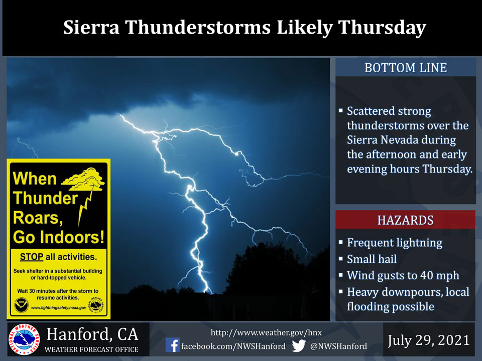
July 29, 2021 - The National Weather Service Hanford Office reports scattered thunderstorms will develop over the Sierra Nevada by early Thursday afternoon and linger into the evening hours.
In addition to dangerous cloud to ground lightning, a few thunderstorms will bring small hail, wind gusts to about 40 mph and heavy rain with the potential for flash flooding.
Hikers should be prepared to seek a safe place when skies turn ominous and thunder is heard.
  Area Forecast Discussion
  National Weather Service Hanford CA
  1239 PM PDT Thu Jul 29 2021


  .SYNOPSIS...
  Slightly warmer than average high temperatures look likely into
  the foreseeable future over the forecast area. Monsoonal moisture
  will provide the Sierra Nevada with a chance of afternoon and
  evening thunderstorms each day until Sunday.

  &&

  .DISCUSSION...
  Weak upper level troughing over the eastern Pacific centered
  several hundred miles west of the Point of Conception coupled with
  broad ridging centered over the Plains states is allowing a steady
  stream of mid to high level tropical moisture to stream north to
  northwestward into the forecast area. This moisture stream was
  responsible for yesterdays thunderstorms over the Sierra and for
  the current showers with embedded thunderstorms into this
  afternoon. This pattern has also kept the synoptic temperatures
  pretty steady over the last several days and will do so through at
  least Saturday.

  A stronger surge of moisture will advect into the region tomorrow
  and this will not only increase the chances of thunderstorms but
  also increase the potential rainfall amounts possible with any of
  the given thunderstorms that do develop. The highest likelihood
  of thunderstorms will be for the higher elevations of the Sierra
  Nevada but a few thunderstorms over the Kern County Mountains and
  Deserts would not be out of the question each afternoon through
  Sunday. However, the chances for the larger precipitation amounts
  with thunderstorms will be greatest for the higher elevations.
  With this reasoning in mind a Flash Flood Watch for above 5000
  feet has been issued for the Sierra Nevada from Yosemite southward
  to parts of the Kern County Mountains around Tehachapi. This
  watch will begin at Noon Friday through 8 PM Saturday night.
  Hikers and Campers venturing out to these areas should stay aware
  of any changes in the weather and remember to never set up a
  campsite in a low lying area as heavy rainfall in higher
  elevations can quickly flood those areas with little notice from a
  distance. Besides the heavy rainfall threat, thunderstorms will
  also bring strong gusty winds, small hail, and of course dangerous
  lightning.

  By early Sunday, troughing to the west will push eastward and this
  will redirect the monsoonal moisture flow further eastward and
  allow ridging to begin building into southern California. This
  will bring slightly warmer temperatures and allow drier weather
  to return to the region with a more southwesterly flow aloft at
  least through Thursday.

  &&


  .AVIATION...
  Mountain obscurations in showers and scattered thunderstorms
  possible over the Sierra through 03Z Fri and again after 19z
  Friday. Otherwise, VFR conditions will prevail through the next 24
  hours.

  &&

  .AIR QUALITY ISSUES...
  On Thursday July 29 2021... Unhealthy for sensitive groups in
  Fresno... Kern... Madera... Merced and Tulare Counties and Sequoia
  National Park and Forest.
  Further information is available at Valleyair.org
Source: NWS