


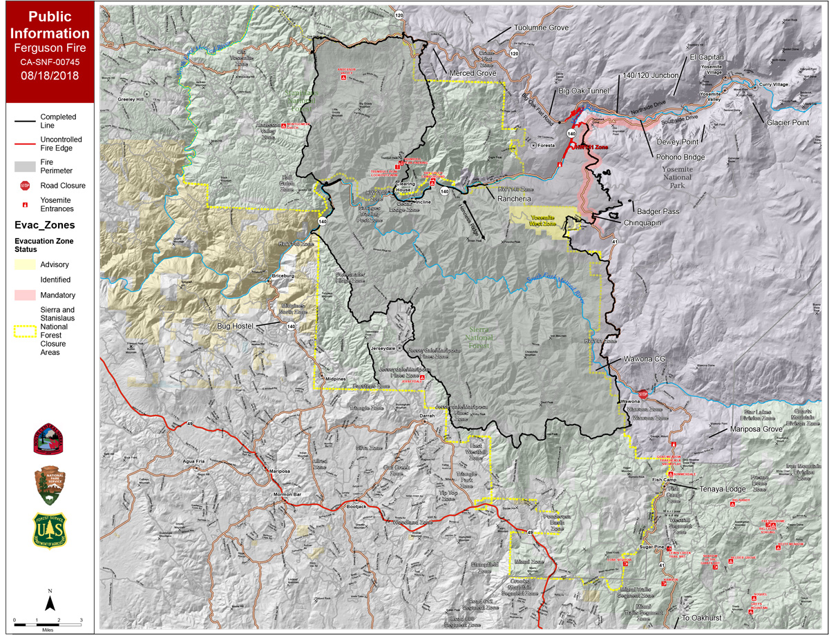
 Saturday Public Information Map
CLICK HERE FOR A LARGE MAP (3,000 Pixels Wide and 3.0MB)

Click here for the Sierra Sun Times Scanner
Reminder: Scanner Information is NOT Official
Click here for Friday's Information on the Ferguson Fire
Update: 8:00 A.M. Forest Service Wildland Fire Smoke/Air Quality Outlook for Yosemite National Park for Saturday, August 18
Update: 7:50 A.M. Ferguson Fire Near Yosemite National Park in Mariposa County Saturday Morning, August 18, 2018 Update: 96,824 Acres with Containment at 87%
Update: 7:10 A.M. On Saturday, August 18th Mariposa County Air Pollution Control District Reports Ferguson Fire is Affecting Air Quality in the Area
Update: 5:55 A.M. Ferguson Fire Near Yosemite National Park in Mariposa County Saturday, August 18 Operations Map
August 18, 2018 - The Ferguson Fire is burning on the Sierra National Forest near Yosemite National Park in Mariposa County.
Friday Evening Information
96,824 Acres with 87% Containment
Planned Actions:
Crews to continue suppression efforts in Divisions D. The fire continues to back to the Merced River.
The fire east of El Portal and north of Highway 140 continues to be in patrol status.
Crews continue to monitor the fire along FS Road 2S20. Resources are addressing hazard trees along all roads and containment lines, while monitoring and securing the fire area.

