


Click here for: Washburn Fire in Yosemite National Park Updates for Sunday, July 17, 2022
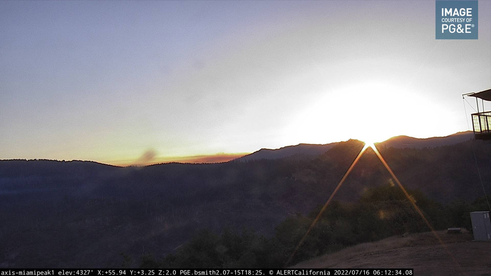
Washburn Fire in Yosemite National Park from the PG&E Miami Mountain Live Camera in Eastern Madera County on Saturday Morning, July 16, 2022 at 6:12 A.M.
Click here for: Washburn Fire in Yosemite National Park Updates for Sunday, July 17, 2022
Note: If you were at or near the Mariposa Grove on July 7, 2022, please contact the NPS Investigative Services Branch (ISB) one of the following ways:
Call or text: 888-653-0009
Email: nps_isb@nps.gov
Web: go.nps.gov/SubmitATip
Evening Update: Washburn Fire in Yosemite National Park is at 4,822 Acres, with 39% Containment and 1,583 Total Personnel.
Basic Information
|
Current as of |
7/16/2022, 6:29:30 PM |
|
Incident Type |
Wildfire |
|
Cause |
Under Investigation |
|
Location |
Southern portion of Yosemite National Park; |
|
Incident Commander |
Josh Boehm, California Interagency Incident Management Team 13. |
|
Incident Description |
Full Suppression. |
|
Coordinates |
37.499 latitude, -119.614 longitude |
Current Situation
|
Total Personnel |
1,583 |
|
Size |
4,822 Acres |
|
Percent of Perimeter Contained |
39% |
|
Fuels Involved |
Very heavy accumulations of available dead surface fuels with ample snags, downed timber, and concentrations in an old-growth forest condition. Representative fuels include large timber with an understory of young conifer and shrubs. Very deep duff and accumulation of timber litter (branchwood and needles) dominate the forest floor. Recent large fire scars in the area include woody fuels and recent shrub growth. Live fuels (shrubs/brush) are seasonally moist and are providing limited intensity and spread. |
|
Significant Events |
Continued persistent weather pattern of warm and dry conditions supports the potential of active-to very active fire behavior for the next several days. The fire continues to burn in heavy dead and down timber fuels. Observed fire behavior has been diminished by successful suppression activities on most portions of the fire. Primary area of concern for fire behavior includes the S. Fk. Merced River upstream to the Iron Cr. and Johnson Cr. areas where most of the current activity is occurring. Continued warm and dry weather may contribute to additional fire growth and smoke production where control lines have yet to be constructed. |
Outlook
|
Planned Actions |
Continue to secure and reinforce the Hwy 41 corridor, Mariposa Grove Rd., and continue to construct handline and dozer line from Wawona Point to the west and north to South Fork of the Merced River. Protect remote cabins within Yosemite National Park and Sierra National Forest. |
|
Projected Incident Activity |
12 hours: Persistent warm and dry weather continues to produce active-to-very active fire behavior during the day, that extends into the night due to poor relative humidity. Continued fire spread was observed on the east flank of the fire south of the S. Fk. Merced River near Iron Creek including torching, flanking, and backing on steep slopes. Downslope and down drainage wind flow will continue to provide smoke accumulation in the valleys during the night under a strong inversion, while south-southwest winds at higher elevations retain a relatively clear sky. 24 hours: continuation of warm/dry weather will provide sustained active fire behavior throughout the period, with the burning conditions extending well into the night due to poor relative humidity recovery on higher terrain. Generally light winds will produce sustained backing on slopes with flanking, torching, and spotting; southwesterly ridgetop winds will provide clear sky and good ventilation. Continued potential for spotting north of the South Fork Merced River in the Johnson Creek area as the fire backs to the bottom of the slope. 48 hours: Warm and dry conditions combined with poor-fair nighttime relative humidity will produce conditions for active to very active fire behavior on uncontained portions of the fire perimeter. Expect sustained backing, active flanking, with torching with spotting as the fire consumes pockets of unburned fuel in the South Fork Merced River drainage. 72 hours: Continued warming and drying will maintain the potential for active to very active fire behavior. Expect a significant reduction in fire activity due to suppression activities. Smoke will be visible in the late afternoon with southwesterly transport wind. Nighttime cooling will allow smoke to accumulate in the valleys due to downslope flow and a strong inversion. Anticipated after 72 hours: The persistent pattern of warm and dry conditions will continue with very little change overall. Conditions will be present to provide the potential of active to very active fire behavior on unlined portions of the fire. |
Current Weather
|
Weather Concerns |
Persistent high pressure over the region will continue to produce warm and dry conditions during the day and mild temperatures with moderate humidity recovery at night. The prevailing winds will be out of the southwest, but most of the fireline will be impacted by terrain driven flow. Elevations above 7500 feet on the eastside of the fire will see gusts between 20 and 25 mph. Observed Weather Conditions July 15, 2022: Wind Speed / Max. Gust Sustained 3-7 mph gusts to 16 mph. Temp Highs 84-91 Direction Southwest RH 18-26% Forecasted Weather for Next Operational Period July 16, 2022: Wind Speed / Max. Gust Sustained 3-7 mph gusts to 15 mph. Temp Highs 85-92 Direction Southwest RH 17-25% |
Update 8:40 A.M. Washburn Fire in Yosemite National Park Operations Video for Saturday, July 16, 2022
Update 6:10 A.M. Air Quality Measurements
Update 6:00 A.M. Washburn Fire in Yosemite National Park Briefing and Infrared Maps for Saturday, July 16, 2022
July 16, 2022 - Washburn Fire in Yosemite National Park is at 4,822 Acres and 37% Containment.
Update 9:00 A.M. Below is the Daily Update
Location: Yosemite National Park, Mariposa Grove
Percent Contained: 37%
Start Date: July 7, 2022
Cause: Under Investigation
Size: 4822 acres
Number of Personnel Assigned: 1623
Weather/Fire Conditions:
Weather continues to stay consistently warm and dry with active to very active fire behavior. This active behavior will possibly include group torching as fire backs down to the Merced River and upstream near Iron Creek. Mop up and hazard tree removal operations are in place along Yosemite’s Wawona Rd and Mariposa Grove. Expect winds over the incident area to remain light to moderate and mostly terrain driven. Temperatures will reach the low-90s and relative humidity is predicted to be in the 22-32% range. For a detailed look at smoke conditions: Washburn Fire Smoke Report.
It should be noted that to date all structures remain unharmed and no serious injuries have been inflicted on this incident.
Sierra National Forest Washburn Fire Closure Order: The Washburn Fire is now active on the Sierra National Forest. To aid firefighters and protect public safety during the Washburn Fire, the Sierra National Forest has issued a Washburn Fire Closure Forest Order:
Forest Order: 05-15-00-22-15: This order is effective from July 15, 2022 through August 1, 2022. For a detailed description including a map, please view the following link: Forest Order 05-15-00-22-15. All closure roads are on the Bass Lake Ranger District and they include: Road 5S06 Mtn. Raymond Rd, 5S22 Big Sandy Rd, 5S43 White Chief Mtn. Rd, 6S10 Sky Ranch Rd, 5S40Y Lost Lake Rd, 5S40Z Lost Lake Rd, 5S04 Chiquito Lake Rd, 5S70A Red Top Rd. Additionally Off-roaders, to protect public and firefighter safety, please avoid the Kamook Staging Area. Firefighters are using the site for the staging of firefighting heavy equipment. An alternative spot is Lone Sequoia trailhead/campground on the 5S24 road about 2 miles from Hwy 41, or any dispersed site along the 5S15 road in Miami Trails. Please be advised that USFS law enforcement will be on patrol. We would like to thank all members of the public for avoiding the closure area so that incident personnel may stay focused on the difficult and dangerous work that remains.
Yosemite National Park Fire Restrictions: Starting July 16, fire restrictions are in effect below 8,000 feet of elevation and smoking is restricted park wide. The residences of El Portal and Foresta are on a strict fire restriction due to high potential fire danger. For more information please visit Yosemite National Park Fire Restrictions
Wawona Evacuation Update: Structure defense groups are working to build contingency line on the northwest edge of the community of Wawona to further increase security. Stay-tuned for a resident re-population update in the very near future. To stay updated with alerts from Yosemite National Park sign up for the alert system: Yosemite Alert System. The protection of both life and property continues to be a top priority.
Evacuations & Closures: Wawona, Wawona Road (Hwy 41) south of Yosemite West, and the Mariposa Grove are closed until further notice. The South Entrance remains closed. All other areas of Yosemite National Park are open. Use El Portal Rd (Hwy 140) or Big Oak Flat Rd. (Hwy 120 East) or Tioga Rd (Hwy 120 West) to enter Yosemite. Reservations are still required; visit www.recreation.gov
· 4,822 acres (+37 acres), brush and timber
37% contained (+2% containment)
· Minimal fire behavior overnight
· Threat to critical infrastructure and Giant Sequoia grove
· Threat to the community of Wawona
· Mandatory evacuation orders in effect for the community of Wawona
· Road, trail and campground closures in the area
· CAIIMT 13 (Boehm) in command
Basic Information
| Current as of | 7/16/2022, 6:18:47 AM |
| Incident Type | Wildfire |
| Cause | Under Investigation |
| Location | Southern portion of Yosemite National Park; |
| Incident Commander | Josh Boehm, California Interagency Incident Management Team 13. |
| Incident Description | Full Suppression. |
| Coordinates | 37.499 latitude, -119.614 longitude |
Current Situation
| Total Personnel | 1,623 |
| Size | 4,822 Acres |
| Percent of Perimeter Contained | 37% |
| Fuels Involved |
Very heavy accumulations of available dead surface fuels with ample snags, downed timber, and concentrations in an old-growth forest condition. Representative fuels include large timber with an understory of young conifer and shrubs. Very deep duff and accumulation of timber litter (branchwood and needles) dominate the forest floor. Recent large fire scars in the area include woody fuels and recent shrub growth. Live fuels (shrubs/brush) are seasonally moist and are providing limited intensity and spread. |
| Significant Events |
A persistent weather pattern for the next several days will support active-to-very active fire behavior in heavy dead and down fuels. Expect afternoon episodes of group torching, short crown runs, and spotting primarily on the south side of the S. Fk. Merced River and upstream toward Iron Cr.. Continued warming and drying over the next several days will bring additional fire growth and smoke production where control lines have yet to be constructed. |
Outlook
| Planned Actions |
Continue to secure and reinforce the Hwy 41 corridor, Mariposa Grove Rd., and continue to construct handline and dozer line from Wawona Point to the west and north to South Fork of the Merced River. Protect remote cabins within Yosemite National Park and Sierra National Forest. |
| Projected Incident Activity |
12 hours: Persistent warm and dry conditions continue to produce active-to-very active fire behavior during the day, that extends into the night due to poor relative humidity. Significant activity was observed on the east flank of the fire south of the S. Fk. Merced River near Iron Creek including group torching and short crown runs on steep slopes. Up canyon wind flow is producing sustained backing on slopes, flanking, and torching with spotting as the fire progresses up the South Fork Merced River drainage. Downslope and down drainage wind flow will continue to provide smoke accumulation in the valleys during the night under a strong inversion, while south-southwest winds at higher elevations remain relatively clear. 24 hours: Continuing warm and dry conditions will to provide sustained active fire behavior throughout the period, with the burning conditions extending well into the night due to poor relative humidity recovery on higher terrain. Generally light winds will provide sustained backing on slopes with flanking, torching, and spotting, ridgetop winds will provide clear sky and good ventilation. Continued fire spread may be expected on the east flank of the fire in the South Fork Merced River drainage in the Iron Creek area. Potential for spotting north of the South Fork Merced River in the Johnson Creek area as the fire backs to the bottom of the slope. 48 hours: Warm and dry conditions combined with poor-fair night time relative humidity will produce conditions for active to very active fire behavior on uncontained portions of the fire perimeter. Expect sustained backing, active flanking, with frequent torching with spotting, and short headfire runs in the South Fork Merced River drainage as the fire spreads to the east. 72 hours: Continued warming and drying will maintain active to very active fire behavior potential. Likely increase in fire behavior to include group torching, short torching/crown runs on wind aligned slopes, and spotting to .5 miles. Smoke will be visible in the late afternoon with southwesterly transport wind. Night time cooling will allow smoke to accumulate in the valleys due to downslope flow and a strong inversion. Anticipated after 72 hours: The persistent pattern of warm and dry conditions will continue with very little change overall. Conditions will be present to provide active to very active fire behavior on uncontained portions of the fire. |
Current Weather
| Weather Concerns |
Persistent high pressure over the region will continue to produce warm and dry conditions during the day and mild temperatures with moderate humidity recovery at night. The prevailing winds will be out of the southwest, but most of the fireline will be impacted by terrain driven flow. Elevations above 7500 feet on the eastside of the fire will see gusts between 20 and 25 mph. Observed Weather Conditions July 15, 2022: Wind Speed / Max. Gust Sustained 3-7 mph gusts to 16 mph. Temp Highs 84-91 Direction Southwest RH 18-26% Forecasted Weather for Next Operational Period ¿ July 16, 2022: Wind Speed / Max. Gust Sustained 3-7 mph gusts to 15 mph. Temp Highs 85-92 Direction Southwest RH 17-25% |
Click here for: Washburn Fire in Yosemite National Park Updates for Friday, July 15, 2022

