


October 2, 2026 - Yosemite National Park Dome Fire Friday Morning, October 2, Update: 5,855 Acres with 40% Containment.
| Total Personnel: | 798 |
|---|---|
| Size | 5,855 Acres |
| Percent of Perimeter Contained | 40% |
| Estimated Containment Date | 10/17/2026 |
| Fuels Involved |
Timber (Litter and Understory) Brush (2 feet) Heavy Logging Slash Red fir fuel type with montane shrub and brush understory interspersed with pockets of non-burnable fuels in granite rock outcrops. Fir trees are large diameter, over 100 ft tall, and suffer from insect and disease mortality, leading to a significant snag component with large amounts of heavy dead and down coarse woody debris. Most active fire behavior has come from the dense, closed canopy red fir stands, where torching and isolated crown fire pockets have also contributed to spotting. Fuels in 2017 fire footprints have less closed canopy but contain significant dead and down with standing snags, increasing spotting potential. Surface spread rates are lower in the Empire Footprint but spotting continues to drive spread. Montane shrubs and brush in the understory are generally available to burn but are not at critical fuel moisture levels. Heavy dead and down fuels are dry, with fuel moisture in 1,000 hr. fuel around 12%. |
| Significant Events |
Moderate, Flanking, Uphill Runs, Single Tree Torching Active fire spread occurred in the area of DP 24 on Division M. Drier weather has led to an increase in fire potential. This will lead to continued downslope progression to the west. There is potential for further active growth to the east as alignment with slope occurs beyond Bridalveil Creek. Spotting continues to occur adjacent to the perimeter and is a primary contributor to fire spread along with terrain alignment. |
| Current as of | Fri, 10/02/2026 - 09:35 |
|---|---|
| Incident Time Zone | Pacific Standard Time |
| Incident Type | Wildfire |
| Cause | Under Investigation |
| Date of Origin | |
| Incident Time Zone | Pacific Standard Time |
| Location | North of Wawona Dome |
| Incident Commander | California Complex Incident Management Team 3, Incident Commander Oscar Vargas. |
| Incident Description | The fire has a moderate rate of spread to the north and northeast. Firefighters have been utilizing natural barriers, and line has been secured on the south and west sides of the fire. The fire is deep in the wilderness and difficult to access due to steep, rugged terrain. |
| Coordinates | 37° 33' 58'' Latitude -119° 36' 82
'' Longitude |
| Planned Actions |
Strengthen primary and contingency lines. Employ rotary-wing aviation assets to check fire spread, moderate flame lengths to thresholds suitable for direct attack. Implement back firing operations in Branch 10. Crews are firing as appropriate to bring fire to containment line from Division K/M break to the west and south toward Division F. Continue with patrol and mop up in Branch 5. |
|---|---|
| Projected Incident Activity |
12 hours: Persistent flanking and backing to the west and east is expected to continue. Uphill runs remain possible where wind and slope align but will remain short in duration. Thermal belt will allow continued overnight spread. 24 hours: Warm and dry weather persists over the fire area, bringing incremental increases in potential fire behavior. Uphill runs remain possible where wind and slope align but will remain short in duration and likely push fire into itself and within planned containment lines. Light 20 ft wind speed will minimize the potential for strong alignments and keep spotting distance low; therefore, minimal fire growth is expected to continue. Largest growth will be from ignitions in Div F and Div K. Firing operations will have favorable winds and expect good consumption. Isolated torching and short runs are possible during firing operations but will push fire back into itself. 48 hours: Warm and dry weather persists over the fire area, bringing incremental increases in potential fire behavior. Uphill runs remain possible where wind and slope align but will remain short in duration and likely push fire into itself and within planned containment lines. Light 20 ft wind speed will minimize the potential for strong alignments and keep spotting distance low; therefore, minimal fire growth is expected to continue. Largest growth will be from ignitions in Div F and Div K. 72 hours: Warm and dry weather persists over the fire area, bringing incremental daily increases in potential fire behavior. Daytime temperatures in the upper 60s will combine with RH values in the mid-20s, which has been a critical factor driving ground fire spread; however; light winds will allow fire behavior and anticipated growth to remain low to moderate. Areas of potential spread continue to shrink as fire reaches containment lines on more of the perimeter and firing operations in Div F near completion. Anticipated after 72 hours: Warm and dry weather persists over the fire area, bringing incremental daily increases in potential fire behavior. Daytime temperatures in the mid-60s will combine with RH values in the mid-20s and mixing heights above 6,500 ft., a combination which has been a critical factor driving fire spread. However; light winds will minimize the potential for strong alignments and keep spotting distance low, making projected fire growth low to moderate. Areas of potential spread continue to shrink as fire reaches containment lines on more of the perimeter. |
| Remarks |
IMT4 is in transition with IMT3 to take over the fire Tomorrow. IMT 4 will take command of the incident at 0700 on 10/02/26 |
| Weather Concerns |
High pressure building over the region will keep warm and dry conditions over the fire. Temperatures reached the low to mid-70s with humidity in the teens and 20s. Winds were generally diurnal, with a general upslope/up valley flow. 12-Hour Overnight: Northeast winds of 8–12 mph is expected overnight, with some locations seeing gusts up to 15 mph. Humidity recoveries are expected to be marginal, reaching 40–50%. Low temperatures will drop into the 40s and 50s under clear skies, although smoky conditions are expected in some valleys. 24–72 Hour Forecast: A weak weather system passing to the north will help to bring increasing high clouds Friday. This will have little impact on the weather, other than lowering temperatures 1-2 degrees. Sunny skies will return Saturday with continued well above normal temperatures, light winds, and low relative humidity. Extended (Beyond 72 Hours): No significant changes, as high pressure will remain over the area through much of next week. Temperatures will run several degrees above normal with dry conditions and typical diurnal winds. |
|---|
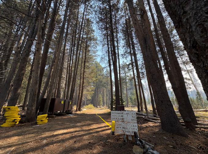
A 1-Mile Long Hose-Lay Stretches from a Trailhead to the Dome Fire
Previous Information
