


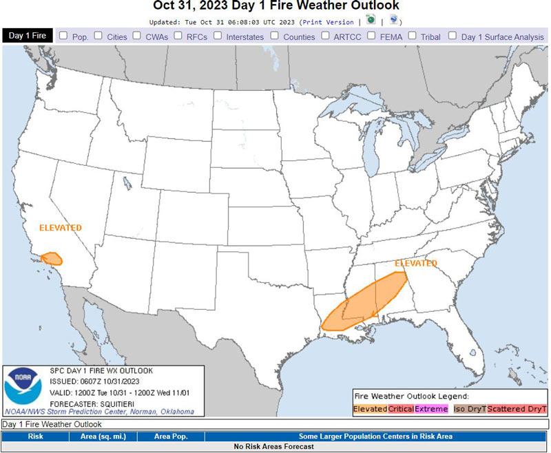
October 31, 2023 - National Weather Service Storm Prediction Center Officials report a mid-level trough and accompanying surface anticyclone will traverse the central and eastern CONUS today, supporting the southeastward surge of cooler, drier air across the Southeast.
Here, RH may dip below 30 percent in the post-cold-frontal airmass, with 10-15 mph sustained northwesterly surface winds supporting Elevated meteorological conditions across portions of central Louisiana into central Mississippi and Alabama.
The eastern shunt of the surface anticyclone will relax the pressure gradient across southern California. While dry offshore flow will persist into the morning hours (hence the Elevated highlights), offshore wind speeds should subside with time, tempering the wildfire-spread threat later in the day.
Source: NWS
