


December 9, 2024 - Fire Weather Outlook NWS Storm Prediction Center, Norman OK
Valid 131200Z - 141200ZCRITICAL FIRE WEATHER AREA FOR THE SOUTHERN CALIFORNIA COAST
Synopsis... ...Southern CA Coast... High-end critical fire weather conditions are expected to develop later this afternoon and into the overnight hours along the southern CA coast.
Latest surface observations show a 1027 mb surface high building across the northern Great Basin/Pacific Northwest. This feature is expected to strengthen over the next 24 hours to around 1036-1038 mb as it shifts into northeast NV in the wake of an amplifying upper trough.
This unseasonably strong surface high (90th percentile for mid-December) will promote a strengthening offshore pressure gradient along the southern CA coast. Although relatively moist and quiescent conditions are noted along the southern CA coast in 06 UTC observations, offshore winds are forecast to increase by mid-afternoon and may gust as high as 45-60 mph by late tonight as the LAX-DAG pressure gradient strengthens to -6 to -8 mb.
Warm/dry low to mid-level air was sampled above a shallow marine layer in the NKX and VGB 00 UTC soundings, suggesting that RH values will quickly fall as downslope warming/drying increases through the afternoon/overnight.
Latest high-res forecast guidance suggests that RH values may fall as low as 5-15% within the higher coastal terrain. As such, critical conditions are expected with pockets of extremely critical conditions possible, especially towards 12 UTC Tuesday.
..Moore.. 12/09/2024
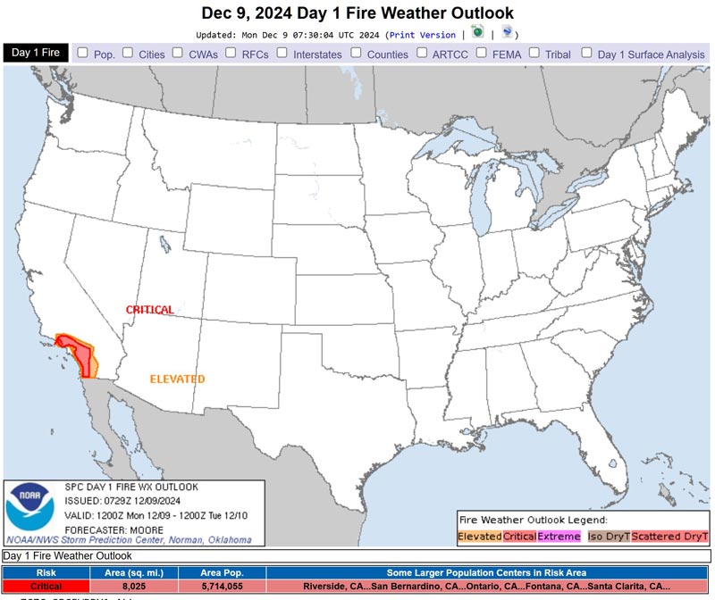
Source: NWS
