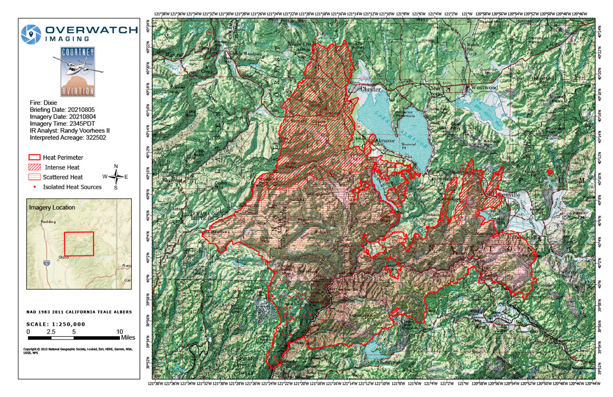
Flight Notes: Interpreted Acreage: 322,502, Growth of 48,363 from last flight
Scattered heat still remains throughout most of the fire. Significant growth to the North. Largest column to north west remained throughout our flight we flew near it on the south side but more spotting could have been present further north. Only scanned upper half of the fire areas. Utilized existing southern isolated and scattered heat polygons. There has been little change to them in recent days so I think they will still be representative of the situation.
Note: Both maps are 1,200 pixels wide
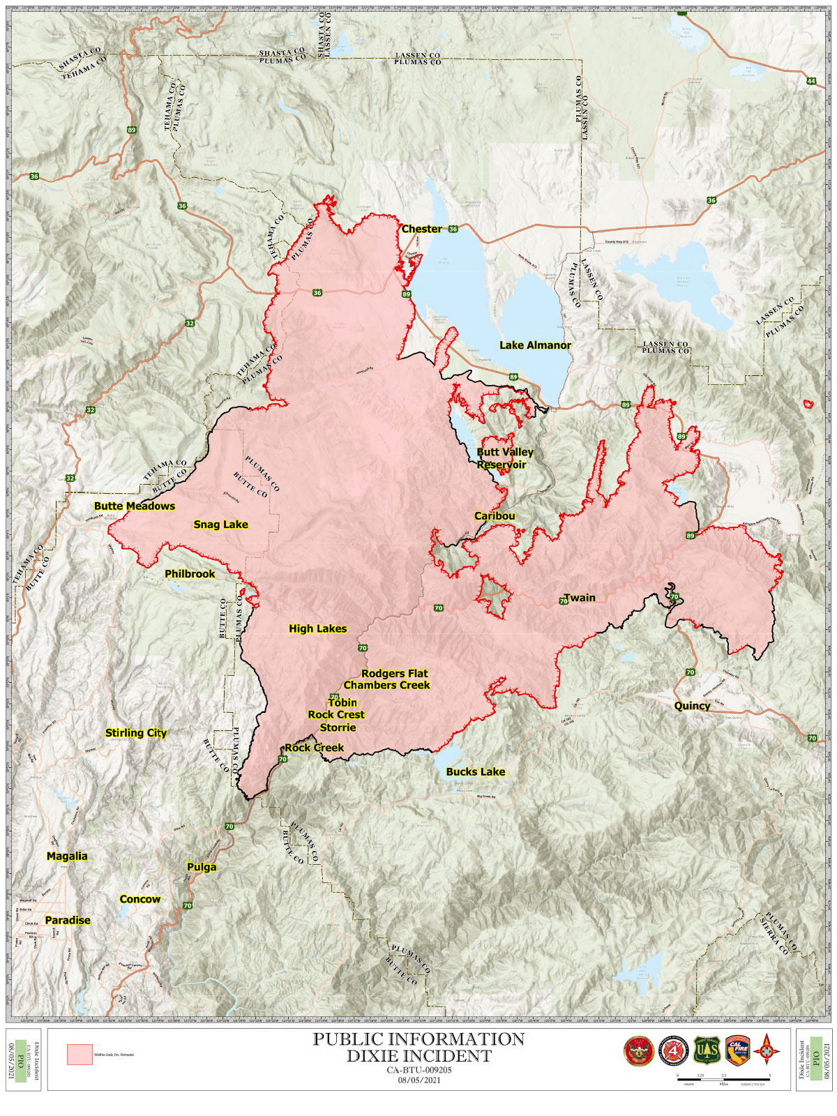
Thursday, August 5, 2021 - Above Map is the Dixie Fire Infrared Map for Today with Flight Notes.
Click Here for: Dixie Fire in Butte and Plumas Counties Thursday, August 5, 2021 Updates
The Bottom Map is the Public Information Map of the Dixie Fire for Today.