 Update: Effective at HERE TODAY (8/18/2021) the following neighborhoods will be reopened to residents only as they run on an independent water source that is safe to use:
- From 759 Greenville Wolf Creek Road north [PLU Zone 14]
- Willow Way Greenville [PLU Zone 14]
UPDATED Evacuation Zone MAP: https://tinyurl.com/ydrapp24
- Portions of North Valley Road from Pecks Valley Road to Stampfli Road are open to residents only
*These two specific areas are reopened; however, the entire zone remains under mandatory evacuation.
*Residents who choose to come back to above locations allowed to only return directly home are not allowed to roam any side streets due to hazard trees and materials in the area-- you may be subject to law enforcement action. PCSO will have continued patrols through Greenville.
*The above-mentioned residents should evaluate their own circumstances when determining if they will return home.
When residents do return to burned areas, it is important to follow protocols for re-entry provided by Plumas County Environmental Health. Only those with residence in the area should enter at this time.
For more information visit https://www.plumascounty.us/2868/Dixie-Fire-Information.
You can determine your zone and see evacuation status by entering your address on the evacuation map located at: https://tinyurl.com/ydrapp24.
For more information visit https://www.plumascounty.us/2868/Dixie-Fire-Information and follow the county Facebook.
Source: Plumas County Sheriff's Office

Update: PUBLIC NOTICE 8/18/2021 2:30 P.M.
DIXIE FIRE EVACUATION STATUS FOR WESTWOOD RESIDENTS
The emergency alert zone map can be accessed at: community.zonehaven.com
The Sheriff’s Office made preliminary plans in cooperation with Cal Fire Incident Management Team 3 to repopulate Westwood as early as 3:00 P.M. this afternoon. Unfortunately, fire activity has increased near Hamilton Mountain, and it has been determined that conditions are unsafe for repopulation of that area at this time.
We will continue to keep the public updated as circumstances change. Thank you for your cooperation and patience.
Sergeant Dustin Russell
Lassen County Sheriff’s Office
Update: Chester and entire Lake Almanor Basin reopening, evacuation order reduction.
 Effective at NOON TODAY (8/18/2021) the follow areas are being changed from a Mandatory Evacuation Order to an Evacuation Warning:
Chester [PLU Zone 8]: From Susanville to Chester via Hwy36.
Lake Almanor West Basin (LAW), Prattville, Peninsula Village and Big Meadows Lane [PLU Zone 5 and 5b]: Includes "LAW", Prattville, Hamilton Branch, Highway 147, West Shore, East Shore, Peninsula, Big Meadows, and the Canyon Dam Boat Launch.
UPDATED Evacuation Zone MAP: https://tinyurl.com/vdrapp24
*Residents should evaluate their own circumstances when determining if they will return home.
At Noon, several roads leading into the repopulation areas of Plumas County will reopen:
- Highway 36 at Highway 32 to Chester
- Highway 147
- Highway 89 (Traffic Control Point will be in place through the town of Greenville)
- Road A13
- Warner Valley Road will NOT reopen as it remains under mandatory evacuation [PLU Zone 41].
Seneca District Hospital in Chester is still closed, including the Emergency Department. They are in the process of opening, but this will take some time and require the approval of the California Department of Public Health.
WATER:
Please consult your water district authority for information on drinking water quality.
Essential services: Will likely be delayed in starting back up again. There remains potential risk of intermittent power outages for the remainder of this fire.
Residential trash management services will not operate in an Evacuation Warning Zone. There are dumpsters located in the following areas, which will be serviced every Monday, Wednesday and Friday starting TODAY, Wednesday (8/18):
- 690 Main Street (Pacific Pride) Chester
- 222 Willow Way (Substation) Chester
- Holiday Market, Chester
- 540 Main Street, Chester
- 111 Slim Drive (Clubhouse) Lake Almanor
- Corner of West and Scott Street, Prattville
When residents do return to burned areas, it is important to follow protocols for re-entry provided by Plurnas County Environmental Health. Only those with residence in the area should enter at this time. For more information visit https://www.plumascounty.us/2868/Dixie-Fire-Information.
While we understand that evacuated residents are understandably eager to get back to their homes and properties, the Dixie Fire is still active, and the public must remain out of Mandatory Evacuation Order zones until the orders are downgraded to warnings or lifted. Please do not attempt to enter restricted areas until evacuation orders are lifted. You can determine your zone and see evacuation status by entering your address on the evacuation map located at: https://tinyurLcom/ydrapp24.
Please note area National Forest closures remain in effect. For more information visit https://www.plumascountv.us/2868/Dixie-Fire-Information and follow the county Facebook.
For more information visit www.plumascountv.us and follow the county Facebook.
Source: Plumas County Sheriff's Office
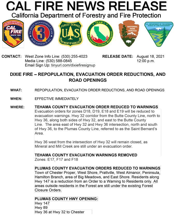
REPOPULATION, EVACUATION ORDER REDUCTIONS, AND ROAD OPENINGS
EFFECTIVE IMMEDIATELY
TEHAMA COUNTY EVACUATION ORDER REDUCED TO WARNINGS
August 18, 2021 - Evacuation orders for zones D18, D19, E18 and E19 will be reduced to evacuation warnings. Hwy 32 corridor from the Butte County Line, north to Hwy 36, along both sides of Hwy 32, and east to the Butte County Line. The area east of Hwy 32 and Hwy 36 intersection, north and south of Hwy 36, to the Plumas County Line, referred to as the Saint Bernard’s Area.
Hwy 36 west from the intersection of Hwy 32 will remain closed, as Mineral and Mill Creek are still under an evacuation order.
TEHAMA COUNTY EVACUATION WARNINGS REMOVED
Zones: E17, F17 and F18
PLUMAS COUNTY EVACUATION ORDERS REDUCED TO WARNINGS
Town of Chester Proper, West Shore, Prattville, West Almanor, Peninsula, Hamilton Branch, area of Big Meadows, and East Shore. Residents along Hwy 147 is a reduction from an Order to a Warning to Residents only. All areas outside residents in the Forest are still under the existing Forest Closure Orders.
PLUMAS COUNTY HWY OPENING:
Hwy 147
Hwy 89
Hwy 36 at Hwy 32 to Chester
CAL FIRE NEWS RELEASE California Department of Forestry and Fire Protection
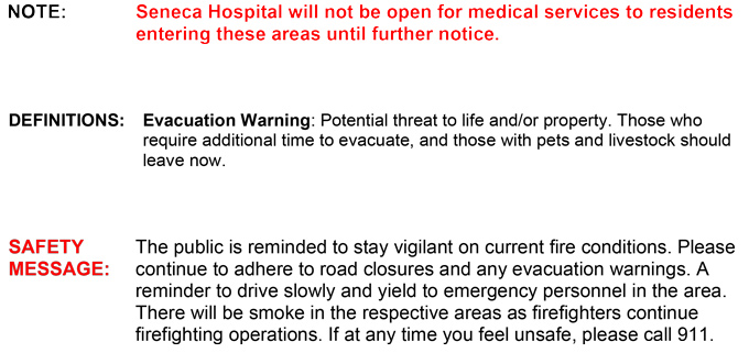
NOTE: Seneca Hospital will not be open for medical services to residents entering these areas until further notice.
DEFINITIONS: Evacuation Warning: Potential threat to life and/or property. Those who require additional time to evacuate, and those with pets and livestock should leave now.
SAFETY MESSAGE: The public is reminded to stay vigilant on current fire conditions. Please continue to adhere to road closures and any evacuation warnings. A reminder to drive slowly and yield to emergency personnel in the area.
There will be smoke in the respective areas as firefighters continue firefighting operations. If at any time you feel unsafe, please call 911
Source: CAL FIRE


