


Dixie Fire Strategic Firing Operation
Credit: USFS
Update: 6:00 P.M. OPERATIONAL UPDATE - Early this afternoon there was increased activity on the southwestern corner of the smaller fire that is to the west of Milford. The fire had pushed off the escarpment and was making a run towards the community however, as of 5:00 P.M., the forward rate of spread had been stopped and firefighters were able to get around it.
Also today, in Genesse and Indian Valley, the fire continues to be active due to significant winds and the fire has burned into the Walker Fire Scar. In the area of Grizzly Peak, they were able to utilize helicopters today so that area did not see significant growth. In the Peters Creek area work continues to add depth and protect the structures.
Update: We just issued the following IPAWS alert in the Janesville/Milford area only. They were already under mandatory evacuation order. Only people in the immediate vicinity of Janesville and Milford should have gotten the alert.
If you are sheltering in place in the area west of Hwy 395 from Janesville Grade south to Milford, you need to evacuate now. If you need assistance, call 530-257-6121. An emergency shelter is located at Lassen Community College. Deputies are going door to door to make notification.
Source: Lassen County Sheriff's Office
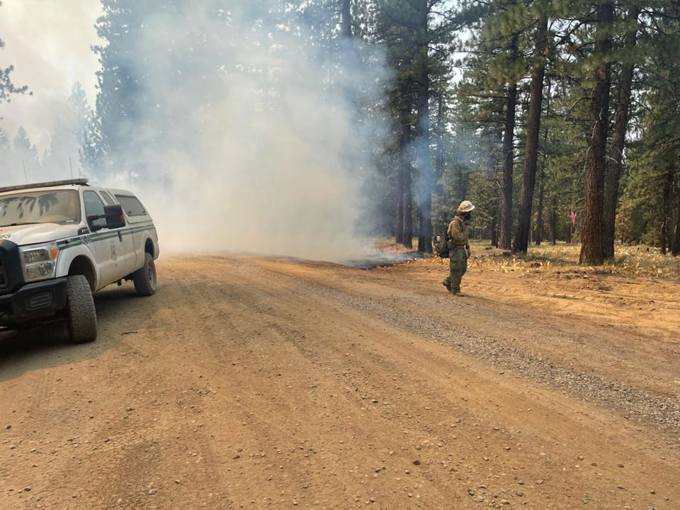
Update: 3:15 P.M. OPERATIONAL UPDATE - MILFORD
The Dixie Fire East Zone has gotten very active along Hwy 395 between Milford and Janesville, in the southeastern corner closest to Milford. They have had some roll out which means burning debris rolling downhill and starting fires. Point protection around structures has been implemented by firefighters working in that area who are also being supported by miscellaneous equipment. Aircraft, such as a Sikorski Type 1 helicopter, are back flying and supporting the effort to keep the fire away from homes. A "pumpkin" or mobile dip tank has been established off 395 to shorten the time needed for the helicopters to fill and return.
Source: Lassen National Forest
Update: Due to the Dixie Fire a MANDATORY EVACUATION ORDER has been issued for the [PLU 43a] Sugar Loaf area: Frenchman Road near Bloomer Lake Road, north to the county line, and the Plumas side of Doyle Grade.
MAP LINK: https://tinyurl.com/zn69rj37
Head to the Veterans Memorial Hall shelter in Portola. Those who need transportation should call 530-283-6414. If you need assistance with animals contact Plumas County Animal Services at 283-3673 or 283-6300.
Source: Plumas County Sheriff's Office
Update: 1:15 P.M. Dixie Fire East Zone Operational Update - Genesee Valley
Activity is also picking up in the Genesee Valley area. The picture below was taken from Drop Point 600, where the black arrow is on the map, where they can see the fire making downhill, short-range, crown runs.
Source: Lassen National Forest
August 21, 2021 - Summary of Dixie Fire Evacuation Orders and Warnings for Saturday, August 21, 2021.
SUMMARY OF DIXIE FIRE EVACUATION ORDERS AND WARNINGS The emergency alert zone map can be accessed at: community.zonehaven.com
PLEASE CALL CALTRANS/CHP ROAD CLOSURES NUMBER (800) 427-7623 FOR UPDATED INFORMATION ON ROAD CLOSURES. 911 AND NON-EMERGENCY DISPATCH WILL NOT HAVE INFORMATION THAT IS NOT AVAILABLE AT THAT NUMBER.
Mandatory Evacuation Orders have been issued for:
- South of Hwy 36 from Devil’s Corral east to Britt Ln and Thumper Hill and south to Cheney Creek Rd
- Bizz Johnson Trail area south of Hwy 36 from Thumper Hill east to Miller Crossing and south to Bauer Rd
- Janesville and Milford west of Hwy 395 from the Bass Hill area south to County Rd A26/Garnier Rd
- Janesville and Milford east of Hwy 395 from A3/Standish Buntingville Rd south to the Flux Rd intersection
- Susan River Canyon/Cheney Creek area south of Hwy 36 from Willard Hill east to Korver Rd and south to the intersection of Cheney Cr. Rd and Gold Run Rd.
- Clear Creek, Westwood, and Pine Town area south of Hwy 36 from the Lassen County line east to the Willard Hill area
- North of Hwy 36 from the Lassen County Line east to Coppervale.
- The area south of Hwy 44 from the Lassen County line east to McCoy Flat including Silver Lake, Juniper Lake, and the Caribou Wilderness Area
Evacuation Warnings have been issued for:
- Lake Forest Estates and Eagle Lake Road A1 from Hwy 36 north to the County Access gate and east to Prattville Rd and north to Paiute Creek.
- The area west of Richmond Rd and south of Hwy 36 from Thumper Hill east to S Weatherlow St and south to Gold Run Rd
- Diamond Mountain area from Forest Service Rd 29NO2 south to the Lassen County line
- West of Richmond Rd from Gold Run Rd south to Childrens Rd but not including roads immediately adjacent to the Golf Course
- East of Hwy 395 from Flux Rd south to the Herlong Access Rd A25
- Area south of Hwy 44, north of Hwy 36, west to Hog Flat Reservoir
Source: Lassen County Sheriff’s Office
